North Leigh No. 1 / Lege / Northleigh
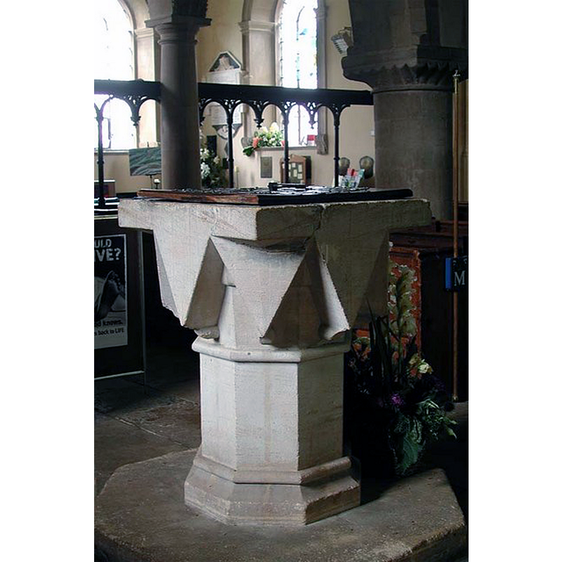
Image copyright © John Salmon, 2009
CC-BY-SA-2.0
Results: 5 records
view of font and cover
Copyright Statement: Image copyright © John Salmon, 2009
Image Source: digital photograph taken 24 August 2004 by John Salmon [www.geograph.org.uk/photo/1623950] [accessed 28 November 2017]
Copyright Instructions: CC-BY-SA-2.0
view of church exterior - southeast view
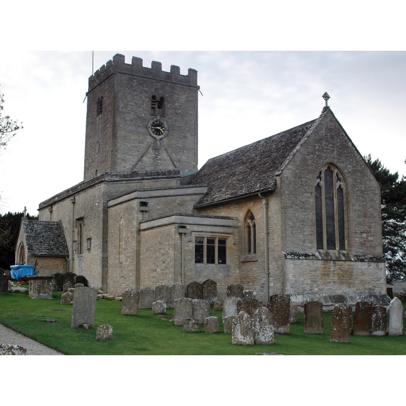
Copyright Statement: Image copyright © Motacilla, 2009
Image Source: digital photograph taken 2 November 2009 by Motacilla [https://commons.wikimedia.org/wiki/File:NorthLeigh_StMarysExterior.JPG] [accessed 28 November 2017]
Copyright Instructions: CC-BY-SA-3.0
view of church exterior - tower - detail
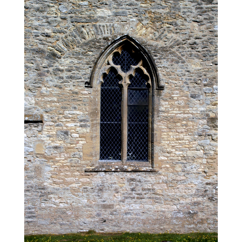
Scene Description: Source caption: "Decorated Gothic window in blocked late Saxon tower arch at the west end of the Church of England parish church of St Mary, North Leigh".
Copyright Statement: Image copyright © Motacilla, 2011
Image Source: digital photograph taken 2 May 2011 by Motacilla [https://commons.wikimedia.org/wiki/File:NorthLeigh_StMary_SaxonArch.jpg] [accessed 28 November 2017]
Copyright Instructions: CC-BY-SA-3.0
view of church interior - nave - looking west
Scene Description: Source caption: "St Mary's North Leigh: view west. Behind the doom painting over the screen is this plaster relief with ANNA in the middle: royal arms of Queen Anne?"
Copyright Statement: Image copyright © Chris Brown, 2017
Image Source: digital photograph taken 26 January 2017 by Chris Brown [www.geograph.org.uk/photo/5357704] [accessed 28 November 2017]
Copyright Instructions: CC-BY-SA-2.0
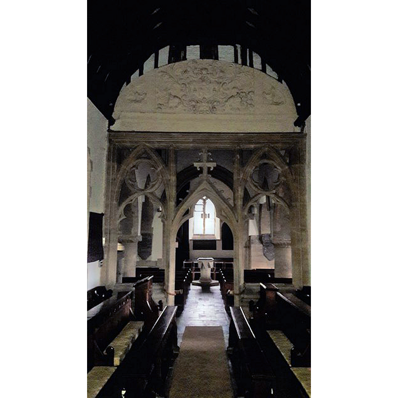
view of church interior - nave - looking east
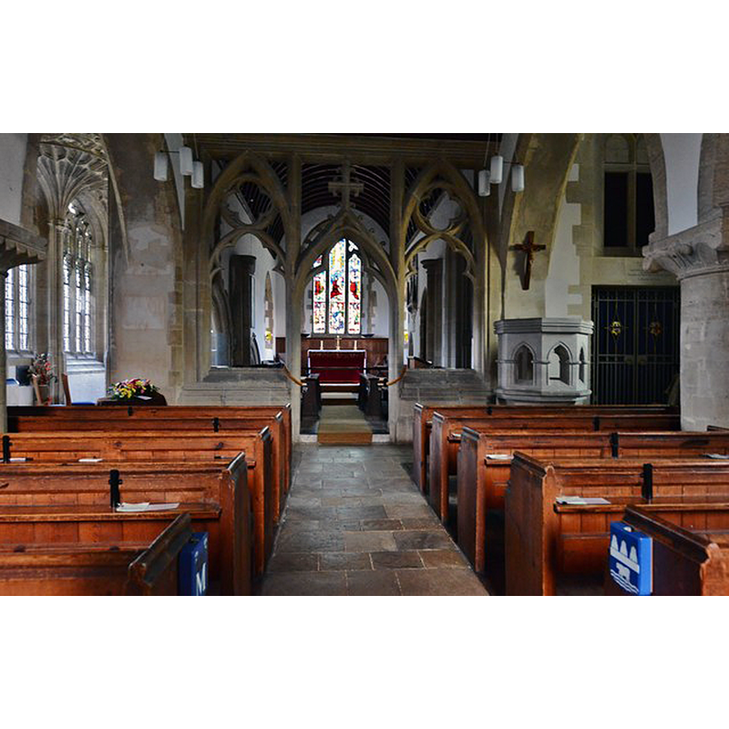
Scene Description: Source caption: "North Leigh, St. Mary's Church: Nave with stone rood screen installed in the 1860s".
Copyright Statement: Image copyright © Michael Garlick, 2016
Image Source: digital photograph taken 11 November 2016 by Michael Garlick [www.geograph.org.uk/photo/5206509] [accessed 28 November 2017]
Copyright Instructions: CC-BY-SA-2.0
INFORMATION
Font ID: 06310NOR
Object Type: Baptismal Font1
Font Century and Period/Style: 11th - 12th century, Norman
Church / Chapel Name: Parish Church of St. Mary
Font Location in Church: [reported in the churchyard ca. 1846]
Church Patron Saint(s): St. Mary the Virgin
Church Address: Church Road, North Leigh, Oxfordshire, OX29 6TX, UK
Site Location: Oxfordshire, South East, England, United Kingdom
Directions to Site: Located off (N) the A4095, 6 km NE of Witney, 8 km WSW of Woodstock
Ecclesiastic Region: Diocese of Oxford
Historical Region: Hundred of Wootton
Additional Comments: abandoned font / recycled font (served as 'water-butt' for over a century before it was re-cut and restored into the church)
Font Notes:
Click to view
There is an entry for [North] Leigh [variant spelling] in the Domesday survey [http://opendomesday.org/place/SP3813/north-leigh/] [accessed 28 November 2017], but it mentions neither priest nor church in it. The Guide to the Architectural Antiquities in the Neighbourhood of Oxford (1846) notes: "The old Norman Font, with a square basin, is in the Churchyard, on the west side of the porch, serving as a water-butt. The present font is of wood, square and panelled, with a Grecian cover, under which is marble mortar, and inside of that a blue and white basin." In The Ecclesiastical and Architectural Topography of England: Oxfordshire (1850). Kelly's Directory of 1911 mentions simply that "there is an ancient Norman font", without mention of its location or of the other font. The Victoria County History (Oxfordshire, vol. 12, 1990) notes: "Part of the fabric of the church is pre-Conquest [...] The church was given to Eynsham abbey between 1140 and 1150 by John of St. John [The existence of a substantial pre-Conquest church is evident from the tower, which is of the earlier 11th century [...] Perrott initiated in 1723 a refitting of the church [...] the Norman font was replaced by a wooden one [...] and put to serve as a water butt in the churchyard [...] Restoration in the 19th century swept away all but the Perrott chapel of the extensive 17th -and 18th-century changes. In 1857 the bowl of the old font was taken from the churchyard, rechiselled, and returned to the church.
gives information similar to the 1846 Guide [cf. supra] on the two fonts.
gives information similar to the 1846 Guide [cf. supra] on the two fonts.
COORDINATES
UTM: 30U 607438 5741549
Latitude & Longitude (Decimal): 51.814444, -1.441389
Latitude & Longitude (DMS): 51° 48′ 52″ N, 1° 26′ 29″ W
MEDIUM AND MEASUREMENTS
Material: stone
Font Shape: square
Basin Exterior Shape: square
REFERENCES
- Victoria County History [online], University of London, 1993-. URL: https://www.british-history.ac.uk.
- Kelly, Kelly's Directory of Oxfordshire, London: Kelly's Directories Ltd., 1911, p. 144 / [http://www.historicaldirectories.org/hd/d.asp] [accessed 3 July 2007]
- Oxford Society for Promoting the Study of Gothic Architecture, Guide to the Architectural Antiquities in the Neighbourhood of Oxford, A, Oxford: John Henry Parker [for the Society], 1846, p. 162
- Parker, John Henry, The Ecclesiastical and architectural topography of England: Oxfordshire, Oxford, London: Published under the sanction of the Central Commitee of the Archaeological Institute of Great Britain and Ireland [by] John Henry Parker, 1850, [unpaged -- entry 219] / [http://books.google.ca/books?id=maikb1i3wSUC&pg=PT144&lpg=PT144&dq=longcot+church+font&source=web&ots=p3k5tJJE6J&sig=KYjkm8H5wOoAuH7BvnLp7JqMPus&hl=en&sa=X&oi=book_result&resnum=6&ct=result#PPA17,M1] [accessed 31 December 2008]