Wootton nr. Woodstock / Optone / Ortone / Wootton-by-Woodstock
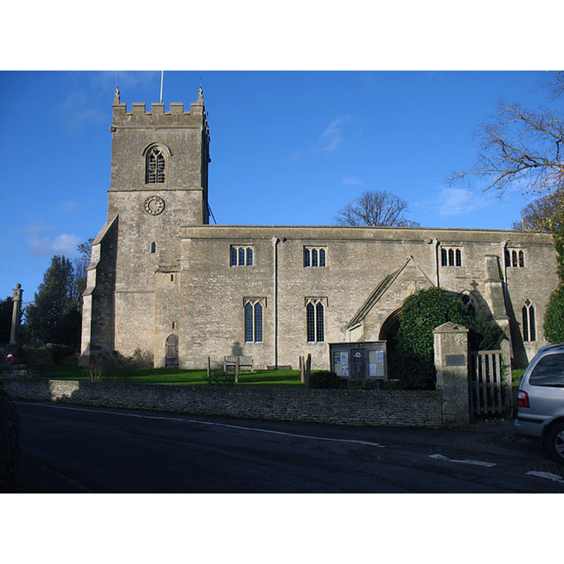
Image copyright © David Purchase, 2014
CC-BY-SA-2.0
Results: 2 records
view of church exterior - south view
Copyright Statement: Image copyright © David Purchase, 2014
Image Source: digital photograph taken 12 November 2014 by David Purchase [www.geograph.org.uk/photo/4294173] [accessed 21 November 2017]
Copyright Instructions: CC-BY-SA-2.0
view of church interior - nave - looking east
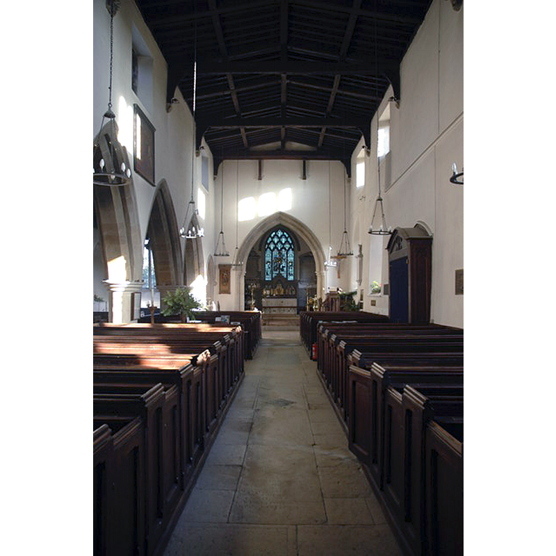
Copyright Statement: Image copyright © Philip Halling, 2009
Image Source: digital photograph taken 3 January 2009 by Philip Halling [www.geograph.org.uk/photo/1117358] [accessed 21 November 2017]
Copyright Instructions: CC-BY-SA-2.0
INFORMATION
Font ID: 06308WOO
Object Type: Baptismal Font1
Font Century and Period/Style: 13th - 14th century, Early English? / Decorated?
Church / Chapel Name: Parish Church of St. Mary the Virgin
Font Location in Church: In the nave
Church Patron Saint(s): St. Mary the Virgin
Church Address: Wootton, Oxfordshire, OX20 1DZ, UK
Site Location: Oxfordshire, South East, England, United Kingdom
Directions to Site: Located off (S) the B4027, just N of the A44 and Blenheim Palace, 4 km N of Woodstock, 15 km NW of Oxford
Ecclesiastic Region: Diocese of Oxford
Historical Region: Hundred of Wootton
Additional Comments: disappeared font? (the one from the original 12thC church here)
Font Notes:
Click to view
There are two entries for this Wootton [variant spelling] in the Domesday survey [http://opendomesday.org/place/SP4319/wootton/] [accessed 21 November 2017], neither of which mentions priest or church in it. The Guide to the Architectural Antiquities in the Neighbourhood of Oxford (1846: 122) reports: "The Font is plain octagon, Early English". In Sherwood & Pevsner (1974): "Octagonal, with convex sides and a moulded base; C14." The entry for this parish in the Victoria County History (Oxon., vol. 11, 1983) notes: "As the centre of a hundred and of a large parish with dependent chapelries, Wootton was probably the site of an early church. In the 12th century [...] The earliest parts are 13th-century [...] The font is a plain octagon, probably 14th century".
COORDINATES
UTM: 30U 612661 5748479
Latitude & Longitude (Decimal): 51.8757, -1.3634
Latitude & Longitude (DMS): 51° 52′ 32.52″ N, 1° 21′ 48.24″ W
MEDIUM AND MEASUREMENTS
Material: stone
Font Shape: octagonal, mounted
Basin Interior Shape: round
Basin Exterior Shape: octagonal
REFERENCES
- Victoria County History [online], University of London, 1993-. URL: https://www.british-history.ac.uk.
- Oxford Society for Promoting the Study of Gothic Architecture, Guide to the Architectural Antiquities in the Neighbourhood of Oxford, A, Oxford: John Henry Parker [for the Society], 1846, p. 112
- Pevsner, Nikolaus, Oxfordshire, Harmondsworth: Penguin Books, 1974, p. 859