Westcott Barton / Barton Westcott / Bertone / Westcot Barton / Westcote Barton
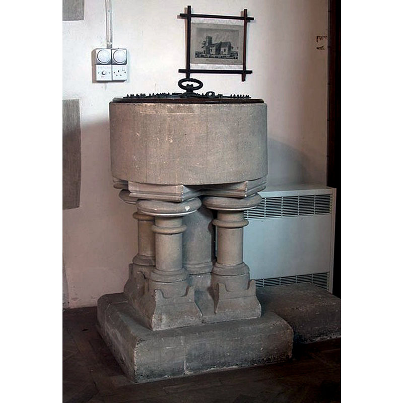
Image copyright © John Salmon, 2009
CC-BY-SA-2.0
Results: 4 records
view of font and cover
Scene Description: the suggestion that the present font incorporates a 11th-12thC basin is likely unfounded
Copyright Statement: Image copyright © John Salmon, 2009
Image Source: digital photograph taken 31 May 2003 by John Salmon [www.geograph.org.uk/photo/1622737] [accessed 15 November 2017]
Copyright Instructions: CC-BY-SA-2.0
view of church exterior - southeast view
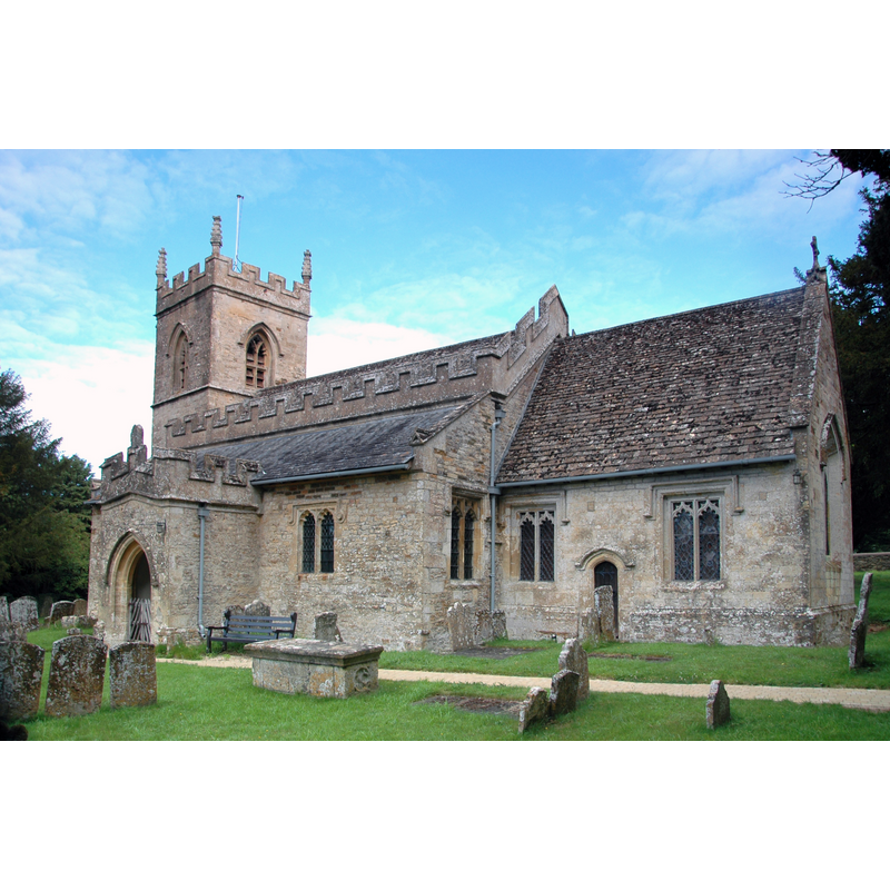
Copyright Statement: Image copyright © Motacilla, 2011
Image Source: digital photograph taken 9 August 2011 by Motacilla [https://commons.wikimedia.org/wiki/File:WestcottBarton_StEdward_SE.jpg] [accessed 15 November 2017]
Copyright Instructions: CC-BY-SA-3.0
view of church exterior - southeast view
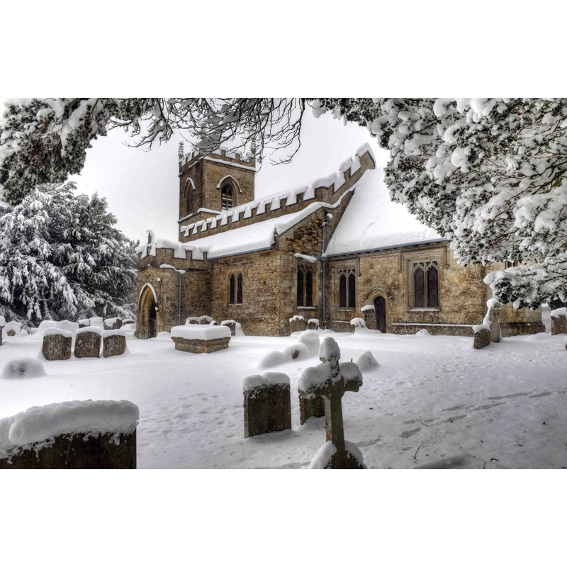
Scene Description: Source caption: "St Edward the Confessor parish church, Westcot Barton, Oxfordshire, seen from the southeast in snow".
Copyright Statement: Image copyright © Lies Thru a Lens, 2010
Image Source: digital photograph taken 20 December 2010 by Lies Thru a Lens [https://commons.wikimedia.org/wiki/File:Church,_Middle_Barton_(6330259666).jpg] [accessed 15 November 2017]
Copyright Instructions: CC-BY-2.0
view of church interior - chancel arch and rood-screen, choir-screen; iconostasis
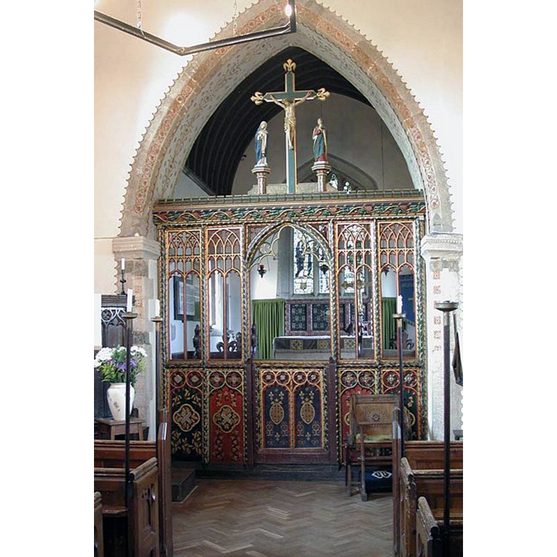
Copyright Statement: Image copyright © John Salmon, 2009
Image Source: digital photograph taken 31 May 2003 by John Salmon [www.geograph.org.uk/photo/1622736] [accessed 15 November 2017]
Copyright Instructions: CC-BY-SA-2.0
INFORMATION
Font ID: 06303WES
Object Type: Baptismal Font1?
Font Century and Period/Style: 11th - 12th century, Pre-Conquest? / Norman?
Church / Chapel Name: Parish Church of St. Edward the Confessor [originally St. Edmund's]
Font Location in Church: [disappeared? / reconstructed?]
Church Patron Saint(s): St. Edward the Confessor [originally St. Edmund]
Church Notes: archaeological evidence claimed for a pre-Conquest church here, said to have been dedicated to St Edmund [dedication changed in 1238];
Church Address: Enstone Road (B4030), Westcott Barton, Oxfordshire, OX7 7AA, UK
Site Location: Oxfordshire, South East, England, United Kingdom
Directions to Site: Located on the B4030, 11 km E of Chipping Norton, 15 km S of Banbury, 19 km N of Oxford
Ecclesiastic Region: Diocese of Oxford
Historical Region: Hundred of Wootton
Additional Comments: replaced font / disappeared font? (the omne from the pre-Conquest church here)
Font Notes:
Click to view
There is an entry for [Westcott] Barton [variant spelling] in the Domesday survey [http://opendomesday.org/place/SP4225/westcott-barton/] [accessed 15 November 2017], but it mentions neither priest nor church in it. The Guide to the Architectural Antiquities in the Neighbourhood of Oxford (1846) reports: "The font is plain round, on a square base, probably Norman, but of no marked character". Soon therefater, however, the font was replaced, as reported in the Victoria County History (Oxford, vol. 11, 1983): the church "was restored in 1855 and 1856, under the direction of G. E. Street. A western gallery, presumably erected in the 18th century, was removed, as were the 'most inconsistent' pews, and the roofs were replaced. A new font was placed at the west end of the church". There is an account of the church and its furnishings written by the Rev. Jenner Marshall, lord of the manor, and published in 1870, which makes reference to the old font just prior to the mid-19th century restoration of the building: "The Church had fallen like so many other country churches into a very unbeseeming state [...] the font had been displaced agains the west pier of the arch which divide the nave from the aisle, and was found, when the repairs occasioned its removal, to have had laid upside down for its pediment the head stone of a coffin of the thirteenth century"; Marshall (ibid.) then mentions E. Street, the diocesan architect, and Messrs. Franklin of Deddington, the designated builders, and notes part of the plans for the restoration, among which, "the Norman font remounted re-adorned and placed immediately on the left of the door of entrance". Not mentioned in Sherwood & Pevsner (1974)
[NB: we have no information on the whereabouts of the old font]
[NB: we have no information on the whereabouts of the old font]
COORDINATES
UTM: 30U 611759 5754275
Latitude & Longitude (Decimal): 51.927974, -1.374611
Latitude & Longitude (DMS): 51° 55′ 40.7″ N, 1° 22′ 28.6″ W
MEDIUM AND MEASUREMENTS
Material: stone
Number of Pieces: two?
Font Shape: round
Basin Interior Shape: round
Basin Exterior Shape: round
REFERENCES
- Victoria County History [online], University of London, 1993-. URL: https://www.british-history.ac.uk.
- Marshall, Jenner (Revd.), Memorials of Westcott Barton in the County of Oxford, London: John Russell Smith, 1870, p. 7, 8 / [http://books.google.ca/books?id=FKgLAAAAYAAJ&pg=PA7&lpg=PA7&dq=westcott+barton+church+font&source=bl&ots=6TLQ_V75nF&sig=aBfyXrXGluJONmi-sjdp9Ri7grw&hl=en&ei=pbPGSYaYLcHgnQfP4tHEDQ&sa=X&oi=book_result&resnum=6&ct=result#PPP9,M1] [accessed 22 March 2009]
- Oxford Society for Promoting the Study of Gothic Architecture, Guide to the Architectural Antiquities in the Neighbourhood of Oxford, A, Oxford: John Henry Parker [for the Society], 1846, p. 94