Bucknell / Buchehelle / Bucknell nr. Bicester
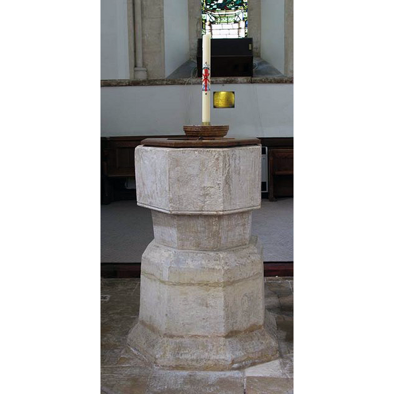
Image copyright © John Salmon, 2009
CC-BY-SA-2.0
Results: 6 records
view of font and cover
Copyright Statement: Image copyright © John Salmon, 2009
Image Source: digital photograph taken 11 June 2005 by John Salmon [www.geograph.org.uk/photo/1634572] [accessed 6 December 2016]
Copyright Instructions: CC-BY-SA-2.0
view of church exterior - north view
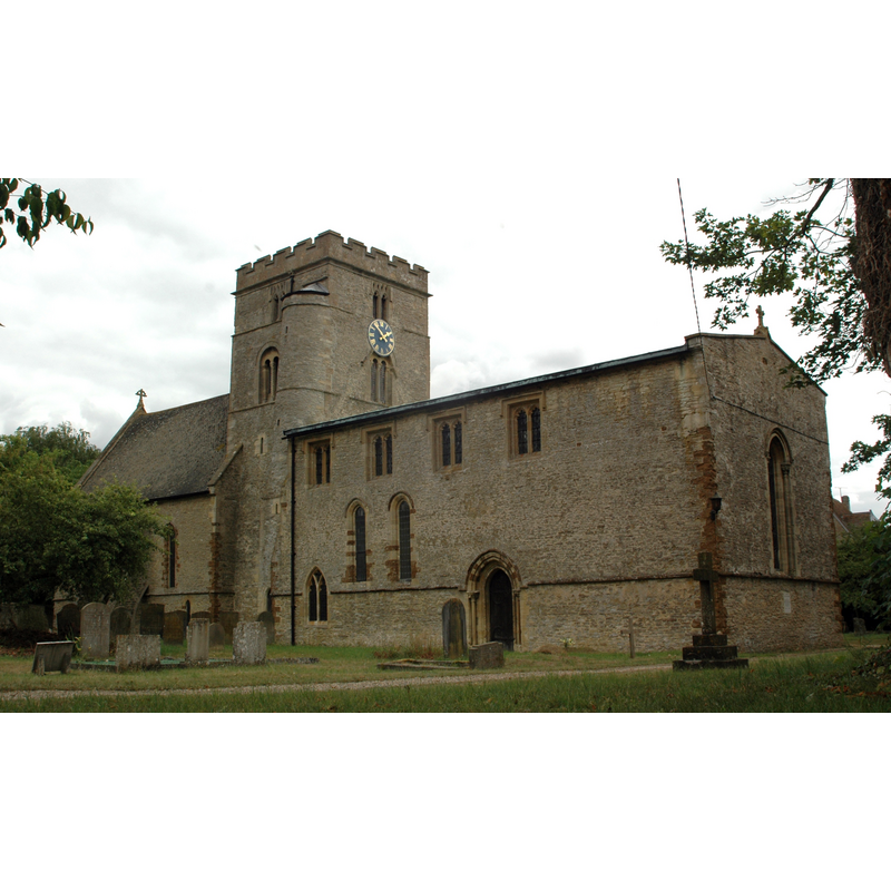
Copyright Statement: Image copyright © Motacilla, 2010
Image Source: digital photograph taken 1 August 2010 by Motacilla [http://en.wikipedia.org/wiki/File:Bucknell_StPeter_NorthElevation.JPG] [accessed 8 February 2013]
Copyright Instructions: CC-BY-SA-2.0
view of church exterior - south view
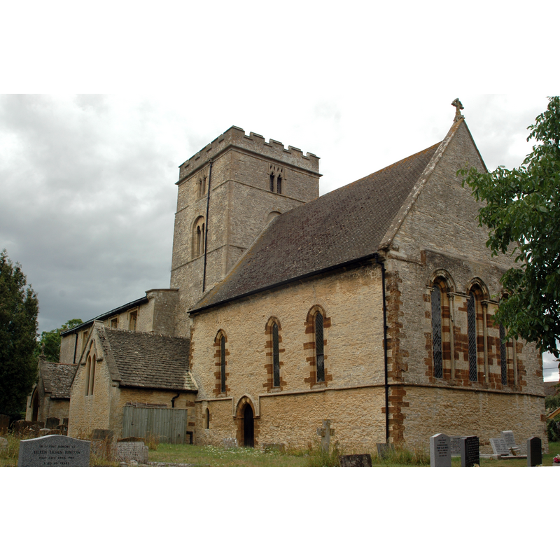
Copyright Statement: Image copyright © Motacilla, 2010
Image Source: digital photograph taken 1 August 2010 by Motacilla [http://en.wikipedia.org/wiki/File:Bucknell_StPeter_SouthElevation.JPG] [accessed 8 February 2013]
Copyright Instructions: CC-BY-SA-2.0
view of font and cover in context
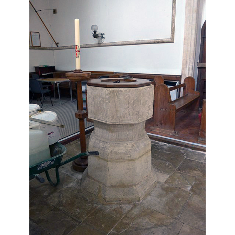
Copyright Statement: Image copyright © Basher Eyre, 2015
Image Source: digital photograph taken 21 September 2015 by Basher Eyre [www.geograph.org.uk/photo/4786081] [accessed 6 December 2016]
Copyright Instructions: CC-BY-SA-2.0
view of church interior - nave - looking west
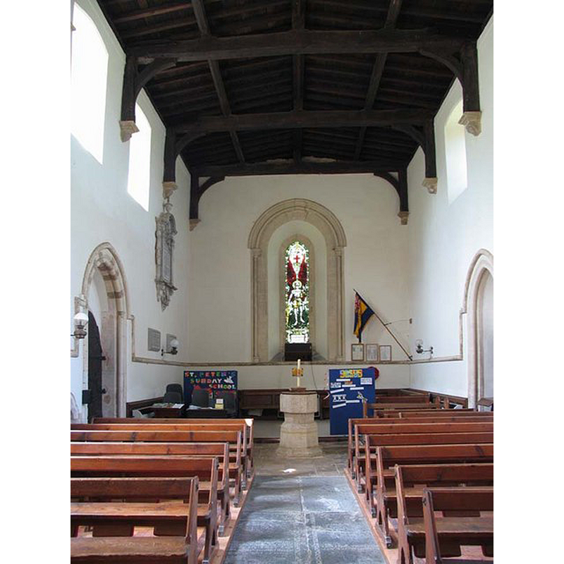
Scene Description: with the font at the far end
Copyright Statement: Image copyright © John Salmon, 2009
Image Source: digital photograph taken 11 June 2005 by John Salmon [www.geograph.org.uk/photo/1634604] [accessed 6 December 2016]
Copyright Instructions: CC-BY-SA-2.0
view of church interior - nave - looking east
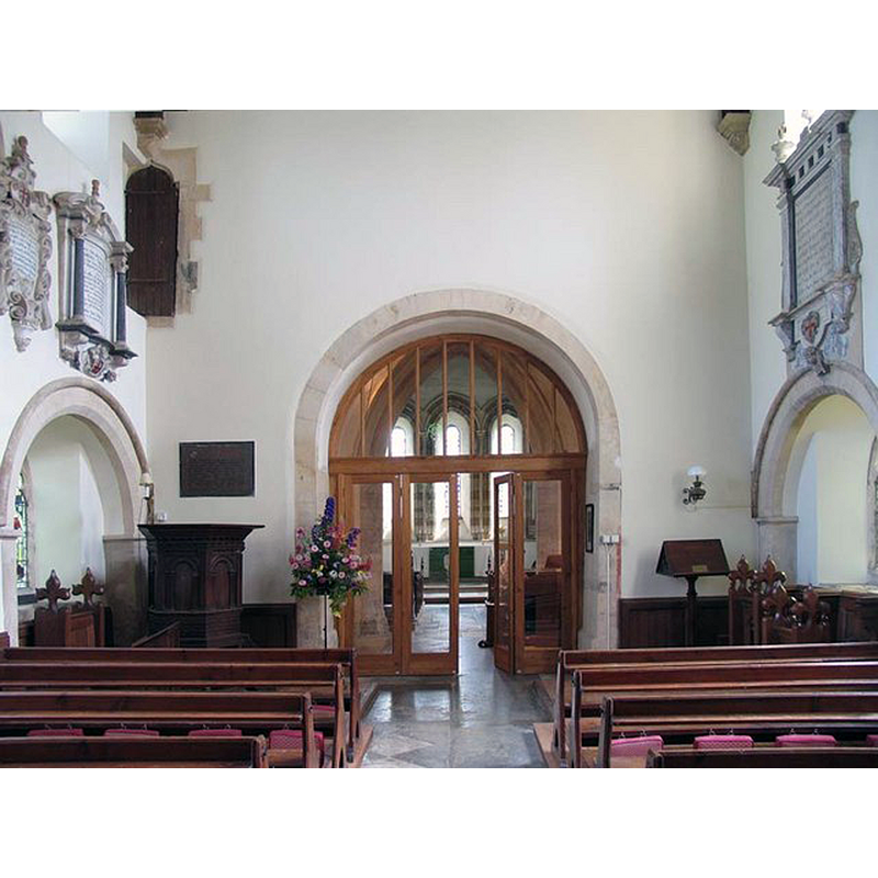
Copyright Statement: Image copyright © John Salmon, 2009
Image Source: digital photograph taken 11 June 2005 by John Salmon [www.geograph.org.uk/photo/1634577] [accessed 6 December 2016]
Copyright Instructions: CC-BY-SA-2.0
INFORMATION
Font ID: 06298BUC
Object Type: Baptismal Font1
Font Century and Period/Style: 14th century, Decorated
Church / Chapel Name: Parish Church of St. Peter
Font Location in Church: Inside the church, in the nave
Church Patron Saint(s): St. Peter
Church Address: Bainton Rd, Bucknell, Oxfordshire, OX27 7LS
Site Location: Oxfordshire, South East, England, United Kingdom
Directions to Site: Located 4 km NW of Bicester
Ecclesiastic Region: Diocese of Oxford
Historical Region: Hundred of Kirtlington [in Domesday] -- Hundred of Ploughley
Additional Comments: disappeared font? (the one from the ca.1074 church here)
Font Notes:
Click to view
There is an entry for this Bucknell [variant spelling] in the Domesday survey [http://opendomesday.org/place/SP5625/bucknell/] [accessed 6 December 2016] but it mentions neither cleric nor church in it. The Guide to the Architectural Antiquities in the Neighbourhood of Oxford (1846) reports an octagonal baptismal font here, "quite plain". The Victoria County History (Oxford, vol. 6, 1959) notes: "The earliest evidence yet found for the existence of a church at Bucknell dates from 1074 [...] In 1074 Robert d'Oilly granted two-thirds of the demesne tithes of Bucknell, along with those of some 70 other manors, to the church of St. George in Oxford castle. [...] The church is a fine example of 13th-century architecture, but the massive tower, placed between chancel and nave, is 12thcentury and belongs to an earlier church [...] a plain octagonal font on an octagonal base of two tiers", and mentions a "Buckler drawing in MS. Top. Oxon. a 65 f. 129" [Bodleian Library, Oxford]. Noted in Sherwood & Pevsner (1974): "Font. Octagonal, Dec[orated]." [NB: the VCH (ibid.) adds: "The earliest evidence yet found for the existence of a church at Bucknell dates from 1074", so it is quite possible there may have been an early Norman font later replaced by the present one]
COORDINATES
UTM: 30U 624711 5754353
Latitude & Longitude (Decimal): 51.92592, -1.18632
Latitude & Longitude (DMS): 51° 55′ 33.31″ N, 1° 11′ 10.75″ W
MEDIUM AND MEASUREMENTS
Material: stone
Font Shape: octagonal, mounted
Basin Interior Shape: round
Basin Exterior Shape: octagonal
LID INFORMATION
Date: modern
Material: wood, oak?
Apparatus: no
Notes: octagonal and flat, with depressed centre; modern
REFERENCES
- Victoria County History [online], University of London, 1993-. URL: https://www.british-history.ac.uk.
- Oxford Society for Promoting the Study of Gothic Architecture, Guide to the Architectural Antiquities in the Neighbourhood of Oxford, A, Oxford: John Henry Parker [for the Society], 1846, p. 35
- Pevsner, Nikolaus, Oxfordshire, Harmondsworth: Penguin Books, 1974, p. 501