Ambrosden / Ameresdone
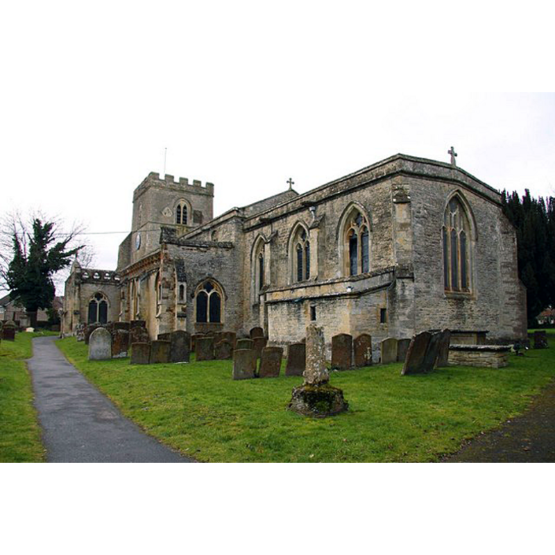
Image copyright © Steve Daniels, 2010
CC-BY-SA-3.0
Results: 3 records
B01: design element - motifs - quatrefoil - 8


view of church exterior - southeast view
Copyright Statement: Image copyright © Steve Daniels, 2010
Image Source: digital photograph taken 22 February 2010 by Steve Daniels [www.geograph.org.uk/photo/1744214] [accessed 12 June 2012]
Copyright Instructions: CC-BY-SA-3.0
view of church interior

Copyright Statement: Image copyright © University of London & History of Parliament Trust, 2008
Image Source: plan of church interior [www.british-history.ac.uk/report.aspx?compid=101878] [accessed] [11 January 2009]
Copyright Instructions: PERMISSION NOT AVAILABLE -- IMAGE NOT FOR PUBLIC USE
INFORMATION
Font ID: 06297AMB
Object Type: Baptismal Font1
Font Century and Period/Style: 14th - 15th century, Perpendicular
Church / Chapel Name: Parish Church of St. Mary the Virgin
Font Location in Church: Inside the church, at the W end of the S aisle, just W of the entranceway [cf. FontNotes]
Church Patron Saint(s): St. Mary the Virgin
Church Address: Church Walk, Ambrosden, Oxfordshire, OX25 2LY
Site Location: Oxfordshire, South East, England, United Kingdom
Directions to Site: Located off the B4011, 5 km SW of Bicester, 20 km from Oxford
Ecclesiastic Region: Diocese of Oxford
Historical Region: Hundred of headington [in Domesday] -- Hundred of Bullingdon
Additional Comments: price of a font cover, crane and lock in 1687: "£1 4s"
Font Notes:
Click to view
There is an entry for Ambrosden [variant spelling] in the Domesday survey [http://opendomesday.org/place/SP6019/ambrosden/] [accessed 10 November 2016]; it does not mention cleric or church in it. A font in this chirch is described in the Guide to the Architectural Antiquities in the Neighbourhood of Oxford (1846): "Perpendicular, octagon, cup-shaped, with a quatrefoil in each face; the shaft plain." The Ecclesiastical and Architectural Topography of England: Oxfordshire (1850) notes: "The font is P[erpendicular]". The Victoria County History (Oxford, vol. 5, 1957) notes: "The only survival of the 12th-century church is a Romanesque north doorway" , and quotes from the churchwardens' accounts: "They record the following items of expenditure: in 1687, £1 4s. 'for a new cover of wainscot for the font', and £1 6s. 'for a crane of iron for the cover . . . And a lock'". Noted in Sherwood & Pevsner (1974): "Font. Octagonal, with a quatrefoil on each face; C14." The Parish web site [http://ambrosdenchurch.org.uk/history.html] [accessed 12 June 2012] notes: "The first recorded priest was Willielmus, Sacerdos de Ambrosden (William priest of Ambrosden) in 1106 AD [...] the font is 14th century, or perhaps earlier, and until 1867 it stood midway between the south and north doors, but the cover is believed to be late 18th century."
COORDINATES
UTM: 30U 629046 5748231
Latitude & Longitude (Decimal): 51.86992, -1.1256
Latitude & Longitude (DMS): 51° 52′ 11.71″ N, 1° 7′ 32.16″ W
MEDIUM AND MEASUREMENTS
Material: stone
Font Shape: octagonal, mounted
Basin Interior Shape: round
Basin Exterior Shape: octagonal
LID INFORMATION
Date: 18th-century?
Material: wood, oak?
Apparatus: yes
Notes: [cf. FontNotes]
REFERENCES
- Victoria County History [online], University of London, 1993-. URL: https://www.british-history.ac.uk.
- Oxford Society for Promoting the Study of Gothic Architecture, Guide to the Architectural Antiquities in the Neighbourhood of Oxford, A, Oxford: John Henry Parker [for the Society], 1846, p. 20
- Parker, John Henry, The Ecclesiastical and architectural topography of England: Oxfordshire, Oxford, London: Published under the sanction of the Central Commitee of the Archaeological Institute of Great Britain and Ireland [by] John Henry Parker, 1850, [unpaged -- entry 28]
- Pevsner, Nikolaus, Oxfordshire, Harmondsworth: Penguin Books, 1974, p. 422