Charlton-on-Otmoor / Cerlentone
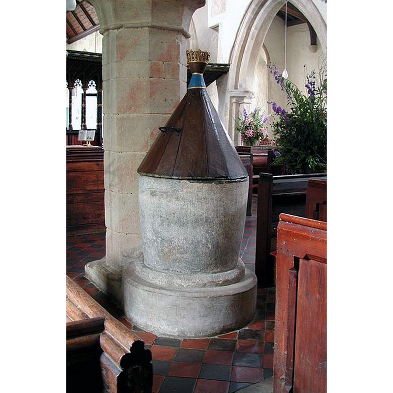
Image copyright © John Salmon, 2009
CC-BY-SA-2.0
Results: 3 records
view of font and cover in context
Copyright Statement: Image copyright © John Salmon, 2009
Image Source: digital photograph taken 26 August 2004 by John Salmon [www.geograph.org.uk/photo/1633258] [accesed 6 December 2016]
Copyright Instructions: CC-BY-SA-2.0
view of church exterior - southeast view
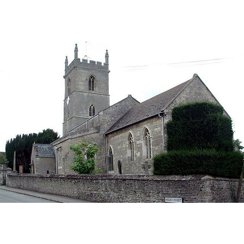
Copyright Statement: Image copyright © John Salmon, 2009
Image Source: digital photograph taken 26 August 2004 by John Salmon [www.geograph.org.uk/photo/1633249] [accesed 6 December 2016]
Copyright Instructions: CC-BY-SA-2.0
view of church interior - nave - looking east
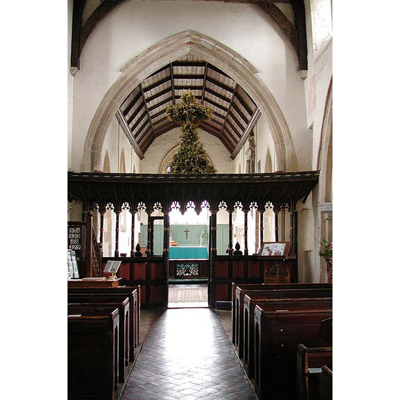
Copyright Statement: Image copyright © John Salmon, 2009
Image Source: digital photograph taken 26 August 2004 by John Salmon [www.geograph.org.uk/photo/1633250] [accesed 6 December 2016]
Copyright Instructions: CC-BY-SA-2.0
INFORMATION
Font ID: 06296CHA
Object Type: Baptismal Font1
Font Century and Period/Style: 13th century, Early English
Church / Chapel Name: Parish Church of St. Mary the Virgin
Font Location in Church: Inside the church
Church Patron Saint(s): St. Mary the Virgin
Church Address: High Street, Charlton-on-Otmoor, Oxfordshire OX5 2UQ
Site Location: Oxfordshire, South East, England, United Kingdom
Directions to Site: Located 5 km NE of Islip, 16 km NE from Oxford
Ecclesiastic Region: Diocese of Oxford
Historical Region: Hundred of Kirtlington [in Domesday] -- Hundred of Ploughley
Additional Comments: disappeared font? (the one from the 11thC church here)
Font Notes:
Click to view
There is an entry for Charlton [-on-Otmoor] [variant spelling] in the Domesday survey [http://opendomesday.org/place/SP5615/charlton-on-otmoor/] [accessed 6 December 2016] but it mentions neither cleric nor church in it. The Guide to the Architectural Antiquities in the Neighbourhood of Oxford (1846) reports: "Font, plain, round, spreading upwards, stands on two steps, which are built in with the west pillar on the north side, so that it is clearly of one age, Early English. The cover is plain pyramidal, with a singular and good top to it, consisting of a sort of crest of the Tudor flower." Noted in Kelly's Oxford Directory of 1911: "the font is plain and round and has a singular crested cover". Ettlinger (1962), probably quoting Lamborn (1929), describes it as the earliest lid of the thirteenth century. The Victoria County History (Oxford, vol. 6, 1959) notes: "There was an 11th-century church at Charlton: after the Conquest Hugh de Grantmesnil granted the advowson with the tithes, 5 virgates of land and a villein to the Benedictine monastery of St. Évroul in Normandy. His grant was confirmed by the king in 1081 [...] The church [...] is a stone building, dating mainly from the 13th and 14th centuries and comprising a chancel, clerestoried nave, north and south aisles, western tower, and south porch. [...] The stone font is plain and round with a pyramid shaped cover of wood." Noted in Sherwood & Pevsner (1974): "Font. Plain, tubshaped. Probably C13." The crested cover is C16." The font-cover is noted in Howard & Crossley (1919) as possibly of the same date as the 13th-century font.
COORDINATES
UTM: 30U 624965 5744615
Latitude & Longitude (Decimal): 51.83835, -1.186153
Latitude & Longitude (DMS): 51° 50′ 18.06″ N, 1° 11′ 10.15″ W
MEDIUM AND MEASUREMENTS
Material: stone
Font Shape: bucket-shaped, mounted
Basin Interior Shape: round
Basin Exterior Shape: round
LID INFORMATION
Date: 13th-century? / 16th-century?
Material: wood
Apparatus: no
Notes: [cf. FontNotes]
REFERENCES
- Victoria County History [online], University of London, 1993-. URL: https://www.british-history.ac.uk.
- Ettlinger, Ellen, "Folklore in Oxfordshire Churches", 73, 3 (Autumn 1962), Folklore, 1962, pp. 160-177; p. 170
- Howard, F.E., English Church Woodwork: a Study in Craftmanship during the Mediaeval period A.D. 1250-1550, London: B.T. Batsford, 1919, p. 321
- Kelly, Kelly's Directory of Oxfordshire, London: Kelly's Directories Ltd., 1911, p. 74
- Lamborn, Edward Arnold Greening, The Parish Church Its Architecture and Antiquities, Oxford: Clarendon Press, 1929, p. 99-100
- Oxford Society for Promoting the Study of Gothic Architecture, Guide to the Architectural Antiquities in the Neighbourhood of Oxford, A, Oxford: John Henry Parker [for the Society], 1846, p. 12
- Pevsner, Nikolaus, Oxfordshire, Harmondsworth: Penguin Books, 1974, p. 530