Vicques / Viques
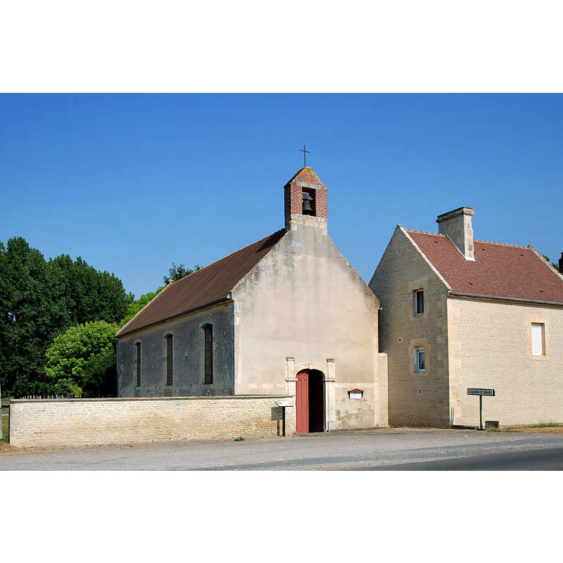
Image copyright © ChBougui, 2013
CC-BY-SA-4.0
Results: 2 records
view of church exterior - northwest view
Scene Description: the 18thC church built on the site of the Chapelle Saint-Roch
Copyright Statement: Image copyright © ChBougui, 2013
Image Source: digital photograph taken 21 July 2013 by ChBougui [https://commons.wikimedia.org/wiki/File:Église_Saint-Gervais_de_Vicques_(Vicquette).JPG] [accessed 27 March 2016]
Copyright Instructions: CC-BY-SA-4.0
view of church interior - nave - looking east
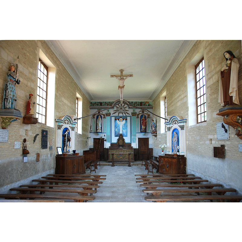
Copyright Statement: Image copyright © ChBougui, 2013
Image Source: digital photograph taken 21 July 2013 by ChBougui [https://commons.wikimedia.org/wiki/File:Nef_de_l'église_Saint-Gervais_de_Vicques_(Vicquette).JPG] [accessed 27 March 2016]
Copyright Instructions: CC-BY-SA-4.0
INFORMATION
Font ID: 06222VIC
Object Type: Baptismal Font1
Font Century and Period/Style: 16th century
Church / Chapel Name: Église paroissiale Saint-Gervais
Font Location in Church: Inside the church
Church Patron Saint(s): St. Gervasius [aka Gervais, Gervase]
Church Notes: present church built 1734 on the site of an old rural chapel, Chapelle Saint-Roch, to replace the earlier church that ended up too far from the centre of the village
Church Address: 14170 Vicques, France
Site Location: Calvados, Normandie, France, Europe
Directions to Site: Located off the D148, between Jort (N) and Morteaux-Coulibœuf (S), 9 km SW of Saint-Pierre-sur-Dives, 12 km NE of Falaise, 16 km NW of Trun
Ecclesiastic Region: Diocèse de Bayeux et Liseux
Historical Region: Basse-Normandie
Font Notes:
Click to view
Described and illustrated in Le patrimoine des communes de Calvados (2001, v. 2: 1216) as a monolithic tub-shaped immersion font of the 16th century [NB: the object is totally plain and is of an odd shape for such a late date. The text in this source states "cuve à immersion en calcaire taillé fait office de fonts baptismaux" [=limestone immersion basin serving as baptismal font]]
COORDINATES
Latitude & Longitude (Decimal): 48.948333, -0.076667
Latitude & Longitude (DMS): 48° 56′ 54″ N, 0° 4′ 36″ W
MEDIUM AND MEASUREMENTS
Material: stone, limestone (Caen stone)
Number of Pieces: one
Font Shape: tub-shaped
Basin Interior Shape: round
Basin Exterior Shape: round
LID INFORMATION
Notes: there is a metal staple on one of the upper basin sides, which may have served to hook the cover to
REFERENCES
- Le Patrimoine des communes du Calvados, Paris: FLOHIC, 2001, vol. 2, p. 1218