Theil-sur-Huisne / Le Theil-sur-Huisne
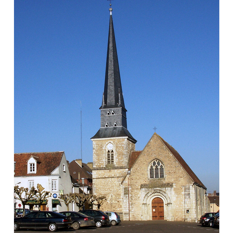
Image copyright © Unozoe, 2006
CC-BY-SA-3.0
Results: 3 records
view of church exterior - southwest view
Scene Description: Source caption: "Construite au 15e s sur les ruines d’une église détruite par la guerre de Cent ans. Nef avec bas-côtés, tour-clocher fortifiée accolée au nord de la façade occidentale. Remaniée au 19e s. ISMH 1975"
Copyright Statement: Image copyright © Unozoe, 2006
Image Source: digital photograph March 2006 by Unozoe [https://commons.wikimedia.org/wiki/File:Le_Theil-sur-Huisne,_Orne,_église_Notre-Dame_bu_140.jpg] [accessed 16 October 2023]
Copyright Instructions: CC-BY-SA-3.0
view of church interior - looking east
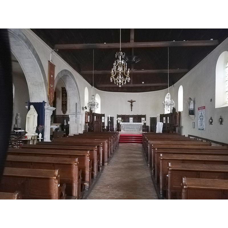
Scene Description: Source caption: "Église Notre-Dame (Le Theil-sur-Huisne) - interior"
Copyright Statement: Image copyright © FLLL, 2021
Image Source: digital photograph 18 June 2021 by FLLL [Église Notre-Dame (Le Theil-sur-Huisne) - interior] [accessed 16 October 2023]
Copyright Instructions: GFDL / CC-BY-SA-4.0,3.0,2.5,2.0,1.0
design element - motifs - foliage

Scene Description: a little of it remains visible around the chamfer

INFORMATION
Font ID: 06217THE
Object Type: Baptismal Font1?
Font Century and Period/Style: 12th - 13th century, Romanesque
Church / Chapel Name: Église paroissiale Notre-Dame-de-l'Assomption
Church Patron Saint(s): The Assumption of St. Mary
Church Notes: Santa Maria de Tillio, possibly Romanesque originally, is documented as "village et église rasés" by the English in 1424; re-built ca. 1450; closed down and used as "salpêtrière" during the Revolution; restored 19thC -- listed in Mérimée [ref.: PA00110955]: "L'église semble avoir été primitivement la chapelle du château qui fut le siège d'une importante châtellenie du Perche. Le porche roman est la seule partie qui subsiste de cette période. En 1428, lors de la guerre de Cent ans, le château et le bourg furent en grande partie détruits. L'église fut relevée après 1450. Elle se compose d'une nef terminée par un choeur en rond-point et un bas-côté voûté d'ogives qui vient buter sur le clocher qui conserve quelques traces défensives. La nef, le choeur et le clocher ont été remaniés à différentes époques, et notamment au 19e siècle."
Church Address: 2 Rue Bacchus, Le Theil-sur-Huisne, 61260 Val-au-Perche, France
Site Location: Orne, Normandie, France, Europe
Directions to Site: Located off the D407 and D636 confluence, in the municipality of Val-au-Perche, 13 km SW of Nogent-le-Rotrou, 55-60 km NE of Le Mans
Ecclesiastic Region: Diocèse de Séez
Historical Region: Le Perche Normand / Basee-Normandie
Additional Comments: disapeared / destroyed font? (the one from the medieval church here)
Font Notes:
Click to view
[NB: we have no information on the baptismal font from the medieval church here; was it destroyed in 1424?]
COORDINATES
UTM: 31U 328545 5348266
Latitude & Longitude (Decimal): 48.264377, 0.689639
Latitude & Longitude (DMS): 48° 15′ 51.76″ N, 0° 41′ 22.7″ E
REFERENCES
- Le Patrimoine des communes du Calvados, Paris: FLOHIC, 2001, vol. 2, p. 943