Northwold
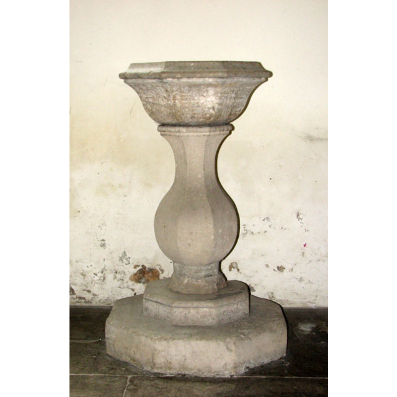
Image copyright © Evelyn Simak, 2010
CC-BY-SA-3.0
Results: 5 records
view of font
Scene Description: the 18th-century font [cf. FontNotes]
Copyright Statement: Image copyright © Evelyn Simak, 2010
Image Source: digital photograph taken 18 June 2010 by Evelyn Simak [www.geograph.org.uk/photo/1915198] [accessed 12 March 2013]
Copyright Instructions: CC-BY-SA-3.0
view of font and cover
![both 19th-century [cf. FontNotes]](/static-50478a99ec6f36a15d6234548c59f63da52304e5/compressed/1130412004_compressed.png)
Scene Description: both 19th-century [cf. FontNotes]
Copyright Statement: Image copyright © Evelyn Simak, 2010
Image Source: digital photograph taken 18 June 2010 by Evelyn Simak [www.geograph.org.uk/photo/1915206] [accessed 12 March 2013]
Copyright Instructions: CC-BY-SA-3.0
view of church exterior - southeast view
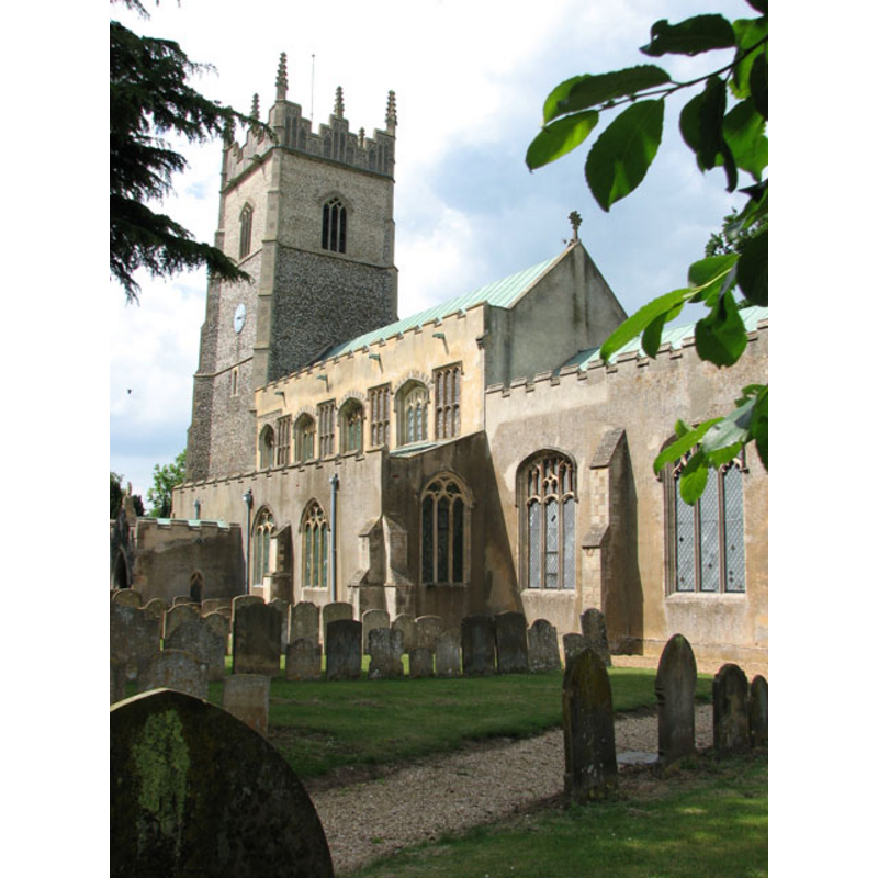
Copyright Statement: Image copyright © Evelyn Simak, 2010
Image Source: digital photograph taken 18 June 2010 by Evelyn Simak [www.geograph.org.uk/photo/1915137] [accessed 12 March 2013]
Copyright Instructions: CC-BY-SA-3.0
view of church interior - nave - looking west
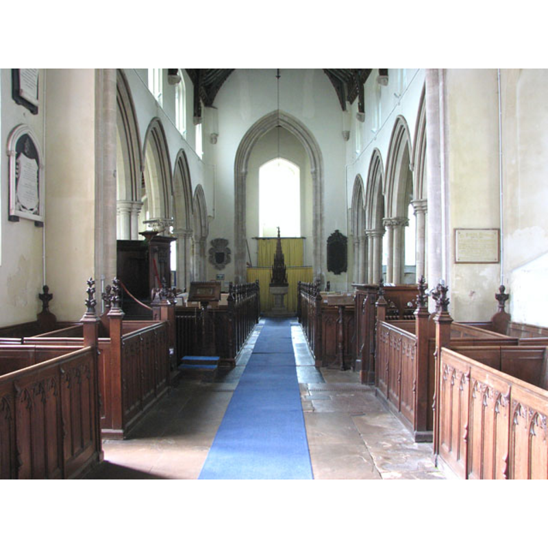
Scene Description: the 19th-century font and cover at the west end, centre aisle
Copyright Statement: Image copyright © Evelyn Simak, 2010
Image Source: digital photograph taken 18 June 2010 by Evelyn Simak [www.geograph.org.uk/photo/1915204] [accessed 12 March 2013]
Copyright Instructions: CC-BY-SA-3.0
view of church interior - nave - looking east
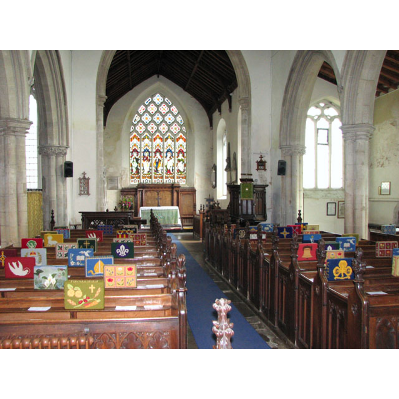
Copyright Statement: Image copyright © Evelyn Simak, 2010
Image Source: digital photograph taken 18 June 2010 by Evelyn Simak [www.geograph.org.uk/photo/1915153] [accessed 12 March 2013]
Copyright Instructions: CC-BY-SA-3.0
INFORMATION
Font ID: 06205NOR
Object Type: Baptismal Font1
Font Century and Period/Style: 13th century (late?), Decorated
Church / Chapel Name: Parish Church of St. Andrew
Font Location in Church: [cf. FontNotes]
Church Patron Saint(s): St. Andrew
Church Address: High Street, Northwold IP26 5LA
Site Location: Norfolk, East Anglia, Spain, Europe
Directions to Site: Located just off the A134, near Methwold, about 16 km ESE of Downham Market
Ecclesiastic Region: Diocese of Ely
Historical Region: Hundred of Grimeshoe [aka Grimeshou]
Additional Comments: abandoned font: unused in the churchyard / disappeared font?
Font Notes:
Click to view
Blomefield (1805-1810) writes; "The Church is dedicated to St. Andrew, and has its nave, north and south isles, with a chancel, all built with flint stones, boulder, &c. covered with lead; at the west end of the nave is a very large and lofty four-square tower, of the aforesaid materials, with quoins and embattlements of freestone, and eight pinnacles of stone, carved; in this tower hang five bells, and here is a clock, with a dial on the south side, fronting the street; this neat and strong tower was built in the reign of King Edward IV. [i.e., 1461-1483] as appears from the will of John Miller of Weeting, dated in 1473, wherein he bequeaths 20s. towards the building of it." Blomefield (ibid.) further notes: "Mr. Walter de Stow occurs rector about 1290", which gives us a rector for a church here earlier than the present one. A font here is described in Tyrrell-Green (1928) as a late baptismal font abandoned and unused in the churchyard. That may be one of two late fonts reported in Pevsner & Wilson (1999): one of "1882 with a font cover of 1887", or, perhaps, "A big c18 baluster font in the chancel". Both these fonts are illustrated in Knott (2008), the former with a tall openwork cover [NB: neither of these modern fonts is listed separately in this Index -- we have no information on the earlier font(s)]
COORDINATES
UTM: 31U 336373 5824623
Latitude & Longitude (Decimal): 52.547058, 0.586813
Latitude & Longitude (DMS): 52° 32′ 49.41″ N, 0° 35′ 12.53″ E
MEDIUM AND MEASUREMENTS
Material: stone
LID INFORMATION
Date: 1887
Material: wood, oak
REFERENCES
- Blomefield, Francis, An essay towards a topographical history of Norfolk, 1805-1810, vol. 2: 210-221 / [www.british-history.ac.uk/report.aspx?compid=78053] [accessed 12 March 2013]
- Knott, Simon, The Norfolk Churches Site, Simon Knott, 2004. [standing permission to reproduce images received from Simon (February 2005]. URL: www.norfolkchurches.co.uk.
- Pevsner, Nikolaus, Norfolk 2: North-West and South (2nd ed.), London: Penguin, 1999, p. 576
- Tyrrell-Green, E., Baptismal Fonts Classified and Illustrated, London: Society for Promoting Christian Knowledge: The Macmillan Co., 1928, p. 40, 45