Minster in Sheppey / Minster, Swale / Minster-in-Sheppey / Minster-on-Sea
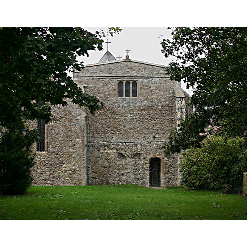
Image copyright © David Kemp, 2011
CC-BY-SA-2.0
Results: 3 records
view of church exterior - east end
Scene Description: Source caption: "SS Mary & Sexburga, Minster. Minster Abbey was founded as a nunnery in 664 and eventually comprised both a parochial church for ordinary worshippers and a nunnery church for the nuns. The east end of the latter is seen here."
Copyright Statement: Image copyright © David Kemp, 2011
Image Source: digital photograph taken 7 September 2011 by David Kemp [www.geograph.org.uk/photo/2726635] [accessed 3 May 2015]
Copyright Instructions: CC-BY-SA-2.0
view of church exterior in context
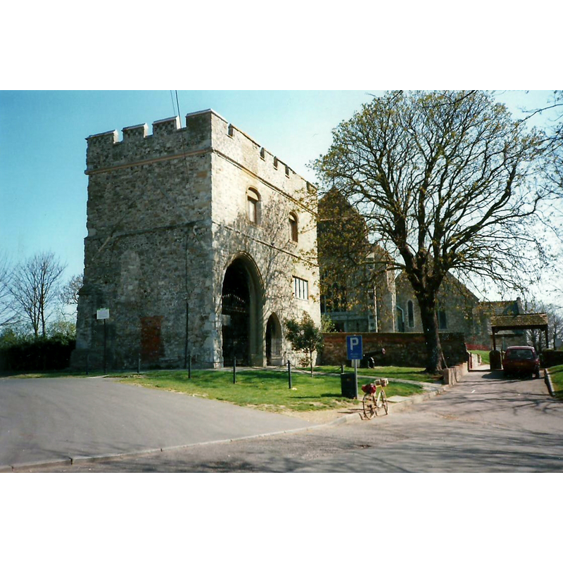
Scene Description: the gate and the abbey in its context in 1997
Copyright Statement: Image copyright © Roger Smith, 2010
Image Source: photograph taken 31 March 1997 by Roger Smith
Copyright Instructions: CC-BY-SA-2.0
view of church exterior in context
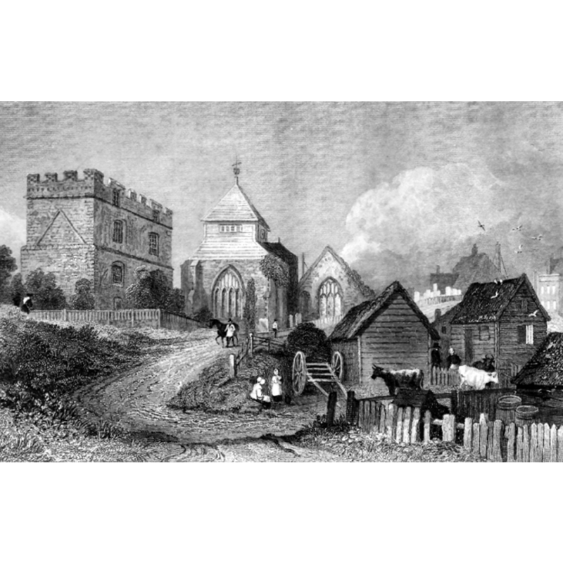
Scene Description: the gate and the abbey in its context ca. 1831
Copyright Statement: Image copyright © [in the public domain]
Image Source: engraving by H. Adlard of a drawing by T.M. Baynes, in Ireland's History of Kent, Vol. 4 (1831: 122-123) [http://en.wikipedia.org/wiki/File:MinsterSheppy.jpg] [accessed 3 May 2015]
Copyright Instructions: PD
INFORMATION
Font ID: 06147SHE
Object Type: Baptismal Font1
Font Century and Period/Style: 15th century, Perpendicular
Church / Chapel Name: Abbey church of Minster in Sheppey [now parish church]
Font Location in Church: Inside the church, in the nave, behind the fourth arch (counting from the altar)
Church Patron Saint(s): St. Mary the Virgin & St. Sexburga
Church Notes: originally a Benedictine nunnery destroyed by the Danes mid-9thC; rebuilt pre-Conquest; re-founded as Augustinian nunnery 12thC; two churches coexisted side by side at one point: abbey church and parish church
Site Location: Kent, South East, England, United Kingdom
Directions to Site: Located on the Island of Sheppey, not far from Sheerness
Ecclesiastic Region: Diocese of Canterbury
Font Notes:
Click to view
There is no entry for this Minster in the Domesday survey. A font here is noted in Glynne (1877): "The font is a plain octagon." Listed in Tyrrell-Green (1928) as the basin of an early baptismal font "with concave sides and octagonal in plan". Noted in Newman (1976): "Font. Simple Perp[endicular], concave-sided, with a Jacobean cover.
COORDINATES
UTM: 31U 347889 5699043
Latitude & Longitude (Decimal): 51.422155, 0.812203
Latitude & Longitude (DMS): 51° 25′ 19.76″ N, 0° 48′ 43.93″ E
MEDIUM AND MEASUREMENTS
Material: stone
Font Shape: octagonal, mounted
Basin Interior Shape: round
Basin Exterior Shape: octagonal
LID INFORMATION
Date: Jacobean? / 17th cetury?
Material: wood
REFERENCES
- Glynne, Steven Richard, Sir, Notes on the churches of Kent, London: John Murray, 1877, p. 138
- Newman, John, North East and East Kent, Harmondsworth: Penguin Books, 1976, p. 388
- Tyrrell-Green, E., Baptismal Fonts Classified and Illustrated, London: Society for Promoting Christian Knowledge: The Macmillan Co., 1928, p. 36