Llangranog / Gogof / Gogoff / Llangaranog
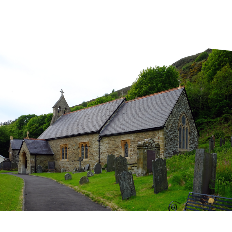
Image copyright © John Winder, 2019
CC-BY-SA-2.0
Results: 1 records
view of church exterior - southeast view
Scene Description: Source caption: "St Carannog's church. This was built in 1884 on the foundations of a much older church."
Copyright Statement: Image copyright © John Winder, 2019
Image Source: digital p photograph taken 20 May 2018 by John Winder [www.geograph.org.uk/photo/6323096] [accessed 12 January 2020]
Copyright Instructions: CC-BY-SA-2.0
INFORMATION
Font ID: 06129LLA
Object Type: Baptismal Font1
Font Century and Period/Style: 13th century, Medieval
Church / Chapel Name: Parish Church of St. Caranog
Font Location in Church: Inside the church
Church Patron Saint(s): St. Carantoc [aka Carannog, Caranog, Carantoc, Carentoc, Caradec, Cradocus, Cradokus, Crannog]
Church Address: Llangrannog, Llandysul SA44 6RH, UK
Site Location: Ceredigion, Wales, United Kingdom
Directions to Site: Located off the B4321-B4334 crossroads, on the Ceredigion Heritage Coast, about 15 km NE of Cardigan, , 32 km from Lampeter, 40 km SW of Aberystwyth
Ecclesiastic Region: Diocese of St Davids
Historical Region: Hundred of Moythen -- formerly Cardiganshire
Additional Comments: altered font? (square to dodecagonal?)
Font Notes:
Click to view
No entry for a church in Llangranog found in Meyrick. Lewis' Dictionary of 1833 reports the font at St Caranog's: "the font is square, and is supported by a circular pillar". Evans (1914) mentions an Elizabethan chalice of 1574 with the name of the church inscribed in it, but no font. The font here is listed in Tyrrell-Green (1928) as a decagonal mounted baptismal font. The entry for this church in COFLEIN [https://coflein.gov.uk/en/site/105265/details/st-cranogs-church-llangrannog] [accessed 12 January 2020] notes: "During the medieval period the church was a chapelry belonging to Llandisiliogog parish [...] The church is thought to have become a parish church in the sixteenth century. [...] The church was entirely rebuilt in 1884, on the foundations of its predecessor. [...] The octagonal font bowl, with vertical roll-mouldings and cylindrical stem and base, is thought to be early thirteenth century in date."
COORDINATES
UTM: 30U 399923 5779732
Latitude & Longitude (Decimal): 52.159, -4.463
Latitude & Longitude (DMS): 52° 9′ 32.4″ N, 4° 27′ 46.8″ W
MEDIUM AND MEASUREMENTS
Material: stone
Font Shape: cf. Font Notes
Basin Exterior Shape: cf. Font Notes
REFERENCES
- Lewis, Samuel, A Topographical Dictionary of Wales, Comprising the Several Counties, Cities, Boroughs, Corporate and Market Towns, Parishes, Chapelries, and Townships, with Historical and Statistical Descriptions [...], London: S. Lewis, 1833, [www.british-history.ac.uk/report.asp?compid=47852] [accessed 28 December 2006]
- Tyrrell-Green, E., Baptismal Fonts Classified and Illustrated, London: Society for Promoting Christian Knowledge: The Macmillan Co., 1928, p. 34