Wing nr. Oakham / Wenge / Weyng / Whenge / Wieng / Wyenge / Wynge
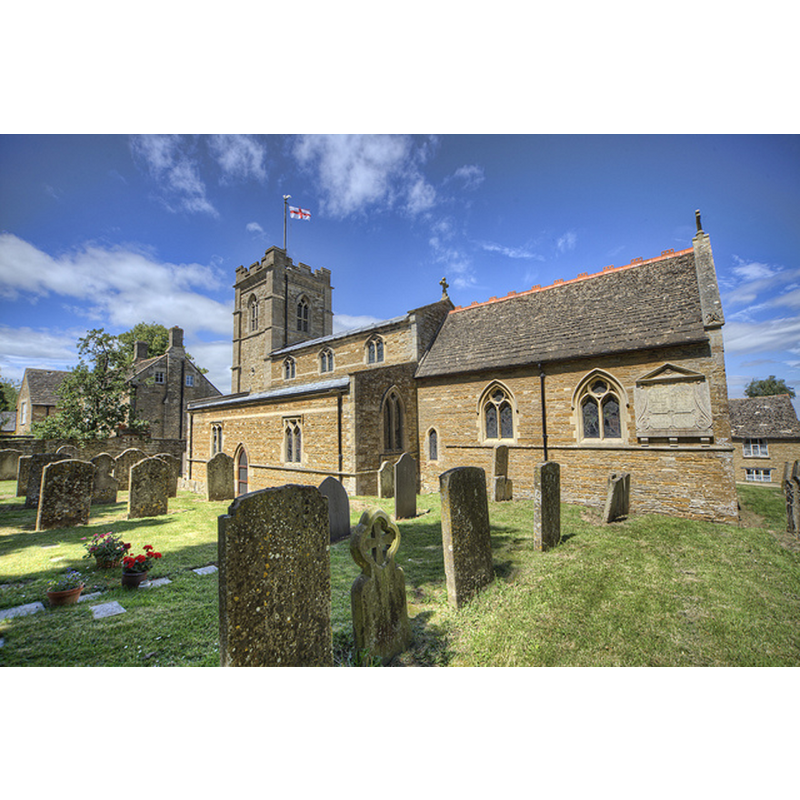
Image copyright © Christopher Jones, 2015
Standing permission
Results: 5 records
view of church exterior - southeast view
Copyright Statement: Image copyright © Christopher Jones, 2015
Image Source: digital photograph taken by Christopher Jones [www.leicestershirechurches.co.uk/wing-church-st-peter-st-paul/] [accessed 15 July 2015]
Copyright Instructions: Standing permission
view of font and cover in context
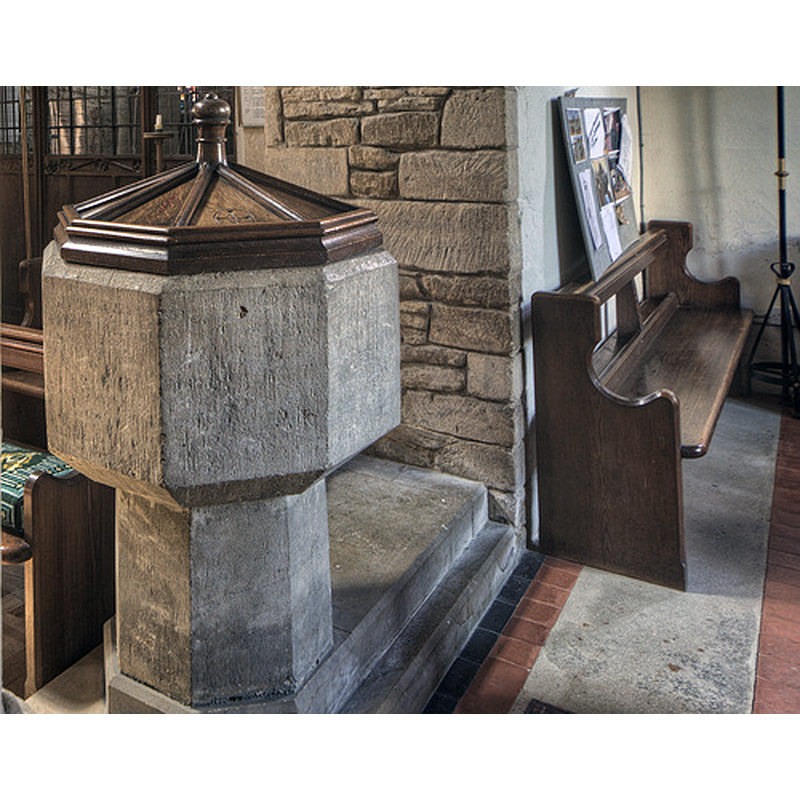
Scene Description: the base and plinth may be modern
Copyright Statement: Image copyright © Christopher Jones, 2015
Image Source: digital photograph taken by Christopher Jones [www.leicestershirechurches.co.uk/wing-church-st-peter-st-paul/] [accessed 15 July 2015]
Copyright Instructions: Standing permission
view of church interior - nave - arcade - detail
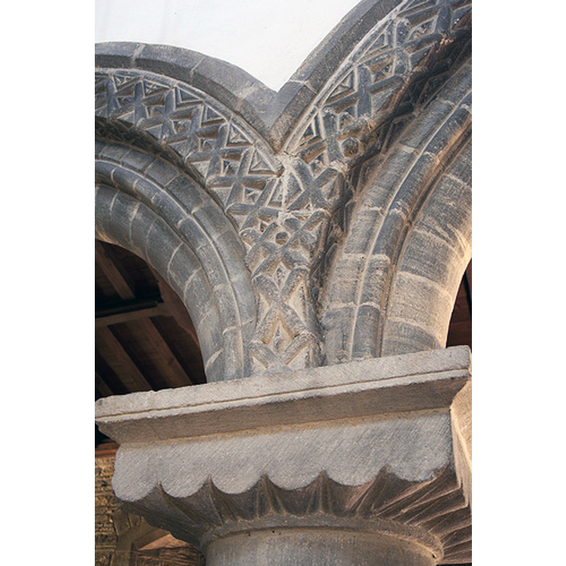
Copyright Statement: Image copyright © Christopher Jones, 2015
Image Source: digital photograph taken by Christopher Jones [www.leicestershirechurches.co.uk/wing-church-st-peter-st-paul/] [accessed 15 July 2015]
Copyright Instructions: Standing permission
view of church interior - nave - looking west
Copyright Statement: Image copyright © Christopher Jones, 2015
Image Source: digital photograph taken by Christopher Jones [www.leicestershirechurches.co.uk/wing-church-st-peter-st-paul/] [accessed 15 July 2015]
Copyright Instructions: Standing permission
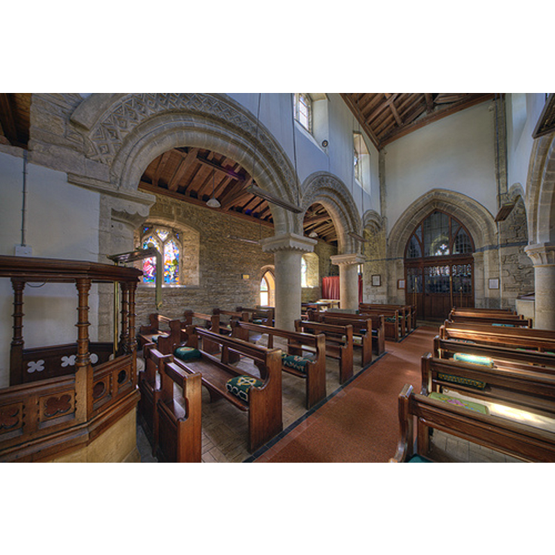
view of church interior - nave - looking east
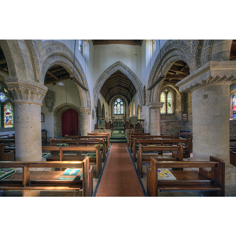
Copyright Statement: Image copyright © Christopher Jones, 2015
Image Source: digital photograph taken by Christopher Jones [www.leicestershirechurches.co.uk/wing-church-st-peter-st-paul/] [accessed 15 July 2015]
Copyright Instructions: Standing permission
INFORMATION
Font ID: 06033WIN
Object Type: Baptismal Font1
Font Century and Period/Style: 13th century, Transitional / Early English
Church / Chapel Name: Parish Church of St. Peter and St. Paul
Font Location in Church: Inside the church, benath the last arch of the N arcade
Church Patron Saint(s): St. Peter & St. Paul
Church Notes: original church here early-12thC?
Church Address: 7 Top St, Wing, Rutland LE15 8SE
Site Location: Rutland, East Midlands, England, United Kingdom
Directions to Site: Located, 5 km NE of Uppingham, 7-9 km ESE of Oakham, just E of the A6003
Ecclesiastic Region: Diocese of Peterborough
Historical Region: Hundred of Martinsley
Additional Comments: altered font? (the present one appears to have a later base and plinth) -- disappeared font? (the one from the original early-12thC? church here)
Font Notes:
Click to view
No entry for this Wing found in the Domesday survey. Tyrrell-Green (1928) list this as one in a very large group of baptismal fonts that are plain octagonal with straightsided basins; no date given. The Victoria County History (Rutland, vol. 2, 1935) notes: "The earliest church on the site was probably an aisleless building and was enlarged c. 1140 by the addition of a south aisle [...] Towards the end of the 12th century, probably c. 1180, a north aisle was added, and the existing arcade is of this date. [...] Until the close of the 14th century it seems likely that the church had no tower, but only a western bell-cote. The present tower was built c. 1380– 1400, and to make room for it the western bay of the nave was shortened, the tower being constructed partly within the nave, and the west responds and half an arch on each side taken down [...] The font has a plain octagonal bowl, chamfered on the underside, on a modern stem and base." The basin is totally plain but for the chamfering at the upper rim and underbowl, raised on a plain octagonal pedestal base and a two-step polygonal plinth; the base and the plinth appear modern; the basin is difficult to date.
Credit and Acknowledgements: We are grateful to Christopher Jones, of Leicestershire & Rutland Churches [www.leicestershirechurches.co.uk] & [www.rutlandchurches.co.uk], for his photographs of this church and font
COORDINATES
UTM: 30U 656965 5832217
Latitude & Longitude (Decimal): 52.617237, -0.68137
Latitude & Longitude (DMS): 52° 37′ 2.05″ N, 0° 40′ 52.93″ W
MEDIUM AND MEASUREMENTS
Material: stone
Font Shape: octagonal, mounted
Basin Interior Shape: round
Basin Exterior Shape: octagonal
LID INFORMATION
Date: modern?
Material: wood, oak?
Apparatus: no
Notes: octagonal low pyramid with moulded sides and arrises; knob finial; appears modern
REFERENCES
- Victoria County History [online], University of London, 1993-. URL: https://www.british-history.ac.uk.
- Tyrrell-Green, E., Baptismal Fonts Classified and Illustrated, London: Society for Promoting Christian Knowledge: The Macmillan Co., 1928, p. 32