Thornage / Tornedis
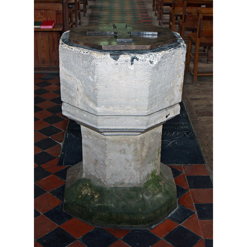
Image copyright © Brokentaco, 2008
CC-BY-SA-3.0
Results: 7 records
view of font and cover
Copyright Statement: Image copyright © Brokentaco, 2008
Image Source: digital photograph taken 28 September 2008 by Brokentaco [www.flickr.com/photos/brokentaco/3022035735/] [accessed 30 January 2014]
Copyright Instructions: CC-BY-SA-3.0
design element - motifs - moulding
Copyright Statement: Image copyright © Brokentaco, 2008
Image Source: digital photograph taken 28 September 2008 by Brokentaco [www.flickr.com/photos/brokentaco/3022035735/] [accessed 30 January 2014]
Copyright Instructions: CC-BY-SA-3.0
view of church exterior - northwest end
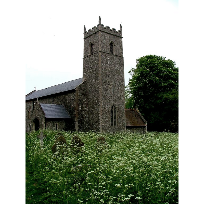
Copyright Statement: Image copyright © Simon Knott, 2006
Image Source: digital photograph July 2006 taken by Simon Knott [www.norfolkchurches.co.uk/thornage/thornage.htm] [accessed 30 January 2014]
Copyright Instructions: Standing permission
view of church exterior - north view - detail
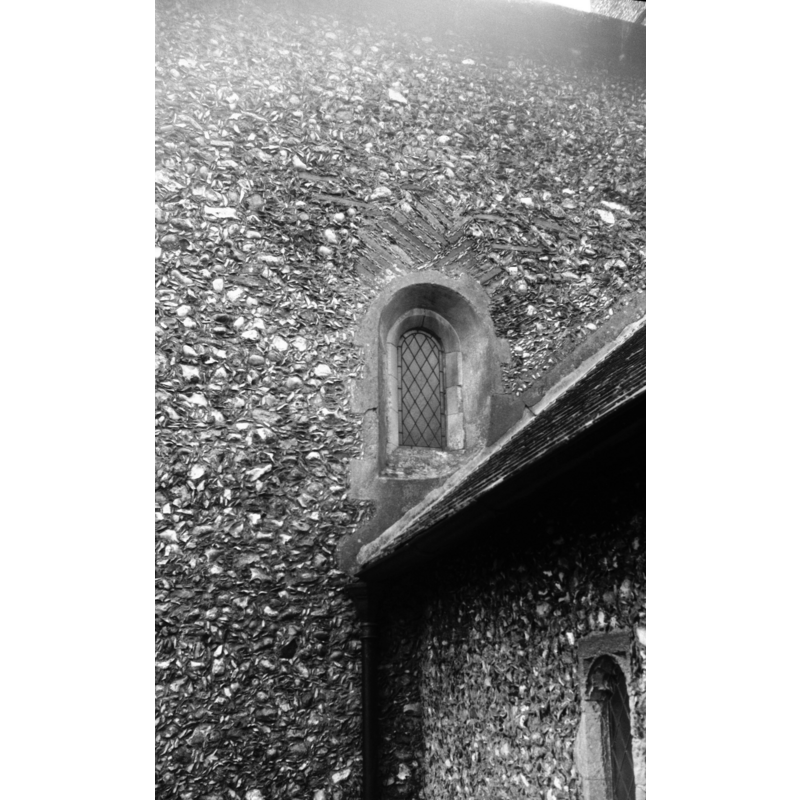
Scene Description: Photo capton: "On the north side of nave. Unusual brickwork above arch"
Copyright Statement: Image copyright © George Plunkett, 2014
Image Source: B&W photograph taken 19 June 1980 by George Plunkett [www.georgeplunkett.co.uk/Norfolk/T/Thornage All Saints church Norman window [6114] 1980-06-19.jpg] [accessed 30 January 2014]
Copyright Instructions: Standing permission by Jonathan Plunkett
view of church exterior - northwest view
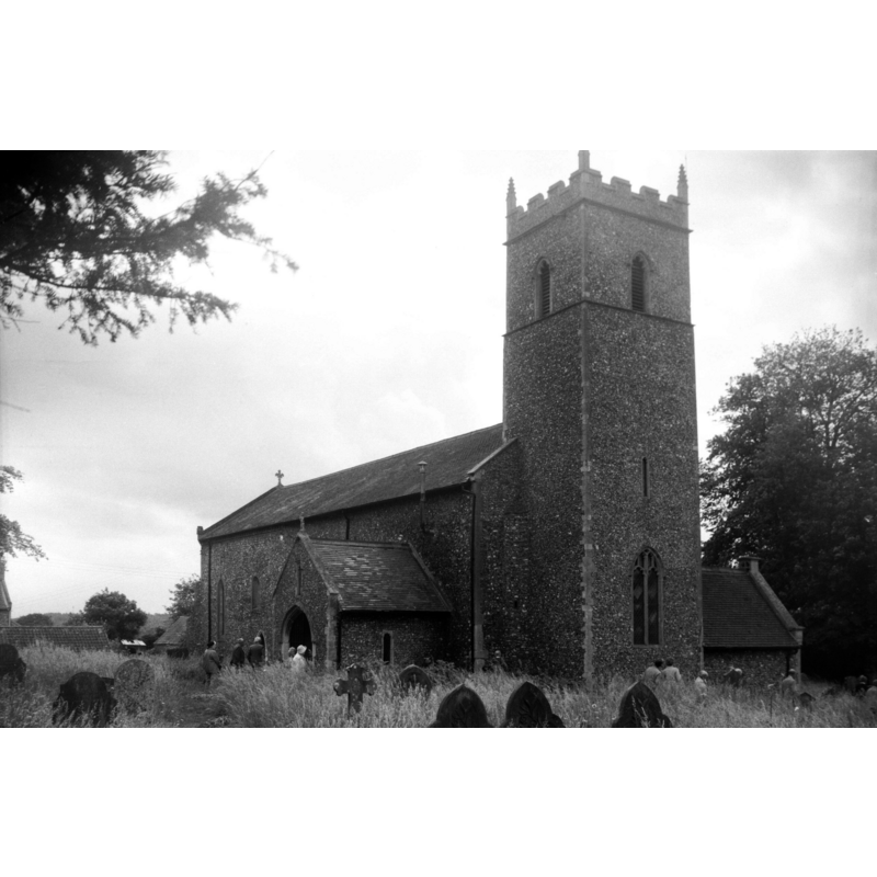
Copyright Statement: Image copyright © George Plunkett, 2014
Image Source: B&W photograph taken 19 June 1980 by George Plunkett [www.georgeplunkett.co.uk/Norfolk/T/Thornage All Saints church from NW [6113] 1980-06-19.jpg] [accessed 30 January 2014]
Copyright Instructions: Standing permission by Jonathan Plunkett
view of church interior - nave - looking west
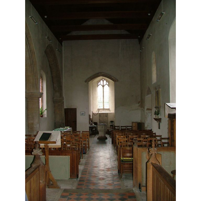
Scene Description: the font at the west end
Copyright Statement: Image copyright © Simon Knott, 2006
Image Source: digital photograph July 2006 taken by Simon Knott [www.norfolkchurches.co.uk/thornage/thornage.htm] [accessed 30 January 2014]
Copyright Instructions: Standing permission
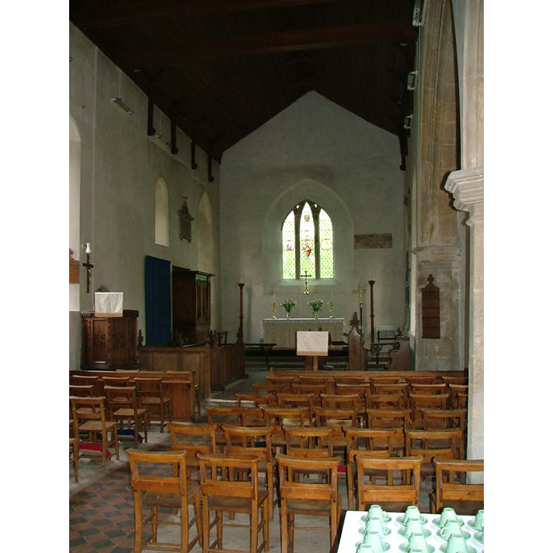
view of church interior - nave - looking east
Copyright Statement: Image copyright © Simon Knott, 2006
Image Source: digital photograph July 2006 taken by Simon Knott [www.norfolkchurches.co.uk/thornage/thornage.htm] [accessed 30 January 2014]
Copyright Instructions: Standing permission
INFORMATION
Font ID: 06025THO
Object Type: Baptismal Font1
Font Century and Period/Style: 13th - 15th century, Medieval
Church / Chapel Name: Parish Church of All Saints
Font Location in Church: Inside the church, at the W end of the nave
Church Patron Saint(s): All Saints
Church Address: Thornage, Norfolk, NR25 7QD
Site Location: Norfolk, East Anglia, England, United Kingdom
Directions to Site: Located on the B1110, 5 km SW of Holt, 16 km EEN of Fakenham, 40 KM NW of Norwich
Ecclesiastic Region: Diocese of Norwich
Historical Region: Hundred of Holt
Additional Comments: disappeared font? (the one from the Domesday-time church here)
Font Notes:
Click to view
There is an entry for Thornage [variant spelling] in the Domesday survey [http://domesdaymap.co.uk/place/TG0436/thornage/] [accessed 30 January 2014], with a church reported in it. Blomefield (1805-1810) writes: "The Church is a rectory. [...] In 1258, Mr. Simon de Letheringset occurs rector." The present font here is listed in Tyrrell-Green (1928) as one in a very large group of baptismal fonts that are plain octagonal with straightsided basins. The font consists of a plain octagonal basin with a moulded underbowl, raised on a plain octagonal stem and lower base. The wooden cover is octagonal and flat, with a flat cross decoration also in wood. Not mentioned in Pevsner & Wilson (1997).
Credit and Acknowledgements: We are grateful to Simon Knott, of Norfolk Churches [www.norfolkchurches.co.uk], for his photographs of this church; we are also grateful to Jonathan Plunkett for the photographs of this church taken by his father, George Plunkett, in June 1980
COORDINATES
UTM: 31U 368461 5861186
Latitude & Longitude (Decimal): 52.884267, 1.045086
Latitude & Longitude (DMS): 52° 53′ 3.36″ N, 1° 2′ 42.31″ E
MEDIUM AND MEASUREMENTS
Material: stone
Font Shape: octagonal, mounted
Basin Interior Shape: round
Basin Exterior Shape: octagonal
Drainage Notes: lead-lined
LID INFORMATION
Date: modern?
Material: wood, oak?
Apparatus: no
Notes: [cf. FontNotes]
REFERENCES
- Blomefield, Francis, An essay towards a topographical history of Norfolk, 1805-1810, vol. 9: 445-446 / [www.british-history.ac.uk/report.aspx?compid=78590] [accessed 30 January 2014]
- Tyrrell-Green, E., Baptismal Fonts Classified and Illustrated, London: Society for Promoting Christian Knowledge: The Macmillan Co., 1928, p. 32