Stanford nr. Swaffham
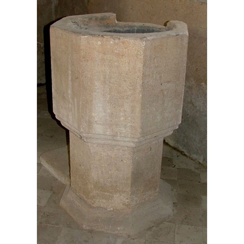
Image copyright © Simon Knott, 2004
Standing permission
Results: 5 records
view of font
Copyright Statement: Image copyright © Simon Knott, 2004
Image Source: digital photograph May 2004 taken by Simon Knott [www.norfolkchurches.co.uk/stanford/stanford.htm] [accessed 26 August 2009]
Copyright Instructions: Standing permission
design element - motifs - moulding - graded
Copyright Statement: Image copyright © Simon Knott, 2004
Image Source: digital photograph May 2004 taken by Simon Knott [www.norfolkchurches.co.uk/stanford/stanford.htm] [accessed 26 August 2009]
Copyright Instructions: Standing permission
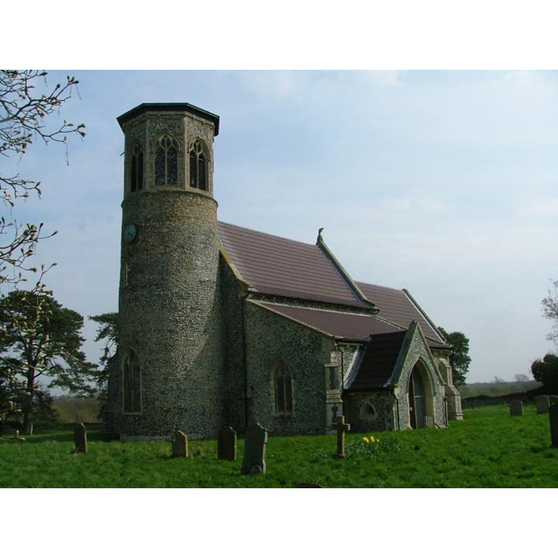
view of church exterior - southwest view
Copyright Statement: Image copyright © Simon Knott, 2004
Image Source: digital photograph May 2004 taken by Simon Knott [www.norfolkchurches.co.uk/stanford/stanford.htm] [accessed 13 March 2013]
Copyright Instructions: Standing permission
view of church interior - nave - looking southwest
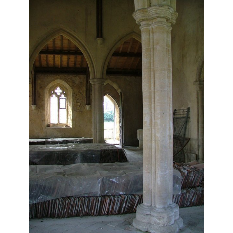
Scene Description: photograph taken from the north aisle, lokking across the nave to the south aisle; the font is partly visible at the southwest corner
Copyright Statement: Image copyright © Simon Knott, 2004
Image Source: digital photograph May 2004 taken by Simon Knott [www.norfolkchurches.co.uk/stanford/stanford.htm] [accessed 13 March 2013]
Copyright Instructions: Standing permission
design element - motifs - moulding
Copyright Statement: Image copyright © Simon Knott, 2004
Image Source: digital photograph May 2004 taken by Simon Knott [www.norfolkchurches.co.uk/stanford/stanford.htm] [accessed 26 August 2009]
Copyright Instructions: Standing permission
INFORMATION
Font ID: 06016STA
Object Type: Baptismal Font1
Font Century and Period/Style: 14th - 15th century, Medieval
Church / Chapel Name: Parish Church ofd All Saints [redundant]
Font Location in Church: Inside the church
Church Patron Saint(s): All Saints
Church Notes: round-tower church
Church Address: Stanford Battle Area, Stanford, Norfolk [cf. Directions to Site]
Site Location: Norfolk, East Anglia, England, United Kingdom
Directions to Site: Located in the Battle Zone [i.e., restricted military training area -- access not allowed without special permission from the Army], 10 km NE of Brandon, 15 km S of Swaffham
Ecclesiastic Region: Diocese of Norwich
Historical Region: Hundred of Grimeshoe [aka Grimeshou]
Additional Comments: disappeared font? (the one from the original 13th-century church here)
Font Notes:
Click to view
Blomefield (1805-1810) writes of this church and its dilapidated state at the time: "The Church is dedicated to All-Saints, and is built of brick, &c.; it has been a regular and neat pile, consisting of a nave, north and south isles, and a chancel, but is now in a very sordid and ruinous condition, both church and chancel being for the most part unpaved, the timber of the roof greatly decayed, several good windows or lights worked up, and by no means kept as becomes a place dedicated to the service of God." Blomefield (ibid.) names "Rob. de Grenewesvill" the first recorded rector here, in Henry III's time [i.e., 1216-1272]. A font in this church is listed in Tyrrell-Green (1928: 31) as one in a very large group of baptismal fonts that are plain octagonal with straightsided basins. Illustrated in Knott (2004). The basin has plain basin sides-one of them badly broken at the upper rim- but the underbowl and the lower base are decorated with graded moulding; the octagonal stem is plain. The font could be 14th- or 15th-century. [NB: we have no information on the font from the original 13th-century church here].
Credit and Acknowledgements: We are grateful to Simon Knott, of www.norfolkchurches.co.uk, for his photographs of this church and font
COORDINATES
UTM: 31U 346396 5821161
Latitude & Longitude (Decimal): 52.51888, 0.73611
Latitude & Longitude (DMS): 52° 31′ 7.97″ N, 0° 44′ 10″ E
MEDIUM AND MEASUREMENTS
Material: stone
Font Shape: octagonal, mounted
Basin Interior Shape: round
Basin Exterior Shape: octagonal
REFERENCES
- Blomefield, Francis, An essay towards a topographical history of Norfolk, 1805-1810, vol. 2: 250-256 / [www.british-history.ac.uk/report.aspx?compid=78060] [accessed 13 March 2013]
- Knott, Simon, The Norfolk Churches Site, Simon Knott, 2004. [standing permission to reproduce images received from Simon (February 2005]. URL: www.norfolkchurches.co.uk.
- Tyrrell-Green, E., Baptismal Fonts Classified and Illustrated, London: Society for Promoting Christian Knowledge: The Macmillan Co., 1928, p. 31