South Raynham / Raineham / Rainham St. Martin / Reineham / Reinham / Remeham
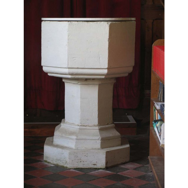
Image copyright © John Salmon, 2007
CC-BY-SA-3.0 Attribution 3.0 Unported
Results: 4 records
view of font and cover
Copyright Statement: Image copyright © John Salmon, 2007
Image Source: digital photograph taken1 November 2007 by John Salmon [www.geograph.org.uk/photo/1700176] [accessed 30 July 2013]
Copyright Instructions: CC-BY-SA-3.0 Attribution 3.0 Unported
view of church exterior - southeast view
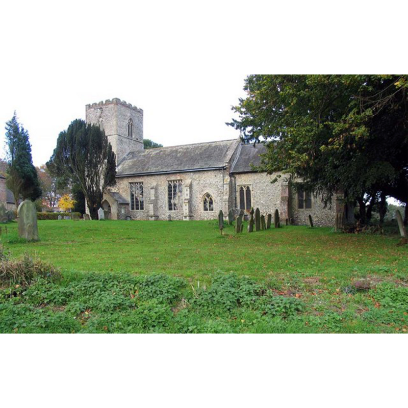
Copyright Statement: Image copyright © John Salmon, 2007
Image Source: digital photograph taken1 November 2007 by John Salmon [www.geograph.org.uk/photo/1700128] [accessed 30 July 2013]
Copyright Instructions: CC-BY-SA-3.0 Attribution 3.0 Unported
view of church interior - nave - looking west
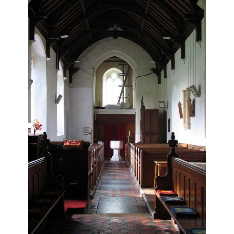
Scene Description: the font visible at the west end
Copyright Statement: Image copyright © John Salmon, 2007
Image Source: digital photograph taken1 November 2007 by John Salmon [www.geograph.org.uk/photo/1700173] [accessed 30 July 2013]
Copyright Instructions: CC-BY-SA-3.0 Attribution 3.0 Unported
view of church interior - nave - looking east
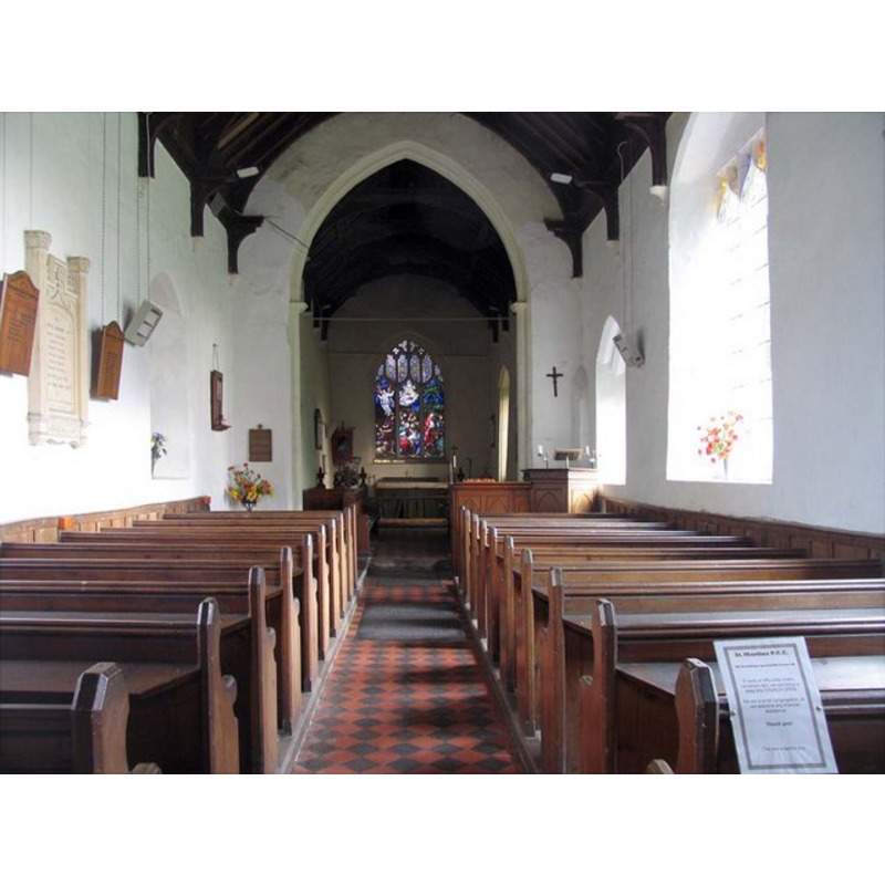
Copyright Statement: Image copyright © John Salmon, 2007
Image Source: digital photograph taken1 November 2007 by John Salmon [www.geograph.org.uk/photo/1700134] [accessed 30 July 2013]
Copyright Instructions: CC-BY-SA-3.0 Attribution 3.0 Unported
INFORMATION
Font ID: 06014RAY
Object Type: Baptismal Font1
Font Century and Period/Style: 14th - 15th century, Medieval
Church / Chapel Name: Parish Church of St. Martin
Font Location in Church: Inside the church, at the W end of the nave
Church Patron Saint(s): St. Martin of Tours
Church Address: Church Lane, South Raynham, Norfolk, NR21 7DE
Site Location: Norfolk, East Anglia, England, United Kingdom
Directions to Site: Located on the A1065, 8 km WSW of Fakenham
Ecclesiastic Region: Diocese of Norwich
Historical Region: Hundreds of Gallow and Brothercross
Additional Comments: painted font (white-washed)
Font Notes:
Click to view
Blomefield (1805-1810) writes about "RAINEHAM, Or Reineham, as it is wrote in the book of Domesday", in which, "part of the town now called East Rainham, and made up that parish, or lordship, as I take it, called now Rainham-Magna [...] South Rainham was then a beruite, that is, a less manor, and depending on this"; a third part was West Reinham. With regards the churches of East Raynham [i.e., Great/Magna] and South Raynham, Blomefield (ibid.) reports a dispute related to their advowsons, which resulted in a fine levied "in the 12th of Henry III" [i.e., 1238]; he names 'Hugh' as first recorded vicar here, in 1325. Listed in Tyrrell-Green (1928) as one in a very large group of baptismal fonts that are plain octagonal with straightsided basins. Knott (2007) shows a plain white-washed octagonal font at the west end of the nave [NB: Knott (2007) reports and illustrates the base of what may have been a 18th-century font in the ruins of West Raynham St. Margaret's]
COORDINATES
UTM: 31U 350817 5850449
Latitude & Longitude (Decimal): 52.783217, 0.787965
Latitude & Longitude (DMS): 52° 46′ 59.58″ N, 0° 47′ 16.67″ E
MEDIUM AND MEASUREMENTS
Material: stone
Font Shape: octagonal, mounted
Basin Interior Shape: round
Basin Exterior Shape: octagonal
LID INFORMATION
Date: modern
Material: wood
Apparatus: no
Notes: round, flat and plain; modern
REFERENCES
- Blomefield, Francis, An essay towards a topographical history of Norfolk, 1805-1810, vol. 7: 121-151 / [www.british-history.ac.uk/report.aspx?compid=78317] [accessed 30 July 2013]
- Knott, Simon, The Norfolk Churches Site, Simon Knott, 2004. [standing permission to reproduce images received from Simon (February 2005]. URL: www.norfolkchurches.co.uk.
- Tyrrell-Green, E., Baptismal Fonts Classified and Illustrated, London: Society for Promoting Christian Knowledge: The Macmillan Co., 1928, p. 31