Oxwick nr. Colkirk / Ossuic / Oxwyc / Oswyk
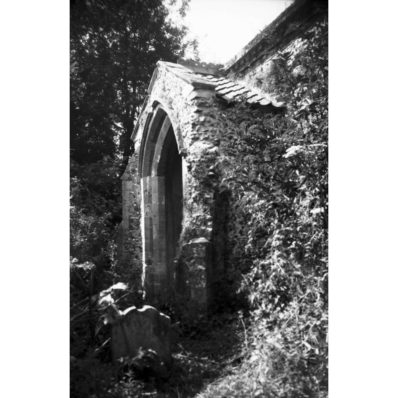
Image copyright © George Plunkett, 2014
Standing permission by Jonathan Plunkett
Results: 5 records
view of church exterior - south porch
Copyright Statement: Image copyright © George Plunkett, 2014
Image Source: B&W photograph taken 31 July 1999 by George Plunkett [www.georgeplunkett.co.uk/Norfolk/O/Oxwick All Saints church south porch [7666] 1999-07-31.jpg] [accessed 10 February 2014]
Copyright Instructions: Standing permission by Jonathan Plunkett
view of church exterior - southeast end
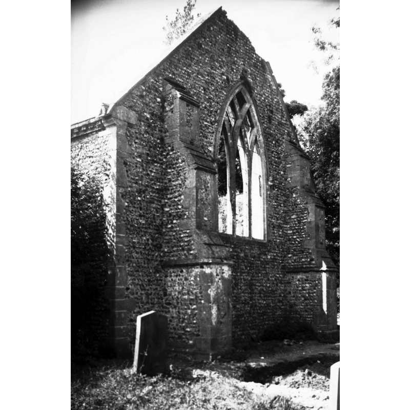
Scene Description: Photo caption: ""Chancel and nave in one, and south porch c1300. Original chancel demolished in 17c. Tower reduced to single storey in 18c. Abandoned 1940. Village depopulated." (The Ruined and Disused Churches of Norfolk by Neil Babcock)"
Copyright Statement: Image copyright © George Plunkett, 2014
Image Source: B&W photograph taken 31 July 1999 by George Plunkett [www.georgeplunkett.co.uk/Norfolk/O/Oxwick All Saints church ruin from east [7665] 1999-07-31.jpg] [accessed 10 February 2014]
Copyright Instructions: Standing permission by Jonathan Plunkett
view of church interior - west end
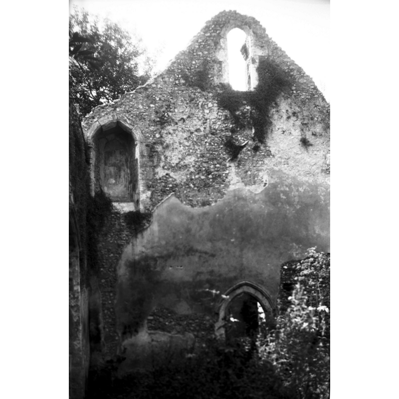
Copyright Statement: Image copyright © George Plunkett, 2014
Image Source: B&W photograph taken 31 July 1999 by George Plunkett [www.georgeplunkett.co.uk/Norfolk/O/Oxwick All Saints church interior view west [7669] 1999-07-31.jpg] [accessed 10 February 2014]
Copyright Instructions: Standing permission by Jonathan Plunkett
view of church interior - nave - looking northeast
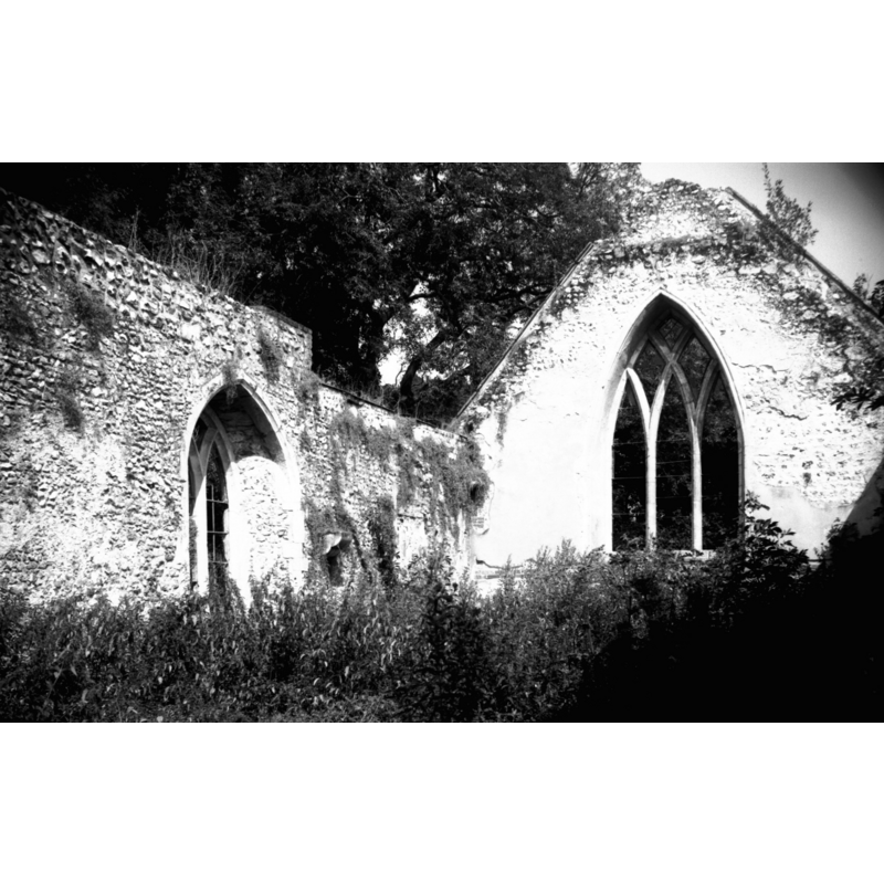
Copyright Statement: Image copyright © George Plunkett, 2014
Image Source: B&W photograph taken 31 July 1999 by George Plunkett [www.georgeplunkett.co.uk/Norfolk/O/Oxwick All Saints church interior view NE [7667] 1999-07-31.jpg] [accessed 10 February 2014]
Copyright Instructions: Standing permission by Jonathan Plunkett
view of church exterior in context - south view

Scene Description: photograph taken before 1940
Copyright Statement: Image copyright © [s.n., s.d.]
Image Source: sepia photograph of Mrs. Mary Greef standing in front of the church; photo supplied to Simon Knott by Steve Greff, Mary's great-grandson [www.norfolkchurches.co.uk/oxwick/oxwick.htm] [accessed 10 February 2014]
Copyright Instructions: PERMISSION NOT AVAILABLE -- IMAGE NOT FOR PUBLIC USE
INFORMATION
Font ID: 06013OXW
Object Type: Baptismal Font1
Font Century and Period/Style: 13th century, Medieval
Church / Chapel Name: Parish Church of All Saints [in ruins]
Font Location in Church: [cf. FontNotes]
Church Patron Saint(s): All Saints
Church Address: Colkirk, Norfolk NR21 7HX
Site Location: Norfolk, East Anglia, England, United Kingdom
Directions to Site: Located 2 km SW of Colkirk
Ecclesiastic Region: [Diocese of Norwich]
Historical Region: Hundred of Launditch
Additional Comments: disappeared font? (the one from the 13thC church here)
Font Notes:
Click to view
There is an entry for Oxwick in the Domesday survey [http://domesdaymap.co.uk/place/TF9125/oxwick/] [accessed 10 February 2014], but it mentions neither church nor cleric in it. Blomefield (1805-1810) writes: "The Church is dedicated to All-Saints, and is a rectory [...] William de Becco occurs rector in Henry the Third's time" [i.e., 1216-1272]. The present font here is listed in Tyrrell-Green (1928) as one in a very large group of baptismal fonts that are plain octagonal with straightsided basins. Pevsner & Wilson (1999) note that this "church was declared redundant in 1946", and described it as "in ruins, roofless, inaccessible and overgrown at the time of writing" [i.e., ca. 1999]. Knott (2006) illustrates the ruins of the church at present, and there does not appear to be a font in them. An early photograph reproduced in Knott (ibid.) shows the church building in good standing at the end of the 19th century (?). [NB: we have no information on the font of the 13th-century church here].
Credit and Acknowledgements: We are grateful to Jonathan Plunkett for the photographs of this church, taken by his father, George Plunkett, in July 1999
COORDINATES
UTM: 31U 353276 5851511
Latitude & Longitude (Decimal): 52.793427, 0.823924
Latitude & Longitude (DMS): 52° 47′ 36.34″ N, 0° 49′ 26.12″ E
MEDIUM AND MEASUREMENTS
Material: stone
Font Shape: octagonal, mounted
Basin Interior Shape: round
Basin Exterior Shape: octagonal
REFERENCES
- Blomefield, Francis, An essay towards a topographical history of Norfolk, 1805-1810, vol. 9: 507-508 / [www.british-history.ac.uk/report.aspx?compid=78606] [accessed 10 February 2014]
- Knott, Simon, The Norfolk Churches Site, Simon Knott, 2004. [standing permission to reproduce images received from Simon (February 2005]. URL: www.norfolkchurches.co.uk.
- Pevsner, Nikolaus, Norfolk 2: North-West and South (2nd ed.), London: Penguin, 1999, p. 588
- Tyrrell-Green, E., Baptismal Fonts Classified and Illustrated, London: Society for Promoting Christian Knowledge: The Macmillan Co., 1928, p. 31