Narford / Nereforda / Nerford
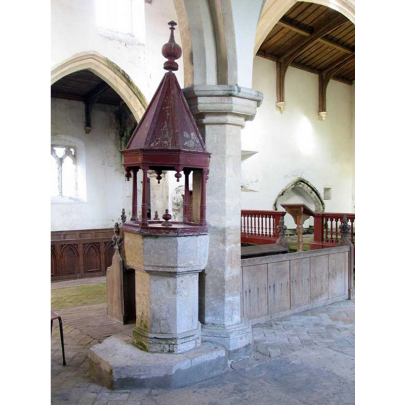
Image copyright © John Salmon, 2008
CC-BY-SA-3.0
Results: 7 records
N/S: design element - motifs - moulding
Copyright Statement: Image copyright © John Salmon, 2008
Image Source: digital photograph taken 15 February 2008 by John Salmon [www.geograph.org.uk/photo/694827] [accessed 12 August 2009]
Copyright Instructions: CC-BY-SA-3.0
view of font and cover
Copyright Statement: Image copyright © John Salmon, 2008
Image Source: digital photograph taken 15 February 2008 by John Salmon [www.geograph.org.uk/photo/694827] [accessed 12 August 2009]
Copyright Instructions: CC-BY-SA-3.0
design element - motifs - moulding
Copyright Statement: Image copyright © John Salmon, 2008
Image Source: digital photograph taken 15 February 2008 by John Salmon [www.geograph.org.uk/photo/694827] [accessed 12 August 2009]
Copyright Instructions: CC-BY-SA-3.0
view of church exterior - southeast view
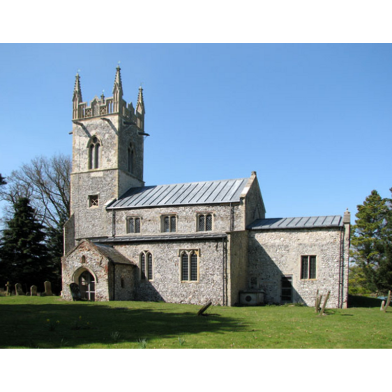
Copyright Statement: Image copyright © Evelyn Simak, 2010
Image Source: digital photograph taken 17 April 2010 by Evelyn Simak [www.geograph.org.uk/photo/1817485] [accessed 22 May 2013]
Copyright Instructions: CC-BY-SA-3.0
view of font and cover in context
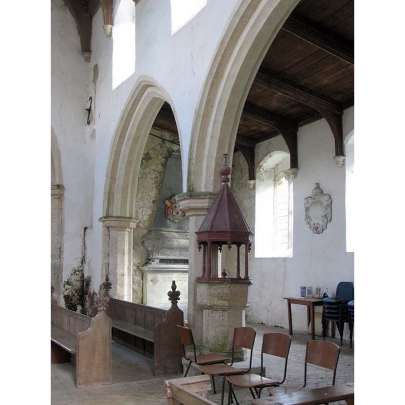
Scene Description: in the second arch of the south arcade
Copyright Statement: Image copyright © John Salmon, 2008
Image Source: digital photograph taken 15 February 2008 by John Salmon [www.geograph.org.uk/photo/1715372] [accessed 22 May 2013]
Copyright Instructions: CC-BY-SA-3.0
view of church interior - nave - looking west
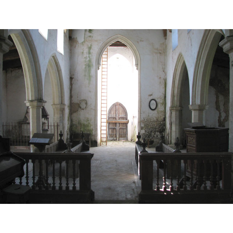
Copyright Statement: Image copyright © Evelyn Simak, 2010
Image Source: digital photograph taken 17 April 2010 by Evelyn Simak [www.geograph.org.uk/photo/1817548] [accessed 22 May 2013]
Copyright Instructions: CC-BY-SA-3.0
view of church interior - nave - looking east
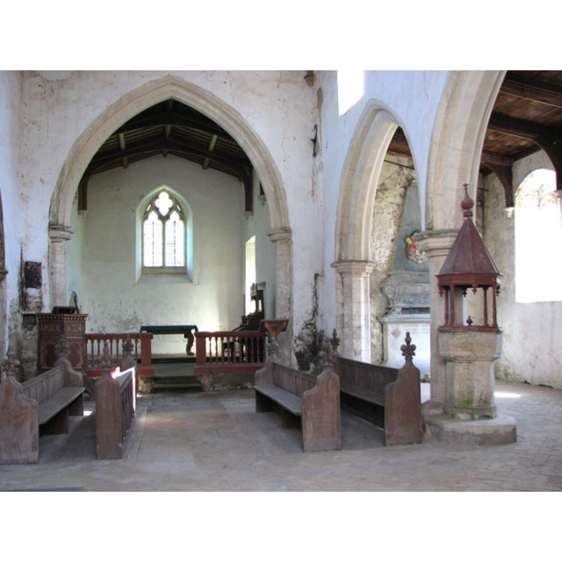
Scene Description: the font and cover in the south arcade
Copyright Statement: Image copyright © Evelyn Simak, 2010
Image Source: digital photograph taken 17 April 2010 by Evelyn Simak [www.geograph.org.uk/photo/1817509] [accessed 22 May 2013]
Copyright Instructions: CC-BY-SA-3.0
INFORMATION
Font ID: 06011NAR
Object Type: Baptismal Font1
Font Century and Period/Style: 14th - 15th century, Medieval
Church / Chapel Name: Parish Church of St. Mary [redundant]
Font Location in Church: Inside the church, in the 2nd arch of the S arcade
Church Patron Saint(s): St. Mary the Virgin
Church Address: Narborough Road, Narford, Narford, Norfolk, PE32 1JA
Site Location: Norfolk, East Anglia, England, United Kingdom
Directions to Site: Located 1 km E of Narborough, 8 km NW of Swaffham [NB: the village has shrunk to about 25 inhabitants in 2010]
Ecclesiastic Region: Diocese of Norwich
Historical Region: Hundred of South Greenhoe
Additional Comments: no entry in Simon's yet [May 2013]
Font Notes:
Click to view
Blomefield (1805-1810) writes: "The Church of Narford is a small regular building dedicated to the Virgin Mary, consisting of a nave, a north and south isle, with a chancel, all covered with lead; and at the west end of the nave stands a foursquare tower, with three bells, on which Sir Andrew Fountaine, a few years past, erected a spire of wood, and painted, with a weather-cock and ball gilt." Blomefield (ibid.) names "Jeffrey de Marham" as the first recorded vivar here, in 1306. The present font is listed in Tyrrell-Green (1928) as one in a very large group of baptismal fonts that are plain octagonal with straightsided basins. Noted in Pevsner & Wilson (1999) as "Octagonal and plain". This same source mentions the font cover: "Jacobean, with a spire on four turned posts." The font itself consists of an octagonal basin with moulded underbowl, and an octagonal pedestal base with a moulded lower base; stands on a small irregular polygonal plinth near one of the pillars at the back of the nave. The cover appears to be actually two covers: one is the octagonal pyramid mounted on four slender pillars at the upper rim of the font; the other is a flat octagonal cover that fits within the pillars on top of the basin well; both painted.
COORDINATES
UTM: 31U 338429 5840798
Latitude & Longitude (Decimal): 52.69296, 0.6092
Latitude & Longitude (DMS): 52° 41′ 34.66″ N, 0° 36′ 33.12″ E
MEDIUM AND MEASUREMENTS
Material: stone
Font Shape: octagonal, mounted
Basin Interior Shape: round
Basin Exterior Shape: octagonal
LID INFORMATION
Date: 17th-century?
Material: wood
Apparatus: no -- the base of the cover rests on the upper rim of the basin
Notes: [cf. FontNotes]
REFERENCES
- Blomefield, Francis, An essay towards a topographical history of Norfolk, 1805-1810, vol. 6: 229-239 / [www.british-history.ac.uk/report.aspx?compid=78246] [accessed 22 May 2013]
- Pevsner, Nikolaus, Norfolk 2: North-West and South (2nd ed.), London: Penguin, 1999, p. 553
- Tyrrell-Green, E., Baptismal Fonts Classified and Illustrated, London: Society for Promoting Christian Knowledge: The Macmillan Co., 1928, p. 31