Milstead / Milsted
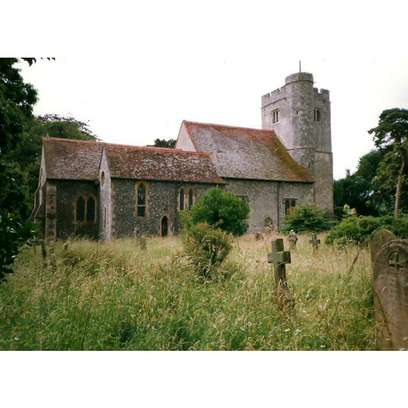
Image copyright © Roger Smith, 1998
CC-BY-SA-3.0
Results: 3 records
view of church exterior - north view
Copyright Statement: Image copyright © Roger Smith, 1998
Image Source: digital photograph taken 28 June 1998 by Roger Smith [www.geograph.org.uk/photo/2210298] [accessed 7 September 2013]
Copyright Instructions: CC-BY-SA-3.0
view of church exterior - southwest view
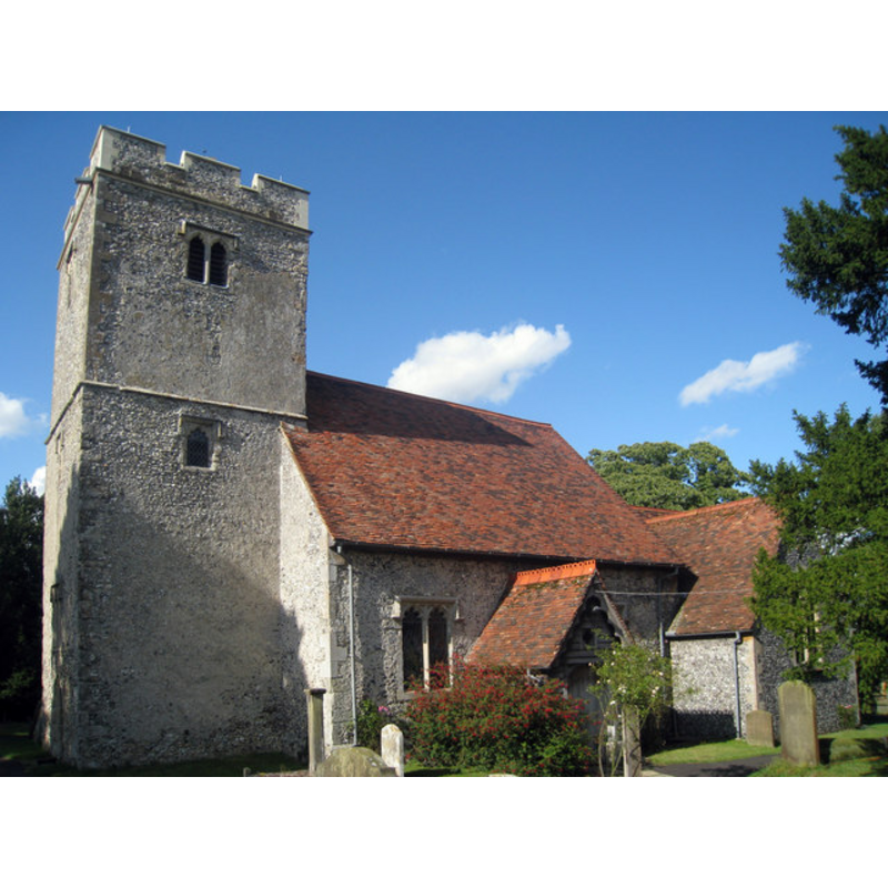
Copyright Statement: Image copyright © Oast House Archive, 2009
Image Source: digital photograph taken 30 July 2009 by Oast House Archive [www.geograph.org.uk/photo/1421337] [accessed 7 September 2013]
Copyright Instructions: CC-BY-SA-3.0
view of church interior - chancel
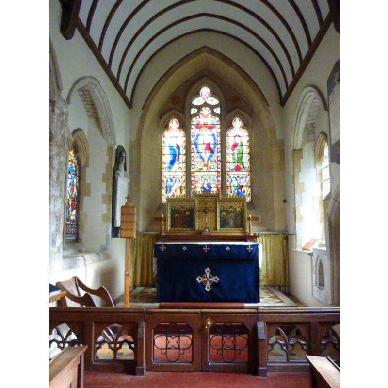
Copyright Statement: Image copyright © Pam Fray, 2013
Image Source: digital photograph taken 15 February 2013 by Pam Fray [www.geograph.org.uk/photo/3333754] [accessed 7 September 2013]
Copyright Instructions: CC-BY-SA-3.0
INFORMATION
Font ID: 05982MIL
Object Type: Baptismal Font1
Font Century and Period/Style: 13th - 14th century, Medieval
Church / Chapel Name: Parish Church of St. Mary and the Holy Cross
Font Location in Church: Inside the church before 1872 [cf. FontNotes]
Church Patron Saint(s): St. Mary the Virgin & Holy Cross
Church Notes: church restored and enlarged 1872 by William Butterfield
Church Address: Rawling Street, Milstead, Kent, ME9 0RX
Site Location: Kent, South East, England, United Kingdom
Directions to Site: Located off (S) the M2, 5 km S of Sittingbourne
Ecclesiastic Region: Diocese of Canterbury
Historical Region: Hundred of Milton [aka Middleton] -- Lath of Sherwinhope [aka Scray, Wiwarlet]
Additional Comments: disappeared font? (the one from the medieval church here)
Font Notes:
Click to view
There is no entry found for Milsted in the Domesday survey. Halsted (1798) writes: "The church of Milsted was given by king John [1199-1216] to Wydon the clerk [...] The church, which is dedicated to St. Mary and the Holy Cross is but small, and consists of one isle and one chancel, with a low square tower at the west end of it, in which hang three bells." Hussey (1852) does not mention the font in his entry for this church, nor does it get noted in Murray's 1858 or King's 1868 handbooks for travellers in the county. Glynne (1877) notes: "The font is a plain octagonal bowl set in a pointed recess on the south of the chancel." The font here is listed in Tyrrell-Green (1928) as one in a very large group of baptismal fonts that are plain octagonal with straightsided basins. Although Tyrrell-Green published his book well after Butterfield restored and enlarged this church in 1872, his information would have been gathered before that year. Glynne [cf. supra] probably visited this church ca. 1850. The present font is a modern one, probably introduced by Butterfield ca. 1872. [NB: we have no information on the whereabouts of the earlier font here].
COORDINATES
UTM: 31U 341795 5684938
Latitude & Longitude (Decimal): 51.293757, 0.730899
Latitude & Longitude (DMS): 51° 17′ 37.52″ N, 0° 43′ 51.23″ E
MEDIUM AND MEASUREMENTS
Material: stone
Font Shape: octagonal, mounted
Basin Interior Shape: round
Basin Exterior Shape: octagonal
REFERENCES
- Glynne, Steven Richard, Sir, Notes on the churches of Kent, London: John Murray, 1877, p. 163
- Hasted, Edward, The History and topographical survey of the County of Kent [...], Canterbury: Printed for the author, by Simmons and Kirkby, 1778-, vol. 6: 107-112 / [www.british-history.ac.uk/report.aspx?compid=62950] [accessed 7 September 2013]
- Hussey, Arthur, Notes on the churches in the counties of Kent, Sussex, and Surrey mentioned in Domesday Book and those of more recent date [...], London: John Russell Smith, 1852, [entry no.] 221
- Tyrrell-Green, E., Baptismal Fonts Classified and Illustrated, London: Society for Promoting Christian Knowledge: The Macmillan Co., 1928, p. 31