Mattishall Burgh / Bergh Parva / Matteshall Bergh / Mattishall Bergh
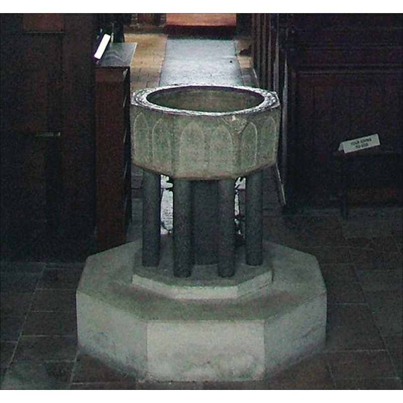
Image copyright © Simon Knott, 2006
Standing permission
Results: 5 records
view of font
Copyright Statement: Image copyright © Simon Knott, 2006
Image Source: digital photograph 2006 taken by Simon Knott [www.norfolkchurches.co.uk/mattishallburgh/mattishallburgh.htm] [accessed 11 August 2009]
Copyright Instructions: Standing permission
design element - architectural - arcade - blind - pointed arches - 16
Copyright Statement: Image copyright © Simon Knott, 2006
Image Source: digital photograph 2006 taken by Simon Knott [www.norfolkchurches.co.uk/mattishallburgh/mattishallburgh.htm] [accessed 11 August 2009]
Copyright Instructions: Standing permission
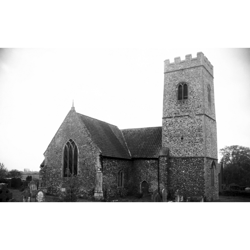
view of church exterior - northwest view
Copyright Statement: Image copyright © George Plunkett, 2014
Image Source: digital image of a B&W photograph taken 23 May 1981 by George Plunkett [www.georgeplunkett.co.uk/Norfolk/M/Mattishall Burgh St Peter's church from NW [6177] 1981-05-23.jpg] [accessed 25 March 2014]
Copyright Instructions: Standing permission by Jonathan Plunkett
view of church interior - nave - looking west
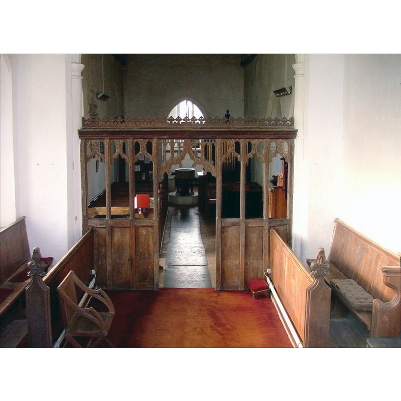
Scene Description: the font is discernible at the west end of the nave
Copyright Statement: Image copyright © Simon Knott, 2006
Image Source: digital photograph 2006 taken by Simon Knott [www.norfolkchurches.co.uk/mattishallburgh/mattishallburgh.htm] [accessed 25 March 2014]
Copyright Instructions: Standing permission
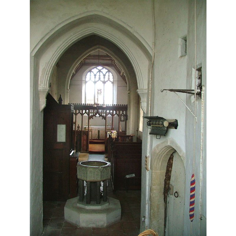
view of church interior - nave - looking east
Copyright Statement: Image copyright © Simon Knott, 2006
Image Source: digital photograph 2006 taken by Simon Knott [www.norfolkchurches.co.uk/mattishallburgh/mattishallburgh.htm] [accessed 11 August 2009]
Copyright Instructions: Standing permission
INFORMATION
Font ID: 05946MAT
Object Type: Baptismal Font1
Font Century and Period/Style: 13th century [basin only] [composite font], Medieval [composite]
Cognate Fonts: Sutton, Beccles, Denham and many others all over England
Church / Chapel Name: Parish Church of St. Peter
Font Location in Church: Inside the church, at the W end
Church Patron Saint(s): St. Peter
Church Notes: "Burgh, pronounced Burr'a" (Simon Knot's Norfolk Churches...)
Church Address: Church Lane, Mattishall, Norfolk, NR20 3RZ
Site Location: Norfolk, East Anglia, England, United Kingdom
Directions to Site: Located just S of the A47, near Mattishall, about 6-7 km E of East Dereham
Ecclesiastic Region: Diocese of Norwich
Historical Region: Hundred and half of Mitford
Additional Comments: altered font [the base is modern]
Font Notes:
Click to view
Blomefield (1805-1810) writes: "In old writing called Bergh Parva, to distinguish it from South Bergh, in this hundred; also Mattishall-Bergh, as lying near to it, and having the same lords. It is not mentioned in the Book of Domesday, being accounted for in the lordships of Ralph de Beaufo in Mateshale, and that of Hermer de Ferrarijs in the said town, as extending into this village [...] The Church has only an isle with a chancel covered with tile, a square tower, and 3 bells, and a chapel on the north side, and is dedicated to St. Peter; it is a rectory [...] Rectors. In 1300, Richard de Geyst instituted, nominated by William Mareshall, presented by the prior and convent of St. Mary of Southwark." The earliest chronological reference to this church in Blomefield (ibid.) is 1288, related to "a fine was levied of this advowson". Tyrrell-Green (1928) writes: "The octagonal form persisted in fonts of the same class in the thirteenth century, with the change that in the Early English style pointed arches take the place of rounded ones in the shallow incised arcading". This font is one of them. Listed in Leach (1975) as a font made of Purbeck marble; "bowl only; supports of usual type but a different stone." Described in Pevsner & Wilson (1999): "Octagonal, of Purbeck marble, i.e. with the usual two shallow blank arches on each side. The shafts beneath are renewed." Noted and illustrated in Knott (2006). Not just the colonnettes are modern; the whole base and the plinth are as well.
Credit and Acknowledgements: We are grateful to Simon Knott, of www.norfolkchurches.co.uk, for his photograph of this font
COORDINATES
UTM: 31U 367445 5836796
Latitude & Longitude (Decimal): 52.664885, 1.039861
Latitude & Longitude (DMS): 52° 39′ 53.59″ N, 1° 2′ 23.5″ E
MEDIUM AND MEASUREMENTS
Material: stone, limestone (Purbeck marble) [basin only]
Font Shape: octagonal, mounted
Basin Interior Shape: round
Basin Exterior Shape: octagonal
Drainage Notes: lead-lined
REFERENCES
- Blomefield, Francis, An essay towards a topographical history of Norfolk, 1805-1810, vol. 10: 195-197 / [www.british-history.ac.uk/report.aspx?compid=78659] [accessed 6 March 2014]
- Knott, Simon, The Norfolk Churches Site, Simon Knott, 2004. [standing permission to reproduce images received from Simon (February 2005]. URL: www.norfolkchurches.co.uk.
- Leach, Rosemary, A Investigation into the use of Purbeck Marble in Medieval England, Hartlepool: E.W. Harrisons & Sons, 1975, p. 77
- Pevsner, Nikolaus, Norfolk 2: North-West and South (2nd ed.), London: Penguin, 1999, p. 537
- Tyrrell-Green, E., Baptismal Fonts Classified and Illustrated, London: Society for Promoting Christian Knowledge: The Macmillan Co., 1928, p. 29