Chaddleworth / Ceadelanuurthe / Cedeledorde / Cedeneord / Chadlyngworth / Chadworth / Cheddeworth / Chedeleswrth / Chedelworth / Chedileswrth / Chedlesworth
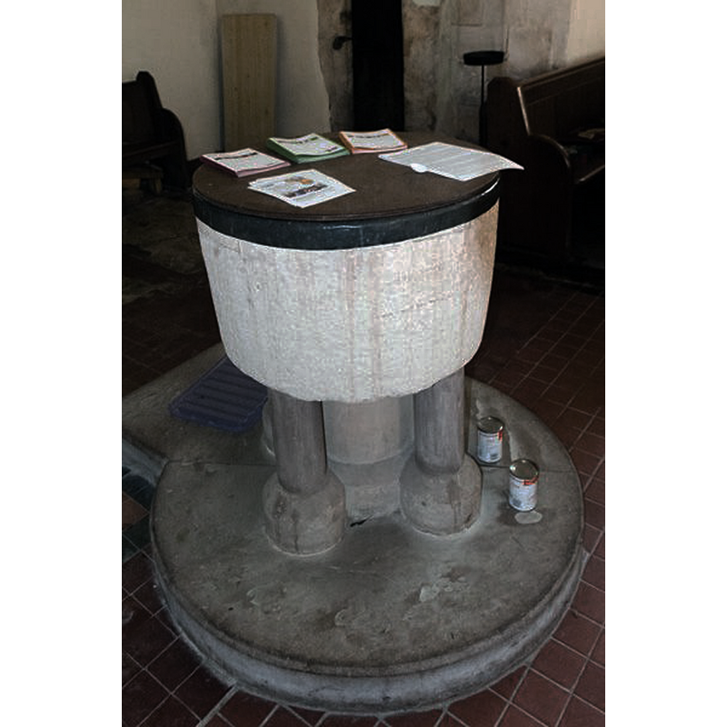
Image copyright © David Ross & Britain Express Ltd, 2015
Standing permission
Results: 4 records
view of font and cover
Copyright Statement: Image copyright © David Ross & Britain Express Ltd, 2015
Image Source: digital photograph taken by David Ross [www.britainexpress.com/counties/berkshire/churches/chaddleworth.htm] [accessed 25 May 2015]
Copyright Instructions: Standing permission
view of church exterior - south portal - detail
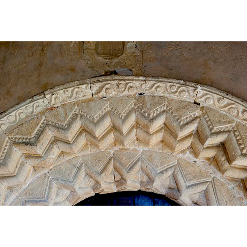
Copyright Statement: Image copyright © David Ross & Britain Express Ltd, 2015
Image Source: digital photograph taken by David Ross [www.britainexpress.com/counties/berkshire/churches/chaddleworth.htm] [accessed 25 May 2015]
Copyright Instructions: Standing permission
view of church exterior - south view
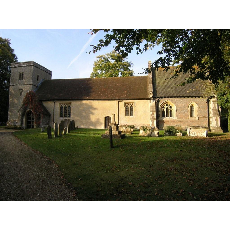
Copyright Statement: Image copyright © Michael Ford, 2002
Image Source: digital photograph taken 2002 by Michael Ford [www.geograph.org.uk/photo/1538204] [accessed 4 November 2011]
Copyright Instructions: CC-BY-SA-3.0
view of church interior - nave - looking east
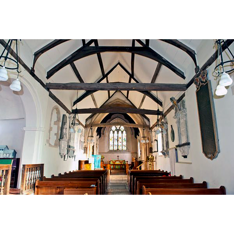
Copyright Statement: Image copyright © David Ross & Britain Express Ltd, 2015
Image Source: digital photograph taken by David Ross [www.britainexpress.com/counties/berkshire/churches/chaddleworth.htm] [accessed 25 May 2015]
Copyright Instructions: Standing permission
INFORMATION
Font ID: 05925CHA
Object Type: Baptismal Font1
Font Century and Period/Style: 12th century (late?) [basin only] [composite font], Medieval [composite]
Church / Chapel Name: Parish Church of St. Andrew
Font Location in Church: Inside the church, at the W end of the nave, S side
Church Patron Saint(s): St. Andrew
Church Address: Tower Hill / Chaddleworth House, Chaddleworth, Berkshire, RG20 7EB
Site Location: Berkshire, South East, England, United Kingdom
Directions to Site: Located off (E) of the A338, N of the M4, about 25 km NNW of Newbury
Ecclesiastic Region: Diocese of Oxford [formerly in the Diocese of Salisbury
Historical Region: Hundred of Eagle [in Domesday] -- Hundred of Kintbury Eagle
Additional Comments: altered font? (basin re-tooled? replacement base)
Font Notes:
Click to view
There are two entries for Chaddleworth [variant spelling] in the Domesday survey [http://opendomesday.org/place/SU4177/chaddleworth/] [accessed 25 May 2015], neither of which mentions cleric or church in it. The Victoria County History (Berkshire, vol. 4, 1924) notes: "The earliest mention of a church at Chaddleworth occurs towards the end of the 12th century, when Ralph de Chaddleworth granted it to the newly-established priory of Poughley. [...] The building has been very much altered from time to time, but appears to be substantially of late 12th-century date, to which period the present nave and lower part of the tower belong. [...] The font consists of a plain circular stone basin, apparently of 12th-century date, on a modern stone base, and is lined with lead. There is also a small 18th-century pillar font with fluted shaft." The font described in Tyrrell-Green (1928) as a round baptismal font mounted on a slender base, appears to be the modern font. Described and illustrated in the CRSBI (2015). A chapel in the hamlet of Wooley is reported in the VCH entry [cf. supra]: "erected at Woolley at an early date, for it formed part of the original endowment of Poughley given by Ralph de Chaddleworth in the 12th century. [,,,] In 1549 it was returned as a free chapel founded by Richard Tate for a priest to say mass at certain times in the year. There was then no incumbent, and the Tates took the profits for their own use. [...] The chapel was pulled down before 1759, [...] and the site is still known." It is not clear, however, whether this chapel had baptismal rights.
Credit and Acknowledgements: We are grateful to David Ross and Britain Express [www.britainexpress.com] for the photographs of this church and font
COORDINATES
UTM: 30U 610443 5706528
Latitude & Longitude (Decimal): 51.499089, -1.408876
Latitude & Longitude (DMS): 51° 29′ 56.72″ N, 1° 24′ 31.96″ W
MEDIUM AND MEASUREMENTS
Material: stone
Font Shape: tub-shaped, mounted
Basin Interior Shape: round
Basin Exterior Shape: round
Drainage Notes: lead-lined
Rim Thickness: 8 cm [calculated]
Diameter (inside rim): 60 cm*
Diameter (includes rim): 76 cm*
Basin Total Height: 44.5 cm*
Notes on Measurements: * CRSBI (2015)
LID INFORMATION
Date: modern
Material: wood
Apparatus: no
Notes: round, flat and plain; modern
REFERENCES
- Victoria County History [online], University of London, 1993-. URL: https://www.british-history.ac.uk.
- Corpus of Romanesque Sculpture in Britain and Ireland, The Corpus of Romanesque Sculpture in Britain and Ireland, The Corpus of Romanesque Sculpture in Britain and Ireland. URL: http://www.crsbi.ac.uk.
- Tyrrell-Green, E., Baptismal Fonts Classified and Illustrated, London: Society for Promoting Christian Knowledge: The Macmillan Co., 1928, p. 26, 45