Llandre / Llanvihangel Geneu'r Glyn / Llanfihangel Castell Gwalter / Llanfihangel Genau y Glyn
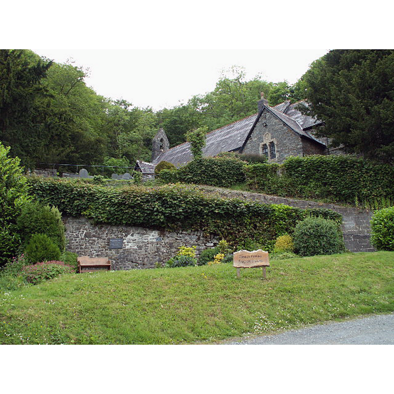
Image copyright © Nigel Callaghan, 2005
CC-BY-SA-2.0
Results: 1 records
view of church exterior in context - southeast view
Scene Description: the latest re-building of a medieval church here [cf. ChurchNotes]
Copyright Statement: Image copyright © Nigel Callaghan, 2005
Image Source: digital photograph taken 5 June 2005 by Nigel Callaghan [www.geograph.org.uk/photo/15474] [accessed 17 January 2020]
Copyright Instructions: CC-BY-SA-2.0
INFORMATION
Font ID: 05875LLA
Object Type: Baptismal Font1?
Church / Chapel Name: Parish Church of St. Michael
Church Patron Saint(s): St. Michael
Church Notes: medieval church demolished; re-built 18thC; also demol;ished; re-built late-19thC
Church Address: 1 Ruel Uchaf, Llandre, Bow Street SY24 5BZ, UK -- Tel.: +44 1970 822267
Site Location: Ceredigion, Wales, United Kingdom
Directions to Site: Located off (W) the B4353, N of the A487 croosroads, 8-9 km NE of Aberystwyth
Ecclesiastic Region: Diocese of St Davids
Historical Region: Hundred of Geneu'r Glyn -- formerly Cardiganshire and Dyfed
Font Notes:
Click to view
The entry for this parish in Lewis' Dictionary of Wales (1833) notes: "The church, dedicated to St. Michael, is spacious cruciform structure, in the later style English architecture, appropriately fitted up for the performance of divine service; and it and a churchyard are particularly admired on account of their secluded and rural aspect"; no font mentioned in it. The entry for this church in COFLEIN [https://coflein.gov.uk/en/site/400451/details/st-michaels-church-llandre] [accessed 17 January 2020] notes: "The church was known as Llanfihangel Castell Gwallter during the medieval period, when it was a chapelry in the Deanery of Ultra-Aeron. [...] Llanfihangel-Geneu'r-Glyn had become a parish by 1803 [...] The form of the medieval church is not known. It was largely rebuilt in the later eighteenth century as a symmetrical cruciform church. [...] The church was demolished in 1884-1885 and a new church built on the same site and in the same location, but retaining nothing from the earlier fabric."
COORDINATES
UTM: 30U 430016 5812590
Latitude & Longitude (Decimal): 52.459, -4.03
Latitude & Longitude (DMS): 52° 27′ 32.4″ N, 4° 1′ 48″ W
REFERENCES
- Lewis, Samuel, A Topographical Dictionary of Wales, Comprising the Several Counties, Cities, Boroughs, Corporate and Market Towns, Parishes, Chapelries, and Townships, with Historical and Statistical Descriptions [...], London: S. Lewis, 1833, vol. 2: 140