Newington / Neutone / Nevtone
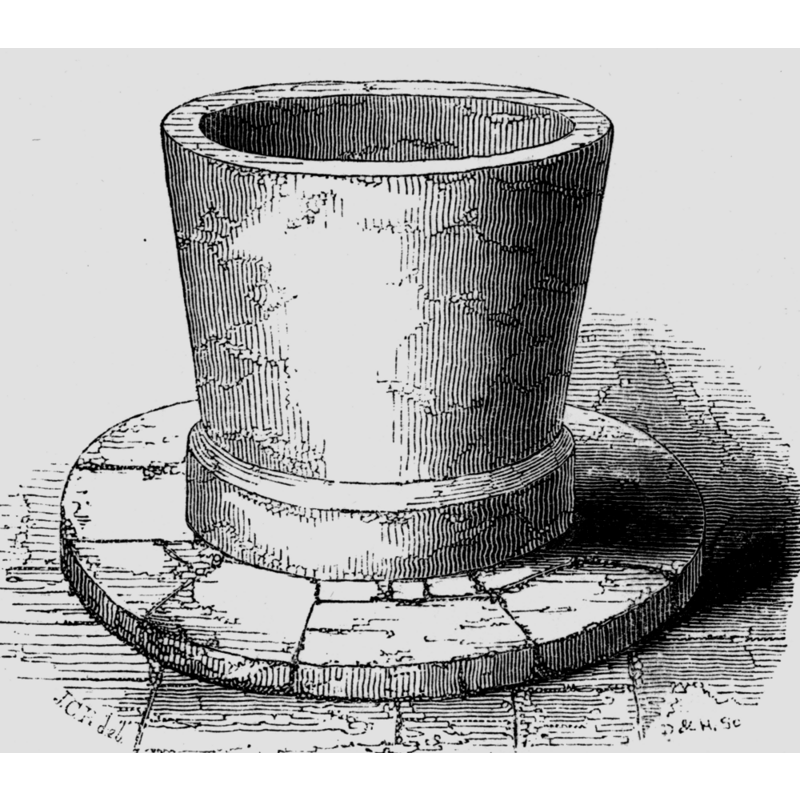
Image copyright © [in the public domain]
PD
Results: 5 records
view of font
Copyright Statement: Image copyright © [in the public domain]
Image Source: digital image of an illustration in Guide... (1846: 323)
Copyright Instructions: PD
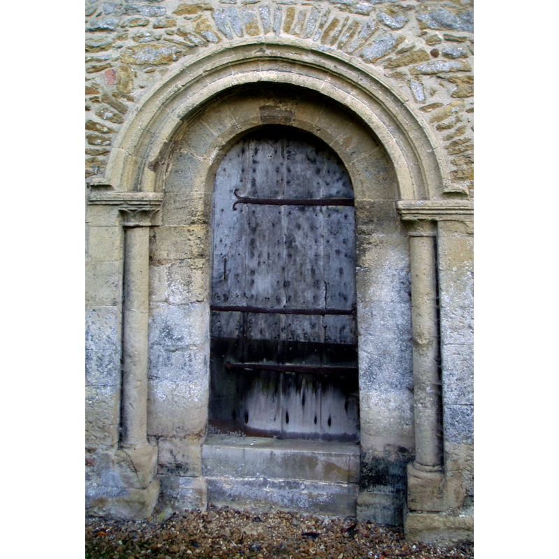
view of church exterior - north portal
Copyright Statement: Image copyright © Aidan McRae Thomson, 2010
Image Source: digital photograph taken 18 October 2010 by Aidan McRae Thomson [www.flickr.com/photos/amthomson/5102303365/in/photostream/] [accessed 3 May 2015]
Copyright Instructions: Standing permission
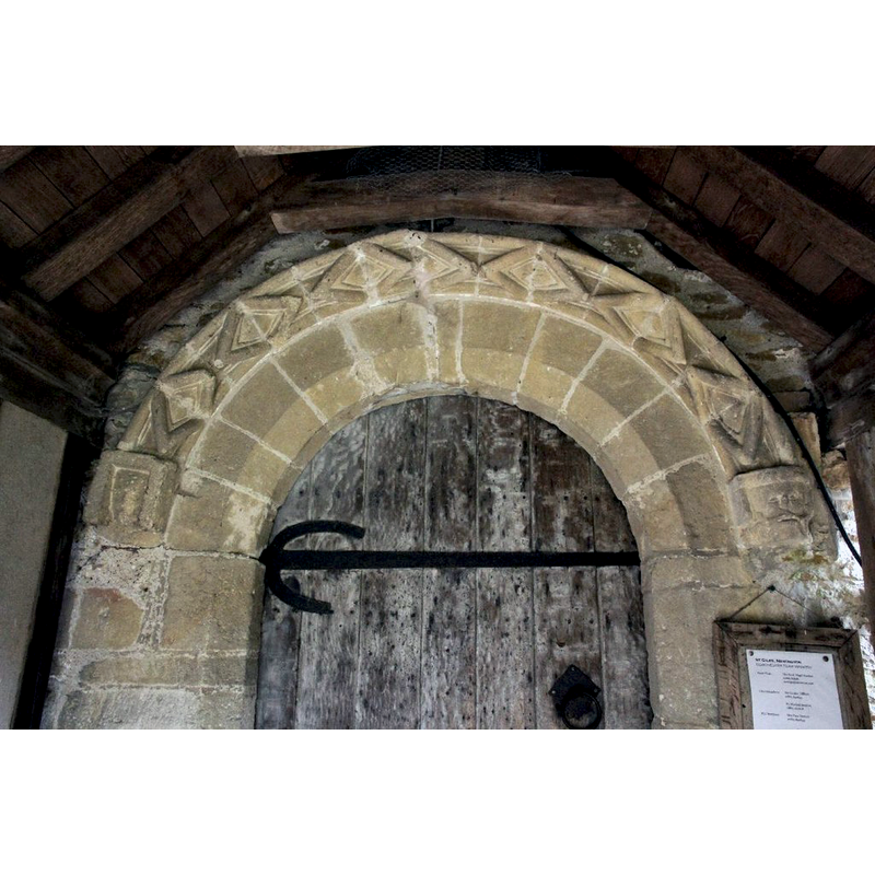
view of church exterior - south portal - detail
Copyright Statement: Image copyright © Bill Nicholls, 2011
Image Source: digital photograph taken 31 July 2011 by Bill Nicholls [whttp://www.geograph.org.uk/photo/2537014] [accessed 3 May 2015]
Copyright Instructions: CC-BY-SA-2.0
view of church exterior - southeast view
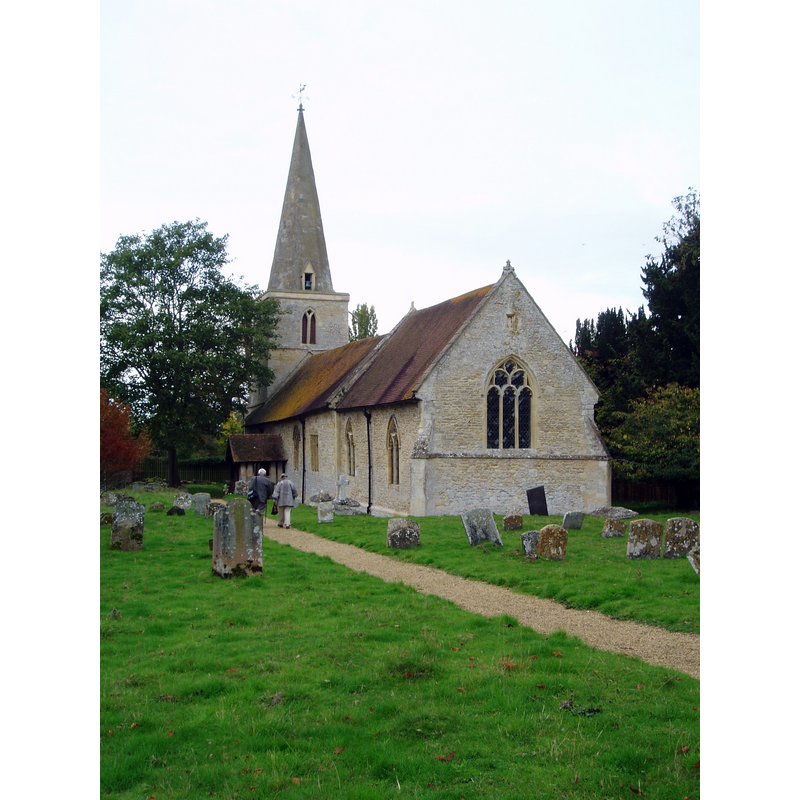
Scene Description: Source caption: "St Giles's church at Newington dates mostly from between the 12th and 14th centuries and consists of chancel and nave without aisles and a small north transept, dominated by the c1300 west tower and spire. It is sadly no longer used for services and facing an uncertain future, and is generally closed to the public. There are some real treasures within; there is outstanding 15th century stained glass in the north chancel including an Assumption of Mary and a Holy Trinity group, with donor figures below. (a further fragment of Mary from an Annunciation is in a south nave window)."
Copyright Statement: Image copyright © Aidan McRae Thomson, 2010
Image Source: digital photograph taken 18 October 2010 by Aidan McRae Thomson [www.flickr.com/photos/amthomson/5100601808/in/photostream/] [accessed 3 May 2015]
Copyright Instructions: Standing permission / CC-BY-SA-2.0
view of church interior - nave - looking east
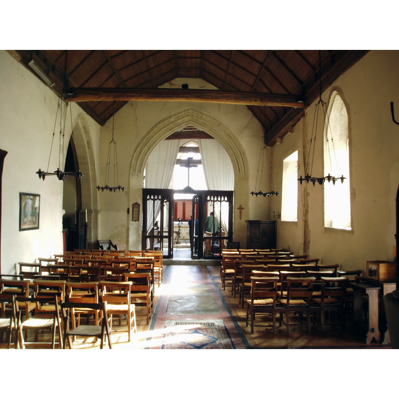
Copyright Statement: Image copyright © Aidan McRae Thomson, 2010
Image Source: digital photograph taken 18 October 2010 by Aidan McRae Thomson [www.flickr.com/photos/amthomson/5102896152/in/photostream/] [accessed 3 May 2015]
Copyright Instructions: Standing permission
INFORMATION
Font ID: 05792NEW
Object Type: Baptismal Font1
Font Century and Period/Style: 12th century, Late Norman
Church / Chapel Name: Parish Church of St. Giles
Font Location in Church: Inside the church, in the nave
Church Patron Saint(s): St. Giles [aka Aegidus, Egidus, Gilles]
Church Address: Newington, Oxfordshire OX10 7AG
Site Location: Oxfordshire, South East, England, United Kingdom
Directions to Site: Located just NE of Dorchester, about 15 km ESE of Oxford, W of the A329
Ecclesiastic Region: Diocese of Oxford
Historical Region: Hundred of Ewelme -- Hundred of Benson [in Domesday]
Font Notes:
Click to view
There is an entry for this Newington [variant spelling] in the Domesday survey [http://opendomesday.org/place/SU6196/newington/] [accessed 3 May 2015], but it mentions no cleric or church in it. A font here is described and illustrated in the Guide to the Architectural Antiquities of the Neighbourhood of Oxford (1846): "The Font, which is very large, is of the round form, quite plain, and apparently of the early part of the thirteenth century". The entry for this church in English Heritage [Listing NGR: SU6087996528] (1963) reports a tub font of the 12 century in it. The font is bucket-shaped, with a tall unmounted basin that appears totally plain except for, as usual with this type of early font, a slightly wider band at the bottom. It is raised on a low circular plinth with kneeling stone. The entry for this parish in the Victoria County History (Oxford, vol. 18, 2016) notes: "By the 12th century Newington had both a parish church and a dependent chapel at Britwell Prior, and during the Middle Ages there were also chapels at Berrick Prior and Brookhampton. The parish formed a peculiar attached to Canterbury diocese until 1846 [...] Newington church, conspicuous by its octagonal broach spire, dates largely from the 12th to 14th centuries, and in the 19th century saw only minor structural alterations. [...] The large plain tub font is probably of similar date" [i.e., 12th-century Norman].
Credit and Acknowledgements: We are grateful to Aidan McRae Thomson for his photographs of this church
COORDINATES
UTM: 30U 629860 5725338
Latitude & Longitude (Decimal): 51.664, -1.122337
Latitude & Longitude (DMS): 51° 39′ 50.4″ N, 1° 7′ 20.41″ W
MEDIUM AND MEASUREMENTS
Material: stone
Number of Pieces: one
Font Shape: bucket-shaped, unmounted
Basin Interior Shape: round
Basin Exterior Shape: round
LID INFORMATION
Date: modern?
Material: wood
Apparatus: no
Notes: round, flat and plain; modern
REFERENCES
- Victoria County History [online], University of London, 1993-. URL: https://www.british-history.ac.uk.
- Oxford Society for Promoting the Study of Gothic Architecture, Guide to the Architectural Antiquities in the Neighbourhood of Oxford, A, Oxford: John Henry Parker [for the Society], 1846, p. 323