Wycliffe / Huitcliffe / Wigeclif / Witclive
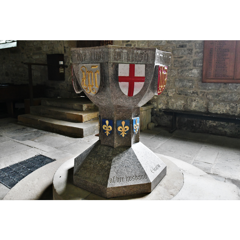
Image copyright © Michael Garlick, 2019
CC-BY-SA-2.0
Results: 13 records
view of font - northwest side
Scene Description: the modern font of 1898
Copyright Statement: Image copyright © Michael Garlick, 2019
Image Source: digital photograph taken 1 August 2019 by Michael Garlick [www.geograph.org.uk/photo/6234621] [accessed 12 November 2019]
Copyright Instructions: CC-BY-SA-2.0
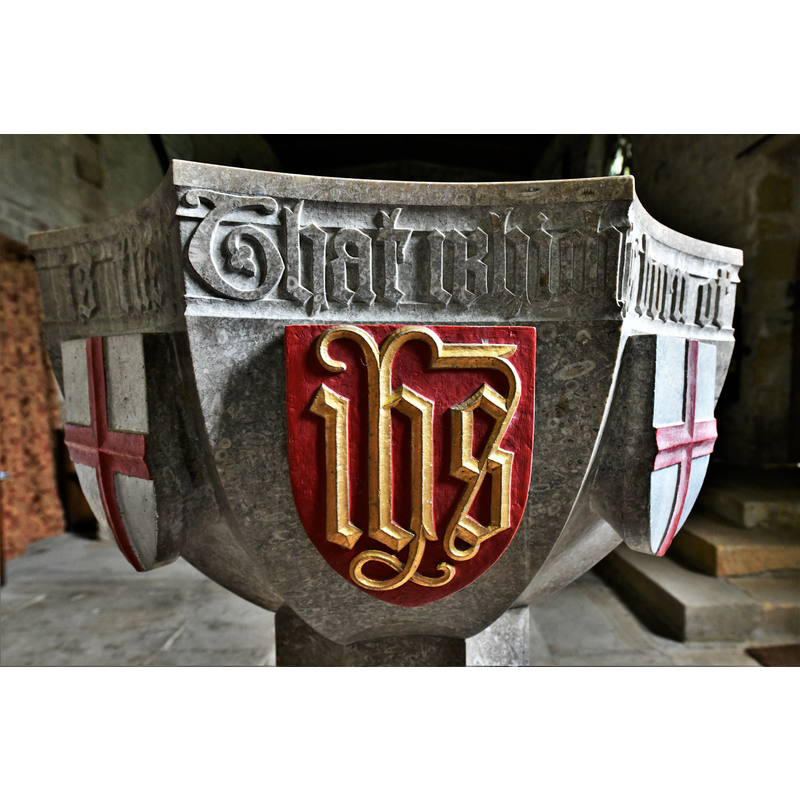
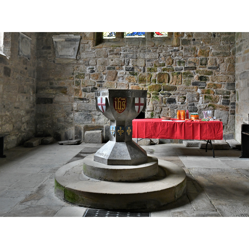
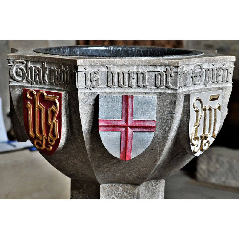
view of basin

Scene Description: the modern font of 1898
Copyright Statement: Image copyright © Michael Garlick, 2019
Image Source: digital photograph taken 1 August 2019 by Michael Garlick [www.geograph.org.uk/photo/6234661] [accessed 12 November 2019]
Copyright Instructions: CC-BY-SA-2.0
view of basin
Scene Description: the modern font of 1898
Copyright Statement: Image copyright © Michael Garlick, 2019
Image Source: digital photograph taken 1 August 2019 by Michael Garlick [www.geograph.org.uk/photo/6234631] [accessed 12 November 2019]
Copyright Instructions: CC-BY-SA-2.0
view of basin
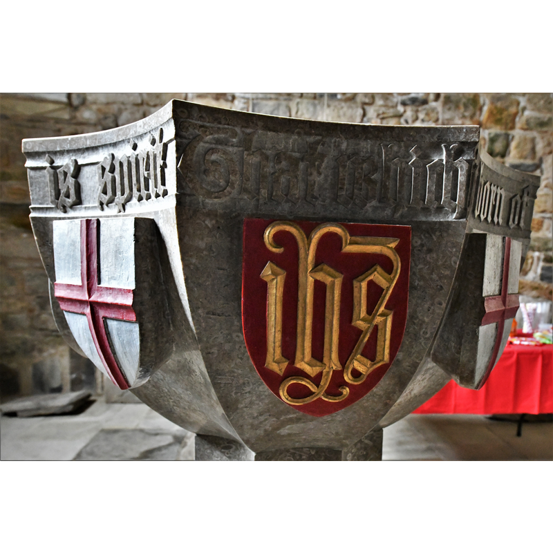
Scene Description: the modern font of 1898
Copyright Statement: Image copyright © Michael Garlick, 2019
Image Source: digital photograph taken 1 August 2019 by Michael Garlick [www.geograph.org.uk/photo/6234625] [accessed 12 November 2019]
Copyright Instructions: CC-BY-SA-2.0
view of basin
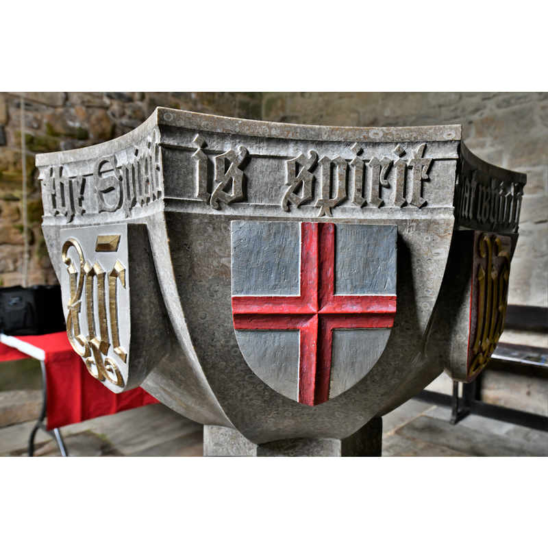
Scene Description: the modern font of 1898
Copyright Statement: Image copyright © Michael Garlick, 2019
Image Source: digital photograph taken 1 August 2019 by Michael Garlick [www.geograph.org.uk/photo/6234624] [accessed 12 November 2019]
Copyright Instructions: CC-BY-SA-2.0
view of church exterior - south view
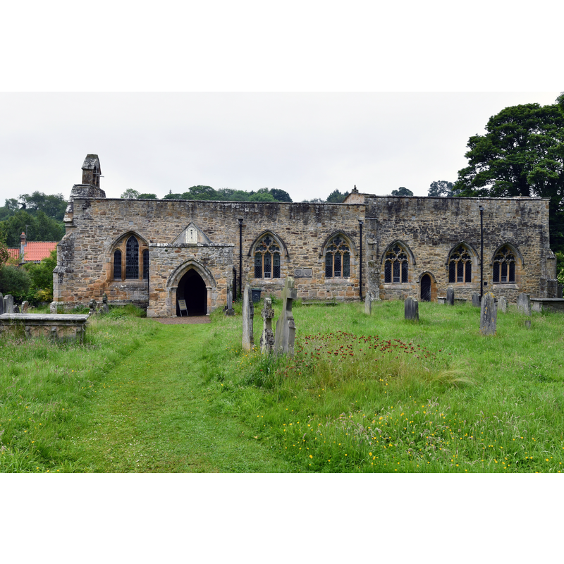
Copyright Statement: Image copyright © Michael Garlick, 2019
Image Source: digital photograph taken 1 August 2019 by Michael Garlick [www.geograph.org.uk/photo/6234594] [accessed 12 November 2019]
Copyright Instructions: CC-BY-SA-2.0
view of font in context - northwest side
Scene Description: the modern font of 1898
Copyright Statement: Image copyright © Michael Garlick, 2019
Image Source: digital photograph taken 1 August 2019 by Michael Garlick [www.geograph.org.uk/photo/6234657] [accessed 12 November 2019]
Copyright Instructions: CC-BY-SA-2.0
view of church interior - tombstone - fragment
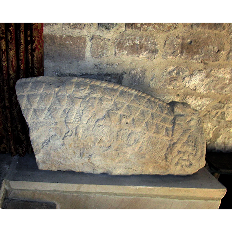
Scene Description: Source caption: "Probably dates from the ninth century."
Copyright Statement: Image copyright © Jonathan Thacker, 2018
Image Source: edited detail of a digital photograph taken 4 May 2018 by Jonathen Thacker [www.geograph.org.uk/photo/5767232] [accessed 12 November 2019]
Copyright Instructions: CC-BY-SA-2.0
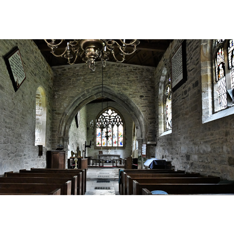
view of church interior - looking west
![the font is visible at the far [west] end](/static-50478a99ec6f36a15d6234548c59f63da52304e5/compressed/1191112003_compressed.png)
Scene Description: the font is visible at the far [west] end
Copyright Statement: Image copyright © Jonathan Thacker, 2018
Image Source: digital photograph taken 4 May 2018 by Jonathan Thacker [www.geograph.org.uk/photo/5767226] [accessed 12 November 2019]
Copyright Instructions: CC-BY-SA-2.0
view of church interior - looking east
Copyright Statement: Image copyright © Michael Garlick, 2019
Image Source: digital photograph taken 1 August 2019 by Michael Garlick [www.geograph.org.uk/photo/6234645] [accessed 12 November 2019]
Copyright Instructions: CC-BY-SA-2.0
view of base - detail
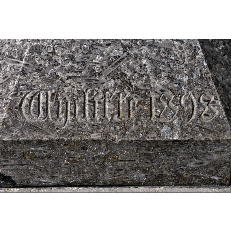
Scene Description: with the inscription "Wycliffe 1898" on the lower base of the modern font -- notice the high fossil content of the stone
Copyright Statement: Image copyright © Michael Garlick, 2019
Image Source: digital photograph taken 1 August 2019 by Michael Garlick [www.geograph.org.uk/photo/6234666] [accessed 12 November 2019]
Copyright Instructions: CC-BY-SA-2.0
view of base - detail
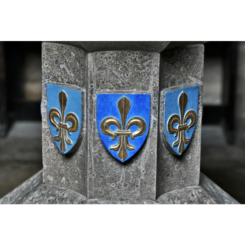
Scene Description: the modern font of 1898
Copyright Statement: Image copyright © Michael Garlick, 2019
Image Source: digital photograph taken 1 August 2019 by Michael Garlick [www.geograph.org.uk/photo/6234662] [accessed 12 November 2019]
Copyright Instructions: CC-BY-SA-2.0
view of basin
Scene Description: the modern font of 1898
Copyright Statement: Image copyright © Michael Garlick, 2019
Image Source: digital photograph taken 1 August 2019 by Michael Garlick [www.geograph.org.uk/photo/6234661] [accessed 12 November 2019]
Copyright Instructions: CC-BY-SA-2.0
INFORMATION
Font ID: 05708WYC
Object Type: Baptismal Font1
Font Century and Period/Style: 17th century[basin only] / 13th century [base only] [composite font], Medieval / Baroque [composite]
Church / Chapel Name: Parish Church of St. Mary the Virgin
Font Location in Church: Inside the church? [cf. FontNotes]
Church Patron Saint(s): St. Mary the Virgin
Church Address: Wycliffe, Barnard Castle DL12 9TS, UK -- Tel.: +44 1833 621217
Site Location: Durham, North East, England, United Kingdom
Directions to Site: Located about 20 km W of Darlington, just S of the Tees river (it is accessible from both the A67 and the A66)
Ecclesiastic Region: Diocese of Leeds
Historical Region: Hundred of Land of Count Alan -- formerly NRYrks
Additional Comments: composite font? / recycled font: a late-17th century mounted on a mid-13th century base [NB: where is this font now [2019?]) -- disappeared font? (the one from the medieval church here)
Font Notes:
Click to view
There is a multiple-place entry for Wycliffe [variant spelling] in the Domesday survey [https://opendomesday.org/place/NZ1114/wycliffe/] [accessed 12 November 2019]; it reports two churches in it. The entry for this parish in Whitaker (1823) notes that the church appears "to have been rebuilt in the reign of Edward III" [i.e., 1327-1377], and adds: "The cylindrical font is of elder date, and could I have persuaded myself that Wickliffe has really been born here, the laver of his regeneration should have been perpetuated by an engraving." Bond (1908: 267) describes a composite baptismal font here: "the base of the font, like the church, is mid-thirteenth century; while the bowl is Post-Reformation" [NB: Bond gives the county as Durham in his index, but Yorkshire in the text -- parts of the North Riding were transferred to Durham in 1974]. The entry for this parish in the Victoria County History (York North Riding, vol. 1, 1914) notes: "The oldest part of the present building dates from about 1240. At that time it appears to have been a simple and small structure [...] The font is modern." The modern font, in a late-Victorian imitation of an earlier heraldic font type, is dated 1898.
COORDINATES
UTM: 30U 576307 6042473
Latitude & Longitude (Decimal): 54.52408, -1.821
Latitude & Longitude (DMS): 54° 31′ 26.69″ N, 1° 49′ 15.6″ W
MEDIUM AND MEASUREMENTS
Material: stone
Number of Pieces: two
REFERENCES
- Victoria County History [online], University of London, 1993-. URL: https://www.british-history.ac.uk.
- Bond, Francis, Fonts and Font Covers, London: Waterstone, 1985 c1908, p. 267
- Whitaker, Thomas Dunham, An history of Richmondshire, in the North Riding of the County of York [...], with illustrations by J.M.W. Turner, London: [s.n.], 1823, vol. 1: 198