Wisley / Wiselei / Wyseleye
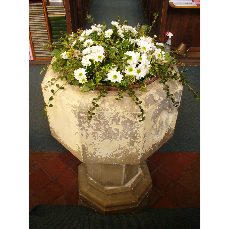
Image copyright © Colin Smith, 2011
Standing permission
Results: 3 records
view of font
Copyright Statement: Image copyright © Colin Smith, 2011
Image Source: digital photograph taken 6 March 2011 by Colin Smith
Copyright Instructions: Standing permission
view of church exterior - southwest view
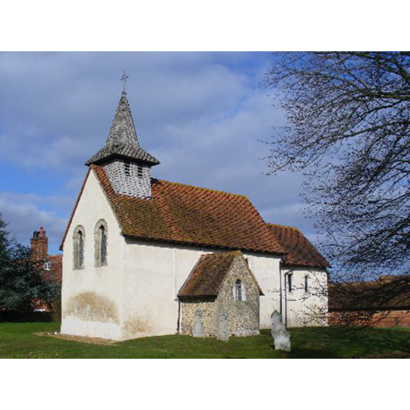
Copyright Statement: Image copyright © Colin Smith, 2011
Image Source: digital photograph taken 6 March 2011 by Colin Smith
Copyright Instructions: Standing permission
view of church interior - nave - looking east
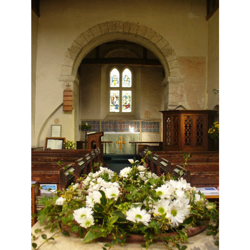
Scene Description: The floral arrangement is on top of the font.
Copyright Statement: Image copyright © Colin Smith, 2011
Image Source: digital photograph taken 6 March 2011 by Colin Smith
Copyright Instructions: Standing permission
INFORMATION
Font ID: 05697WIS
Object Type: Baptismal Font1
Font Century and Period/Style: 17th - 18th century, Post-Reformation
Church / Chapel Name: Parish Church
Font Location in Church: Inside the church
Church Address: Wisley Lane, Wisley, Surrey GU23 6QL
Site Location: Surrey, South East, England, United Kingdom
Directions to Site: Located just NE of Woking, W of the M25
Ecclesiastic Region: Diocese of Guilford
Historical Region: Hundred of Woking
Additional Comments: disappeared font? (the one from the late-12thC church here)
Font Notes:
Click to view
There is an entry for Wisley [variant spelling] in the Domesday survey [http://opendomesday.org/place/TQ0659/wisley/] [accessed 18 December 2015]; a church is mentioned in it. Allen (1831) notes: "The font is a neat octagonal basin." Listed in Bond (1908) as one of several "well meant fonts put up between the Reformation and the Rebellion". There Victoria County History (Surrey, vol. 3, 1911) notes: "There was a church at Wisley at the time of Domesday. [...] The dedication of the church of WISLEY has been lost. It is a very small building [...] of late 12th-century date, to which has been added a wooden north porch, probably in the 17th century, and a small modern south vestry. The church was restored in 1872"; no font mentioned in the VCH entry. [NB: we have no information on the font of that church here].
Credit and Acknowledgements: We are grateful to Colin Smith for his photographs of font and church
COORDINATES
UTM: 30U 675288 5689059
Latitude & Longitude (Decimal): 51.325775, -0.484106
Latitude & Longitude (DMS): 51° 19′ 32.79″ N, 0° 29′ 2.78″ W
MEDIUM AND MEASUREMENTS
Material: stone
Font Shape: octagonal, mounted
Basin Interior Shape: round
Basin Exterior Shape: octagonal
REFERENCES
- Victoria County History [online], University of London, 1993-. URL: https://www.british-history.ac.uk.
- Allen, Thomas, A History of the County of Surrey ; comprising every object of topographical, geological, or historical interest, London: Isaac Taylor Hinton, 1831, vol. 2: 169
- Bond, Francis, Fonts and Font Covers, London: Waterstone, 1985 c1908, p. 265