Ripon No. 2
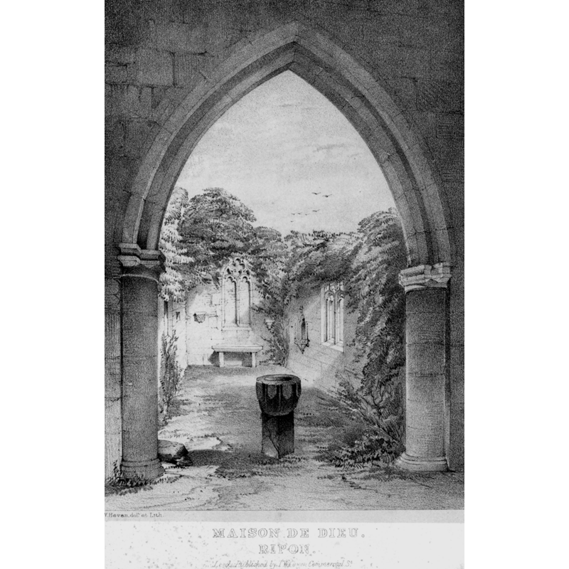
Image copyright © [in the public domain]
PD
Results: 3 records
view of font
Copyright Statement: Image copyright © [in the public domain]
Image Source: Drawing in Fawcett (1844)
Copyright Instructions: PD
symbol - shield - 8
Copyright Statement: Image copyright © Chris06, 2019
Image Source: edited detail of a digital photograph 14 August 2019 by Chris06 [https://commons.wikimedia.org/wiki/File:Chapel_of_St_Anne's_Hospital,_Ripon_(3).jpg] [accessed 8 February 2025]
Copyright Instructions: CC-BY-SA-4.0
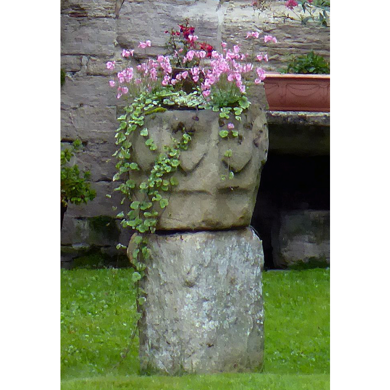
view of font or stoup in context
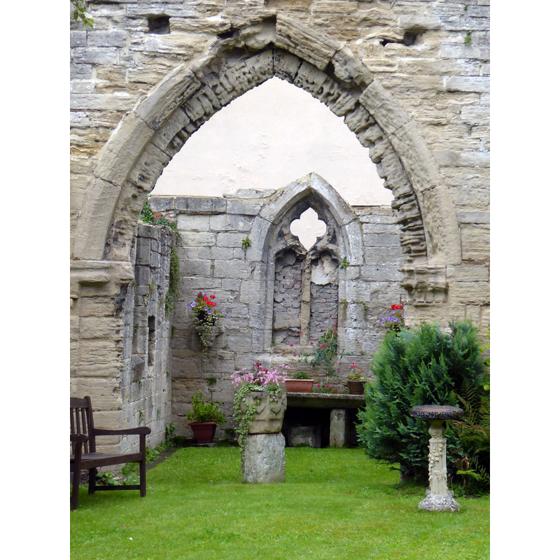
Scene Description: Source caption: "Chapel of St Anne's Hospital, Ripon"
Copyright Statement: Image copyright © Chris06, 2019
Image Source: digital photograph 14 August 2019 by Chris06 [https://commons.wikimedia.org/wiki/File:Chapel_of_St_Anne's_Hospital,_Ripon_(3).jpg] [accessed 8 February 2025]
Copyright Instructions: CC-BY-SA-4.0
INFORMATION
Font ID: 05682RIP
Object Type: Baptismal Font1?
Font Century and Period/Style: 15th century (?), Perpendicular
Church / Chapel Name: Hospital of St. Anne or Maison de Dieu [ruins]
Font Location in Church: In the ruins [ca. 1844]
Church Patron Saint(s): St. Anne?
Site Location: North Yorkshire [formerly West Yorkshire], Yorkshire and the Humber, England, United Kingdom
Directions to Site: Ripon is located about 50 km N of Leeds, about 18 km N of Harrowgate. [the ruins of the chapel are located in High St., Ripon]
Historical Region: formerly in the West Riding of Yorkshire
Additional Comments: abandoned or disused font or stoup
Font Notes:
Click to view
Fawcett (1844) shows a lithograph of a font (or stoup?) standing under an arch in the ruins of the "Maison de Dieu", Ripon; the basin itself is tall and shaped like a half-egg, whereas the base is square and totally unsuited to it [NB: a later photograph shows the basin as octagonal with shields on the sides. Morris (1934) notes that the old hospital "was rebuilt in 1869, but the ruined chapel remains", and adds that "the font is now used as a flower pot." Morris (ibid.) notes that "the building is thought to be of the 15th century". The entry for this site in Historic England [Listing NGR: SE3146071009] dates the remains tro the 14th century and mentions both a piscina and a stoup in it.
COORDINATES
UTM: 30U 596711 5999435
Latitude & Longitude (Decimal): 54.13393, -1.5198
Latitude & Longitude (DMS): 54° 8′ 2.15″ N, 1° 31′ 11.28″ W
MEDIUM AND MEASUREMENTS
Material: stone
Font Shape: octagonal, mounted
Basin Interior Shape: round
Basin Exterior Shape: octagonal
REFERENCES
- Fawcett, Joshua, Churches of Yorkshire, Leeds: T.W. Green, 1844
- Morris, Joseph Ernest, The West Riding of Yorkshire, London: Methuen & Co., 1932, p. 420-421