Thorpe nr. Staines
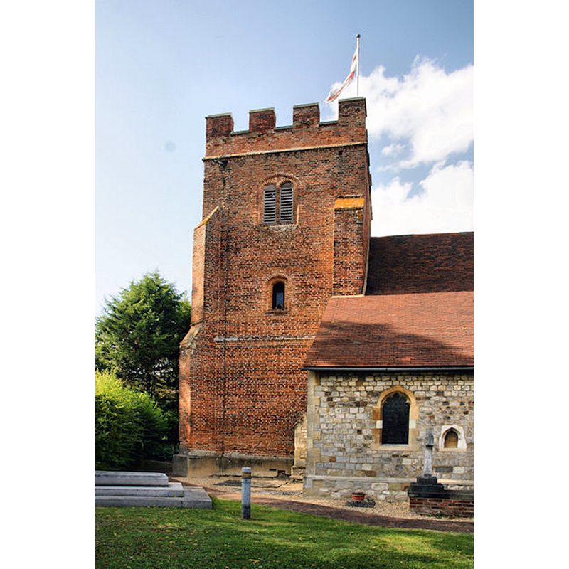
Image copyright © Pierre Terre, 2009
CC-BY-SA-2.0
Results: 5 records
view of church exterior - tower - south view
Copyright Statement: Image copyright © Pierre Terre, 2009
Image Source: digital photograph taken 13 July 2009 by Pierre Terre [www.geograph.org.uk/photo/1408867] [accessed 19 December 2015]
Copyright Instructions: CC-BY-SA-2.0
view of church exterior - southeast view
Scene Description: Source caption: "St Mary's. Thorpe's church is not mentioned in the Domesday Book. It probably dates from the 1300s but the brick tower is 16th Century."
Copyright Statement: Image copyright © Colin Smith, 2009
Image Source: digital photograph taken 15 February 2009 by Colin Smith [www.geograph.org.uk/photo/1165750] [accessed 19 December 2015]
Copyright Instructions: CC-BY-SA-2.0
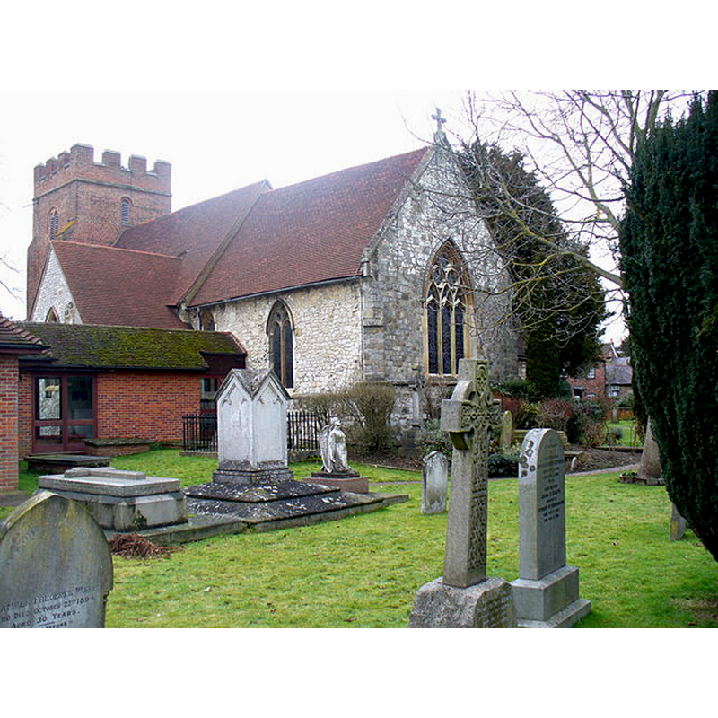
view of church exterior in context - north view
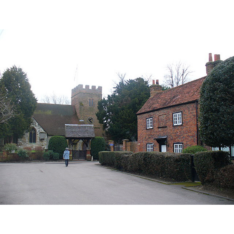
Scene Description: Source caption: "St Mary's Church, Thorpe. This old church is at the end of Church Approach, off Coldharbour Lane. The church is probably 14th Century and was used by the famous Hardy of HMS Victory."
Copyright Statement: Image copyright © Colin Smith, 2009
Image Source: digital photograph taken 15 February 2009 by Colin Smith [www.geograph.org.uk/photo/1165741] [accessed 19 December 2015]
Copyright Instructions: CC-BY-SA-2.0
view of font in context
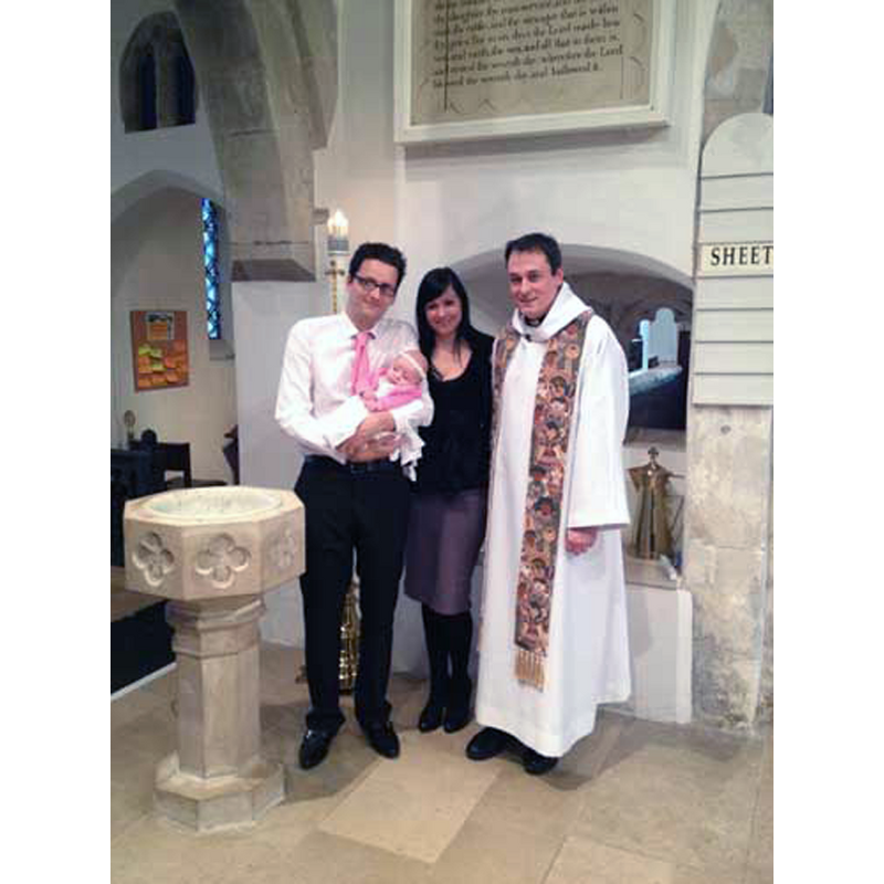
Scene Description: the modern font after (?) a baptism
Copyright Statement: Image copyright © Archbishops' Council, 2015
Image Source: digital photograph taken September 2014 in A Church Near You [www.achurchnearyou.com/photo_gallery/xthorpe_8232_1341982802_381_E5dyu.jpg.pagespeed.ic.kVCP1cjuo_.jpg] [accessed 19 December 2015]
Copyright Instructions: No known copyright restriction / Fair Dealing
view of church interior - chancel
Scene Description: the modern font is visible at the extreme left of the image
Copyright Statement: Image copyright © Archbishops' Council, 2015
Image Source: digital photograph taken September 2014 in A Church Near You [www.achurchnearyou.com/photo_gallery/x41062.jpg.pagespeed.ic.gKZDvjoF2l.jpg] [accessed 19 December 2015]
Copyright Instructions: No known copyright restriction / Fair Dealing
INFORMATION
Font ID: 05644THO
Object Type: Baptismal Font1?
Font Century and Period/Style: 12th century, Norman
Church / Chapel Name: Parish Church of St. Mary
Font Location in Church: [Inside the church ca. 1908?]
Church Patron Saint(s): St. Mary the Virgin
Church Address: Church Approach, Coldharbour Lane, Thorpe, Surrey TW20 8TQ, United Kingdom -- Tel.: +44 1932 565986
Site Location: Surrey, South East, England, United Kingdom
Directions to Site: Located 3 km SSW of Staines, 3 km NW of Chertsey, 3 km SE of Egham, NE of the busy junction of the M3 with the M25
Ecclesiastic Region: Diocese of Guildford
Historical Region: Hundred of Godley
Additional Comments: disappeared font? (the one described in Bond [cf. FontNotes] as Norman)
Font Notes:
Click to view
There is an entry for this Thorpe [variant spelling] in the Domesday survey [http://opendomesday.org/place/TQ0268/thorpe/] [accessed 19 December 2015], but it mentions neither cleric nor church in it. Bond (1908) reports a Norman font "only 9 inches [22.5 cm] deep and 17 inches [42.5 cm] in diameter" in this church. The Victoria County History (Surrey, vol. 3, 1911) notes: "The church is not mentioned in the Taxation of Pope Nicholas, 1291, but was probably included with Egham, the vicar of Egham appointing a chaplain [...] The early history of the church has been greatly obscured by drastic restorations of a fairly recent date, and it is evident that at various late, though not modern, dates the fabric has been allowed to fall into disrepair and has then been clumsily restored. The chancel arch is in part of 12th-century date though much repaired. [...] The font is modern and stands at the west end of the nave; it is octagonal and of poor design."
COORDINATES
UTM: 30U 671845 5698005
Latitude & Longitude (Decimal): 51.407191, -0.529151
Latitude & Longitude (DMS): 51° 24′ 25.89″ N, 0° 31′ 44.95″ W
MEDIUM AND MEASUREMENTS
Material: stone
Basin Exterior Shape: round
Diameter (includes rim): 42.5 cm*
Basin Depth: 22.5 cm*
Notes on Measurements: Bond (1985, c1908: 33) *[NB: it is assumed that the two measurements given by Bond correspond to the depth of the basin well and the outer diameter of the basin]
REFERENCES
- Victoria County History [online], University of London, 1993-. URL: https://www.british-history.ac.uk.
- Bond, Francis, Fonts and Font Covers, London: Waterstone, 1985 c1908, p. 32-33