Stoke / Upper Stoke
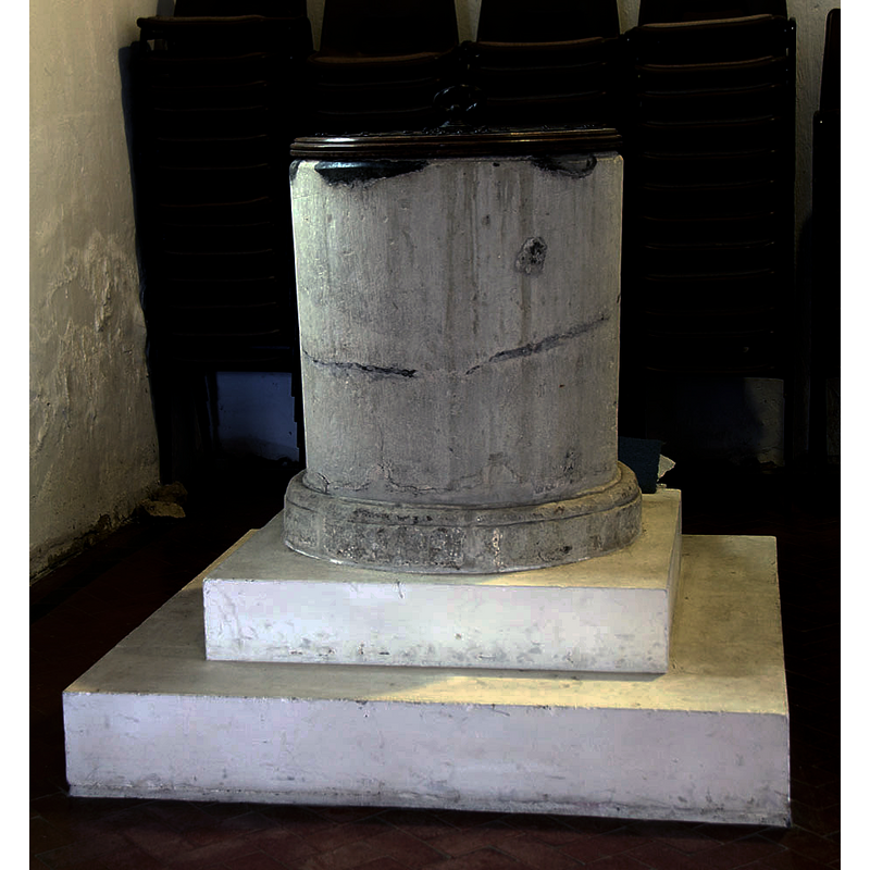
Image copyright © John Salmon, 2013
CC-BY-SA-2.0
Results: 5 records
view of font and cover
Scene Description: the cover and two-step plinth are modern
Copyright Statement: Image copyright © John Salmon, 2013
Image Source: digital photograph taken 24 April 2013 by John Salmon [www.geograph.org.uk/photo/3606744] [accessed 2 August 2019]
Copyright Instructions: CC-BY-SA-2.0
view of church exterior - west portal
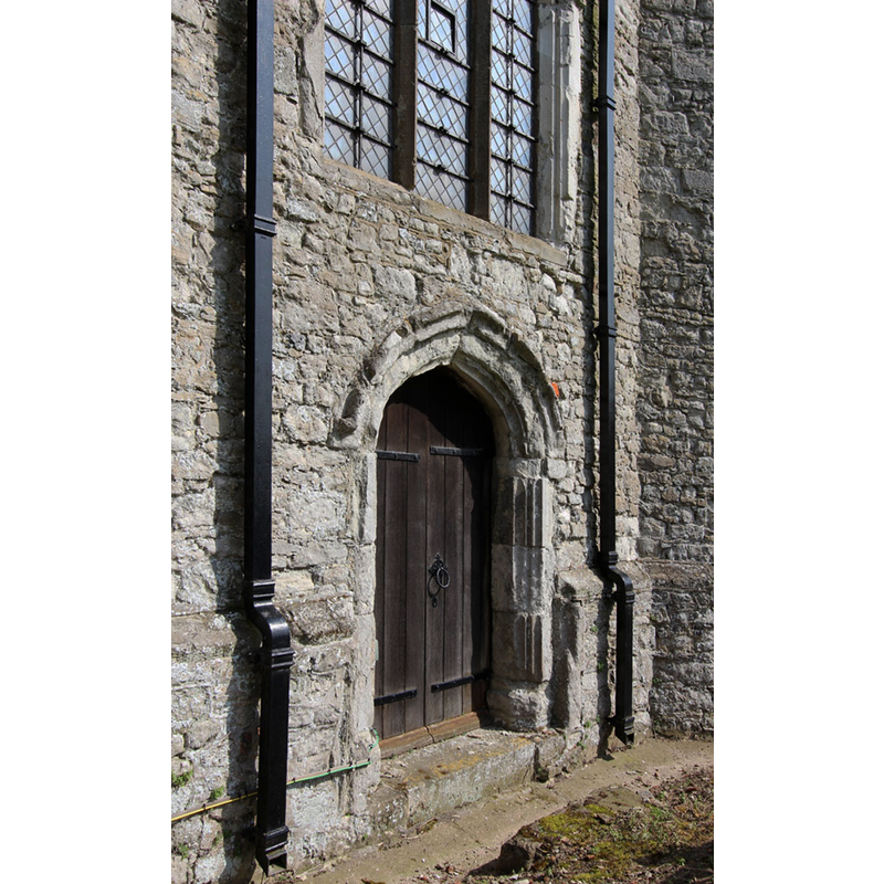
Copyright Statement: Image copyright © John Salmon, 2013
Image Source: digital photograph taken 24 April 2013 by John Salmon [www.geograph.org.uk/photo/3606757] [accessed 2 August 2019]
Copyright Instructions: CC-BY-SA-2.0
view of church exterior in context - west view
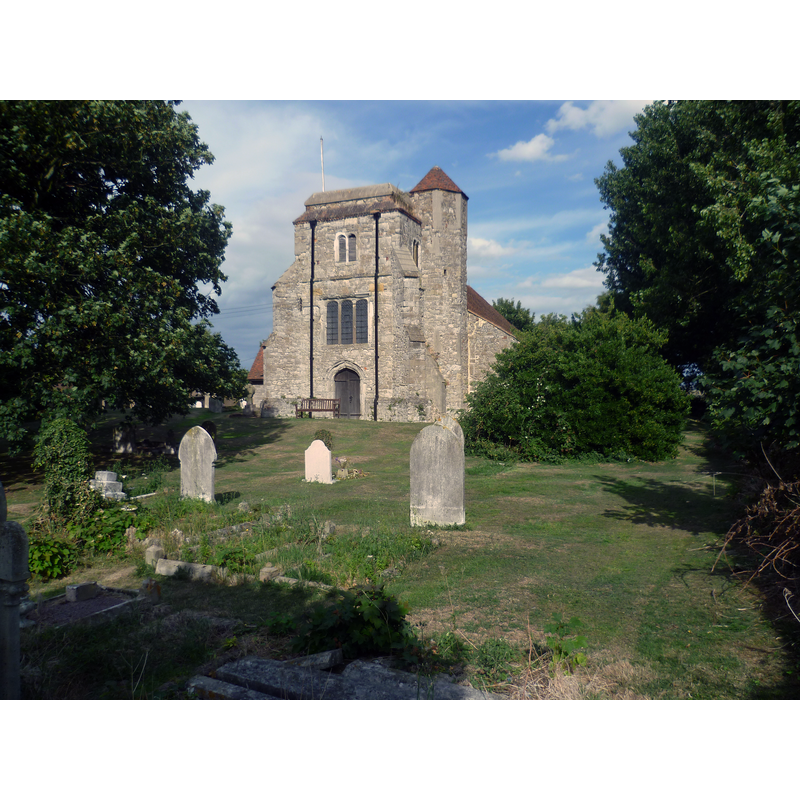
Scene Description: Source caption: "The nave of the church of St Peter and St Paul dates from around 1190. According to Pevsner an earlier tower needed repair in 1479 but a steady stream of bequests failed to raise it above the second stage."
Copyright Statement: Image copyright © Marathon, 2013
Image Source: digital photograph taken 15 August 2013 by Marathon [www.geograph.org.uk/photo/3606873] [accessed 2 August 2019]
Copyright Instructions: CC-BY-SA-2.0
view of church exterior - northwest view
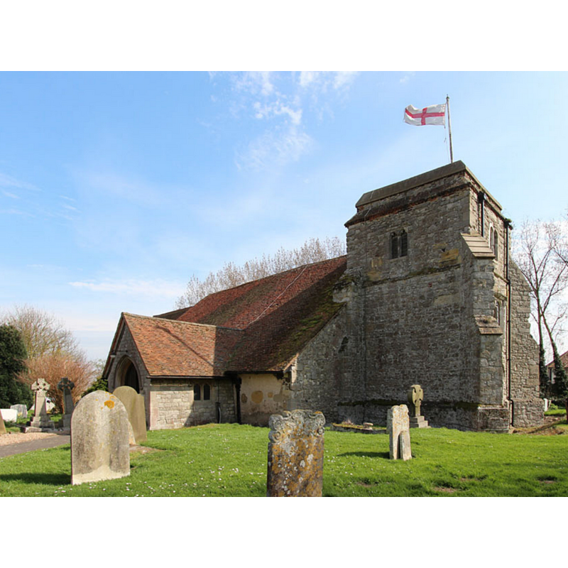
Copyright Statement: Image copyright © John Salmon, 2013
Image Source: edited detail of a digital photograph taken 24 April 2013 by John Salmon [www.geograph.org.uk/photo/3606761] [accessed 2 August 2019]
Copyright Instructions: CC-BY-SA-2.0
view of church interior - looking east
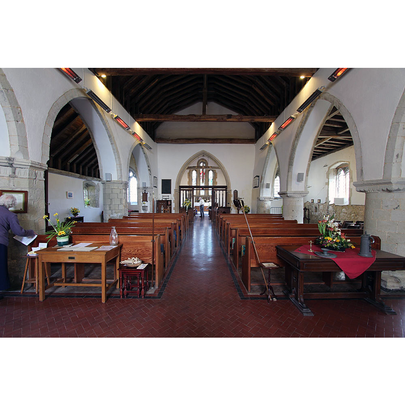
Copyright Statement: Image copyright © John Salmon, 2013
Image Source: digital photograph taken 24 April 2013 by John Salmon [www.geograph.org.uk/photo/3606763] [accessed 2 August 2019]
Copyright Instructions: CC-BY-SA-2.0
INFORMATION
Font ID: 05632STO
Object Type: Baptismal Font1
Font Century and Period/Style: 13th century, Transitional / Early English
Cognate Fonts: a similar font at Allhallows, in the same county
Church / Chapel Name: Parish Church of St. Peter and St. Paul
Font Location in Church: Inside the church, at the W end of the S aisle
Church Patron Saint(s): St. Peter & St. Paul
Church Address: The Street, Upper Stoke, Rochester ME3 9RT, UK -- Tel.: +44 634 272564
Site Location: Kent, South East, England, United Kingdom
Directions to Site: Located off Stoke Rd [aka The Street], on the northern shore of the Medway, about 6-8 km NE of Hoo, 15 km ENE of Rochester, S of the A228
Ecclesiastic Region: Diocese of Rochester
Font Notes:
Click to view
No individual entry found for this Stoke in the Domesday survey. Bond (1908) makes reference to the donation of a basin and ewer to Stoke in 1511: "To the Church of Stoke a bason and a ewer of pewter for the font", without further mention of the font. The font is noted in Newman (1980): "Plain tub, as at Allhallows. C13, judging by the base moulding." The font is a monolithic cylindrical shape with a moulding around the lower end, otherwise plain; raised on a modern two-step quadrangular plinth. Modern cover.
COORDINATES
UTM: 31U 334756 5702020
Latitude & Longitude (Decimal): 51.445232, 0.622554
Latitude & Longitude (DMS): 51° 26′ 42.83″ N, 0° 37′ 19.56″ E
MEDIUM AND MEASUREMENTS
Material: stone
Font Shape: cylindrical, unmounted
Basin Interior Shape: round
Basin Exterior Shape: round
Drainage Notes: lead-lined
LID INFORMATION
Date: modern
Material: wood
Notes: round and flat with decorated top; modern
REFERENCES
- Bond, Francis, Fonts and Font Covers, London: Waterstone, 1985 c1908, p. 61, 63, 63n
- Newman, John, West Kent and the Weald, Harmondsworth: Penguin Books, 1980, p. 547