Bois-de-Cene No. 3 / Boes-de-Cene / Bois-de-Céné / l'Île-Chauvet
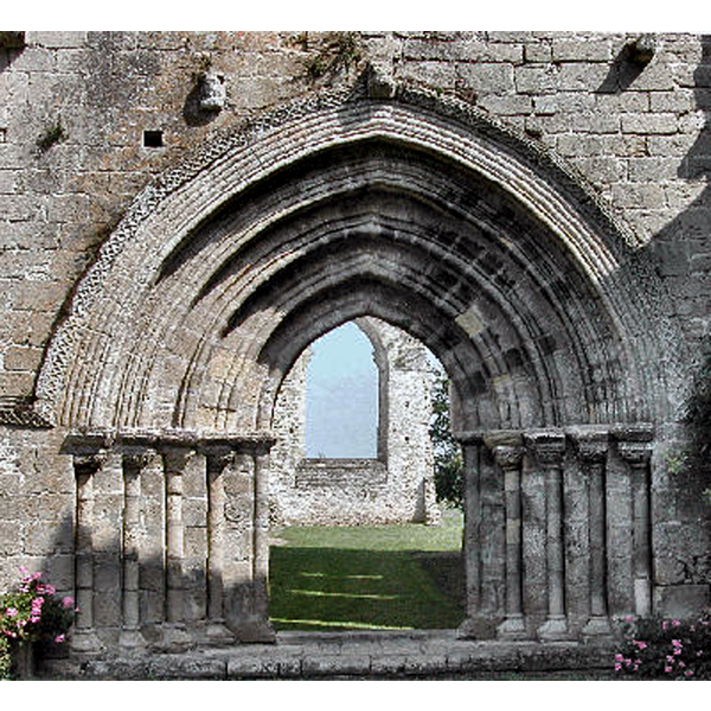
Image copyright © Jacques93, 2010
GFDL / CC-BY-SA-3.0,2.5,2.0,1.0
Results: 3 records
view of church exterior - portal
Copyright Statement: Image copyright © Jacques93, 2010
Image Source: digital photograph 8 November 2010 by Jacques93 [https://commons.wikimedia.org/wiki/File:Chauvet3425a.jpg] [accessed 30 September 2023]
Copyright Instructions: GFDL / CC-BY-SA-3.0,2.5,2.0,1.0
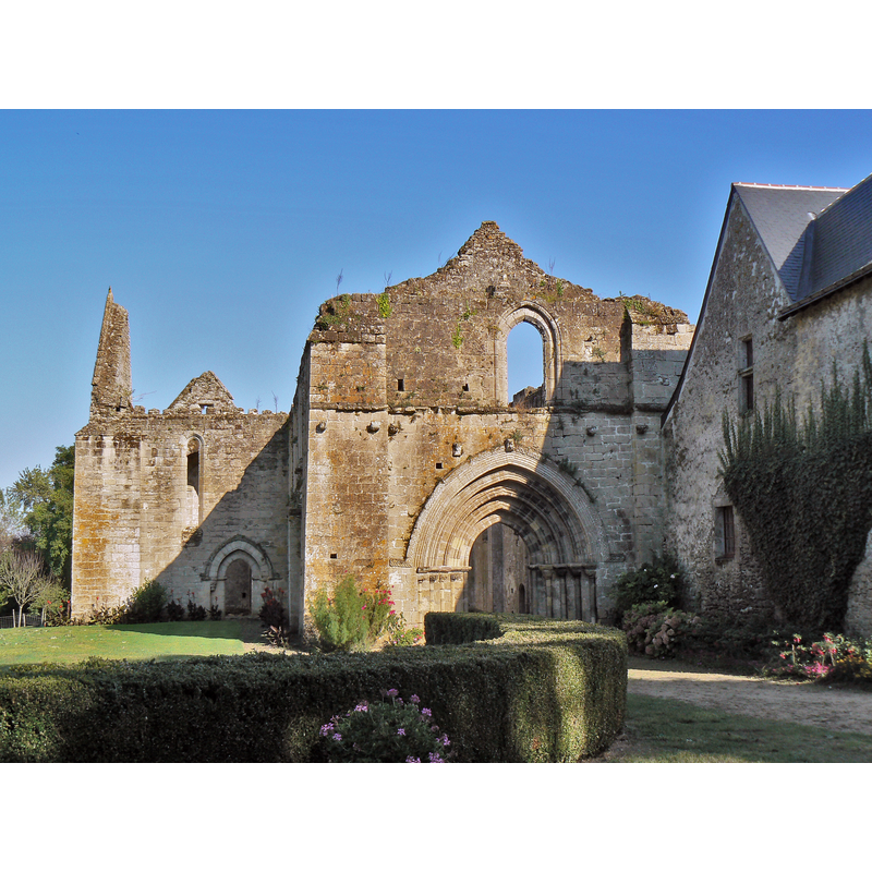
view of church exterior in context - west view
Scene Description: Source caption: "Porte d'entrée de l'abbaye de l'Île-Chauvet"
Copyright Statement: Image copyright © Antoine Meissonnier, 2009
Image Source: digital photograph 26 September 2009 by Antoine Meissonnier [https://commons.wikimedia.org/wiki/File:Abbaye_de_l'Île-Chauvet_01.JPG] [accessed 30 September 2023]
Copyright Instructions: CC-BY-SA-4.0
view of church interior - looking west
![Source caption: "Abbaye de l'Île-Chauvet [...] Nef de l'abbatiale." -- is the object at the far bac, left of the entranceway the stoup?](/static-50478a99ec6f36a15d6234548c59f63da52304e5/compressed/1230930015_compressed.png)
Scene Description: Source caption: "Abbaye de l'Île-Chauvet [...] Nef de l'abbatiale." -- is the object at the far bac, left of the entranceway the stoup?
Copyright Statement: Image copyright © Antoine Meissonnier, 2009
Image Source: digital photograph 26 September 2009 by Antoine Meissonnier [https://commons.wikimedia.org/wiki/File:Abbaye_de_l'Île-Chauvet_04.JPG] [accessed 30 September 2023]
Copyright Instructions: CC-BY-SA-4.0
INFORMATION
Font ID: 05582BOI
Object Type: Stoup
Font Century and Period/Style: 13th - 14th century, Gothic
Cognate Fonts: Its central part is said to be similar to the stoup at Bois-de-Céné No. 2
Church / Chapel Name: Abbaye de l'Île-Chauvet
Font Location in Church: in the ruins of the abbey
Church Patron Saint(s): St. Benedict [aka Benet]?
Church Notes: The benedictine abbey dates from the 12th century, ca. 1130; much damaged and modified since; sold off 1791 -- listed in Mérimée [ref.: PA00110048]: "1130 [...] 12e siècle ; 14e siècle [...] Ruines de l'église, y compris le bénitier se trouvant dans la nef ; deux bâtiments du 12e siècle ; puits gothique situé au centre de l'ancien cloître"
Church Address: Abbaye de l'île Chauvet, L'Île Chauvet, 85710 Bois-de-Céné, France
Site Location: Vendée, Pays de la Loire, France, Europe
Directions to Site: Located at the confluence of roads D21-D28-D58, 10 km N of Challans, 50-60 SW of Nantes
Additional Comments: disused stoup? (in the ruins of the abbey)
Font Notes:
Click to view
Mentioned in Le Patrimoine... de la Vendée (2001, v. 1: p. 92) as a stoup that resembles the Gothic one in the church of St-Étienne in this same town [cf. Index entry for Bois-de-Céné No. 2]
COORDINATES
UTM: 30T 583034 5198333
Latitude & Longitude (Decimal): 46.933333, -1.909167
Latitude & Longitude (DMS): 46° 56′ 0″ N, 1° 54′ 33″ W
MEDIUM AND MEASUREMENTS
Material: stone
REFERENCES
- Le Patrimoine des communes de la Vendée, Paris: FLOHIC, 2001, vol. 1, p. 92