Sempringham No. 1 / Semperingham / Sepingeham / Spingeham / Stepingeham
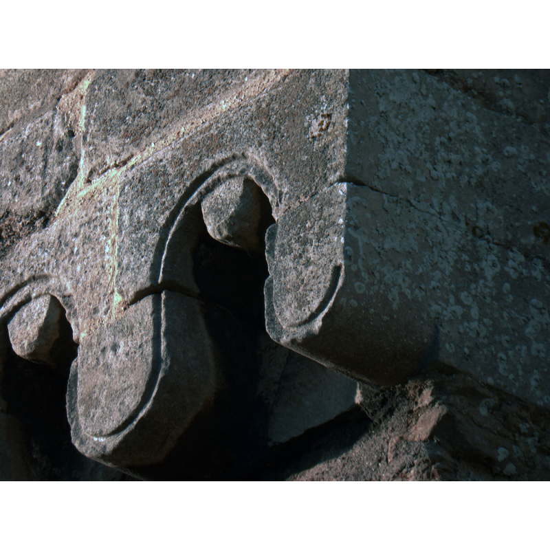
Image copyright © Bob Harvey, 2013
CC-BY-SA-2.0
Results: 3 records
view of church exterior - frieze - detail
Scene Description: Source caption: "Detail of the frieze. The older part of the church of St Andrew is a nave in random stone, almost rubble, which is trimmed in fine tooled stone blocks. Along the roof line is a frieze of these loops."
Copyright Statement: Image copyright © Bob Harvey, 2013
Image Source: digital photograoh taken 1 December 2013 by Bob Harvey [www.geograph.org.uk/photo/3763324] [accessed 3 May 2019]
Copyright Instructions: CC-BY-SA-2.0
view of church exterior - southeast view
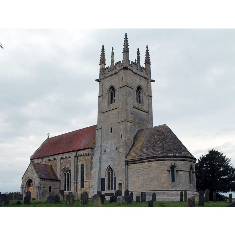
Scene Description: Source caption: "This is the site of the famous St Mary's Priory founded by the crippled priest St. Gilbert in about 1139 as a home for his white-robed Gilbertian order, the only purely English monastic order and the only one which catered for men and women alike. It was sited to the south of the present church but was surrendered and destroyed in 1558 and all that remains today are signs of earthworks, although excavations have been carried out that revealed the foundations together with fish ponds and the old well. The present church of St Andrew's was once much larger than the present building but a Norman chancel and transept were taken down in 1788 after becoming dilapidated, leaving the tower unusually at the east end of the building. A priest's door was also removed and in 1899, the arch was returned and incorporated into a new porch that was designed to protect the original Norman door."
Copyright Statement: Image copyright © J. Hannan-Briggs, 2012
Image Source: digital photograph taken 8 April 2012 by J. Hannan-Briggs [www.geograph.org.uk/photo/2906140] [accessed 3 May 2019]
Copyright Instructions: CC-BY-SA-2.0
view of church exterior in context
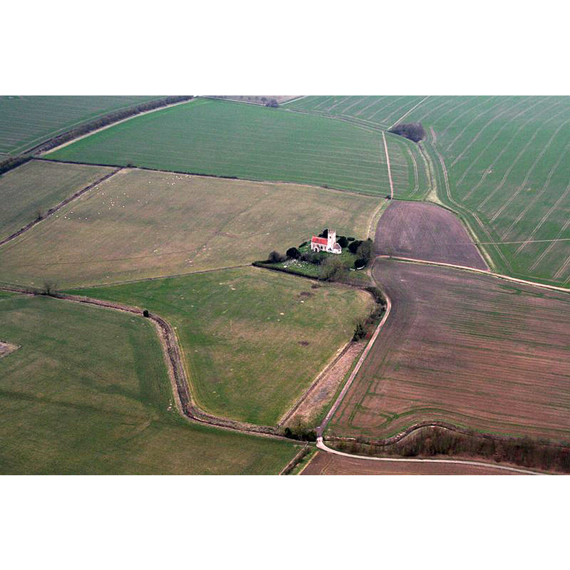
Scene Description: Source caption: "Sempringham Church of St. Andrew and Gilbertine Priory site".
Copyright Statement: Image copyright © Christ, 2019
Image Source: digital photograph taken 16 February 2019 by Chris [www.geograph.org.uk/photo/6061970] [accessed 3 May 2019]
Copyright Instructions: CC-BY-SA-2.0
INFORMATION
Font ID: 05555SEM
Object Type: Baptismal Font1
Font Century and Period/Style: 15th century, Perpendicular
Workshop/Group/Artisan: heraldic font
Church / Chapel Name: Parish Church of St. Andrew
Font Location in Church: Inside the church
Church Patron Saint(s): St. Andrew
Church Address: Sempringham, Sleaford NG34 0LU, UK
Site Location: Lincolnshire, East Midlands, England, United Kingdom
Directions to Site: Located off the B1177 near Pointon and Milthorpe, 13 km N of Bourne, 20 km EES of Grantham
Ecclesiastic Region: Diocese of Lincoln
Historical Region: Hundred of Aveland
Additional Comments: disappeared font? (the one from the Domesday-time church here)
Font Notes:
Click to view
There are three entries for Semprinham in the Domesday survey [https://opendomesday.org/place/TF1032/sempringham/] [accessed 3 May 2019], two of which report "0.7 churches" and "0.3 churches" respectively. Noted in White's History and gazetteer... (1856): "The font is octagonal, with shields in quatrefoils." Bond (1908: 285) relates that in the year 1566 "the churchwardens of Sempringham report[ed] that out of two albs they had made cloths for the comunion table and font", but does not describe the font. The entry for this church in Historic England [Listing NGR: TF1065132895] notes; "Parish church. c.1170, mid C14, c.1400, restored and chancel rebuilt 1868-9 [...] C15 octagonal font with quatrefoil panels containing blank shields."
COORDINATES
UTM: 30U 677804 5862441
Latitude & Longitude (Decimal): 52.88224, -0.3575
Latitude & Longitude (DMS): 52° 52′ 56.06″ N, 0° 21′ 27″ W
REFERENCES
- Bond, Francis, Fonts and Font Covers, London: Waterstone, 1985 c1908, p. 285