Painswick / Wiche
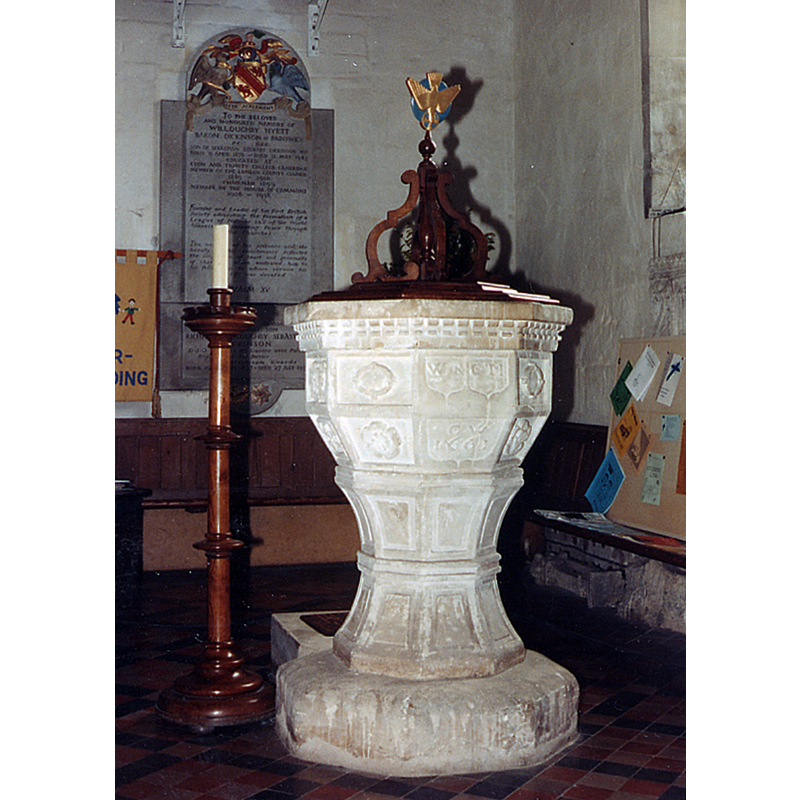
Image copyright © John Salmon, 2013
CC-BY-SA-2.0
Results: 10 records
view of font and cover
Copyright Statement: Image copyright © John Salmon, 2013
Image Source: digital image of a photograph taken in 1985 by John Salmon [www.geograph.org.uk/photo/3305291] [accessed 18 June 2018]
Copyright Instructions: CC-BY-SA-2.0
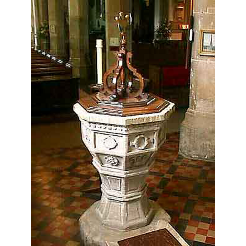
view of font and cover
Copyright Statement: Image copyright © John Wilkes, 2008
Image Source: digital photograph by John Wilkes [www.allthecotswolds.com]
Copyright Instructions: Standing permission
design element - patterns - crenellated
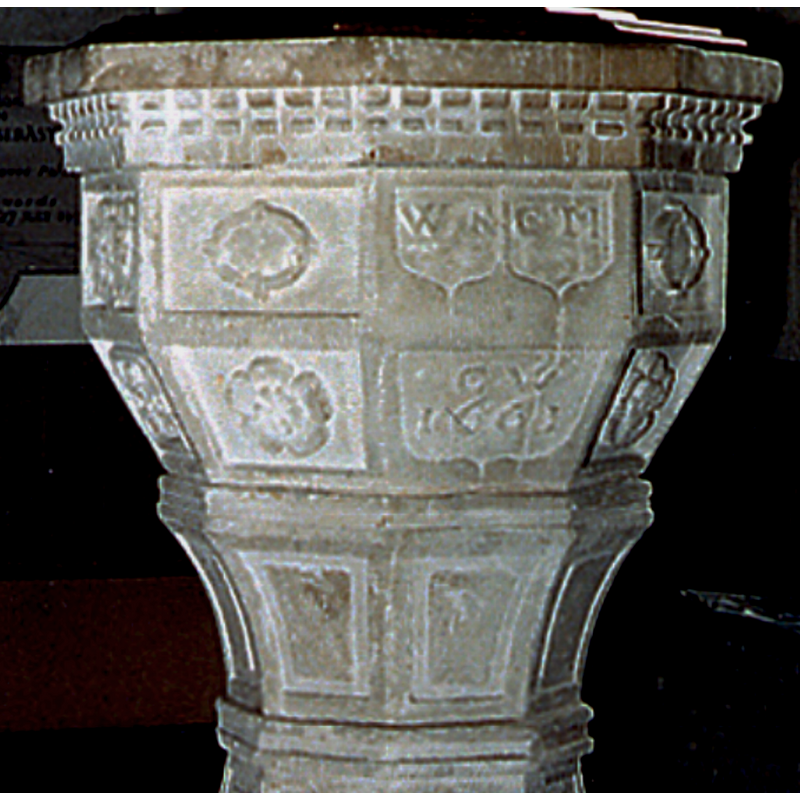
Scene Description: below the upper rim
Copyright Statement: Image copyright © John Salmon, 2013
Image Source: edited detail of a digital image of a photograph taken in 1985 by John Salmon [www.geograph.org.uk/photo/3305291] [accessed 18 June 2018]
Copyright Instructions: CC-BY-SA-2.0
inscription
Scene Description: two sets of initials inscribed in shield frames; said to be initials of church wardens [cf. Inscription area]
Copyright Statement: Image copyright © John Salmon, 2013
Image Source: edited detail of a digital image of a photograph taken in 1985 by John Salmon [www.geograph.org.uk/photo/3305291] [accessed 18 June 2018]
Copyright Instructions: CC-BY-SA-2.0
inscription
Scene Description: "CW / 1661"[NB: CW may stand for 'Church Wardens' [cf. Inscription area]
Copyright Statement: Image copyright © John Salmon, 2013
Image Source: edited detail of a digital image of a photograph taken in 1985 by John Salmon [www.geograph.org.uk/photo/3305291] [accessed 18 June 2018]
Copyright Instructions: CC-BY-SA-2.0
design element - motifs - floral - Tudor rose
Scene Description: on some of the sides of the basin
Copyright Statement: Image copyright © John Wilkes, 2008
Image Source: digital photograph by John Wilkes [www.allthecotswolds.com]
Copyright Instructions: Standing permission
design element - motifs - floral - Tudor rose
Scene Description: on some of the sides of the underbowl
Copyright Statement: Image copyright © John Wilkes, 2008
Image Source: digital photograph by John Wilkes [www.allthecotswolds.com]
Copyright Instructions: Standing permission
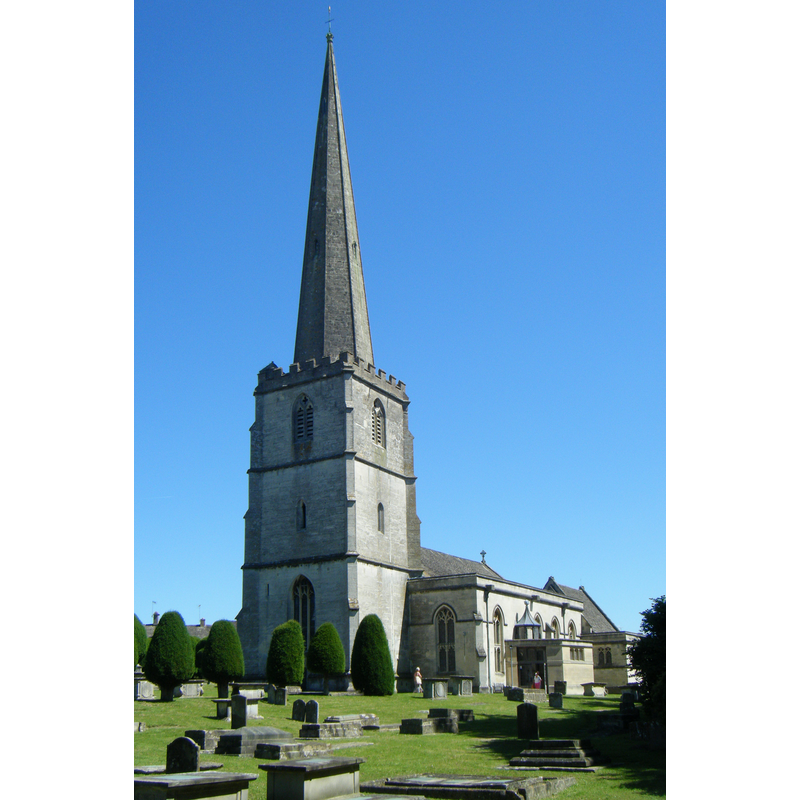
view of church exterior - southwest view
Copyright Statement: Image copyright © Hugh Llewelyn, 2012
Image Source: digital photograph taken 1 July 2012 by Hugh Llewelyn [https://commons.wikimedia.org/wiki/File:Painswick_Church_(7817365226).jpg] [accessed 18 June 2018]
Copyright Instructions: CC-BY-SA-3.0
design element - motifs - moulding
Scene Description: in the middle of the pedestal of the base, giving the pedestal a spindle shape
Copyright Statement: Image copyright © John Wilkes, 2008
Image Source: digital photograph by John Wilkes [www.allthecotswolds.com]
Copyright Instructions: Standing permission
design element - motifs - panel
Scene Description: on two levels of the stem
Copyright Statement: Image copyright © John Wilkes, 2008
Image Source: digital photograph by John Wilkes [www.allthecotswolds.com]
Copyright Instructions: Standing permission
INFORMATION
Font ID: 05516PAI
Object Type: Baptismal Font1
Font Date: 1661
Font Century and Period/Style: 17th century(mid), Restoration
Workshop/Group/Artisan: heraldic font
Church / Chapel Name: Parish Church of St. Mary the Virgin
Font Location in Church: Inside the church
Church Patron Saint(s): St. Mary the Virgin
Church Address: New Street, Painswick, Gloucestershire, GL6 6QB
Site Location: Gloucestershire, South West, England, United Kingdom
Directions to Site: Located off the A46, about 10 km SSE of Gloucester
Ecclesiastic Region: Diocese of Gloucester
Historical Region: Hundred of Bisley
Additional Comments: disappeared font? (the one from the Domesday church here)
Font Notes:
Click to view
There is an entry for Painswick [variant spelling] in the Domesday survey [http://opendomesday.org/place/SO8609/painswick/] [accessed 18 June 2018]; it mentions a priest but not a church in it, though there probably was one there. Described and illustrated in Bond (1908) as an octagonal mounted baptismal font dated by and inscription to 1661. The entry for this parish in the Victoria County History (Gloucester, vol. 11, 1976) notes: "A priest was recorded at Painswick in 1086 [...] and the church there was granted to Llanthony Priory by Hugh de Lacy before 1096. [...] The parish church of St. Mary [...] apparently occupies the site of the church recorded in the late 11th century [...] The oldest part of the fabric appears to be the north chapel, the manorial chapel, which was built in the late 14th or early 15th century. [...] The parish registers survive from 1547." There is no mention of a font in the VCH entry for this parish. Noted in Verey and Brooks (1999-2002): "Font. Octagonal, dated 1661, carved with the churchwardens' initials and typical decorative motifs." The font is made of stone and the outer surface is divided into sections, cartouche-like: eight on the basin sides, eight on the underbowl, eight on the upper base and eight on the lower base; the octagonal plinth is plain and has a "priest's stone" prolongation; under the rim there is crenellation or chequered pattern ornamentation; some of the panels on the basin sides and on the underbowl have a Tudor rose motif in them; others have rings (?), square flowers or inscriptions; the two panels with inscriptions occur on the corresponding sides of the basin and underbowl; the upper inscriptions are said to represent the initials of churchwardens and appear framed in shields; the lower one, "CW" may stand for "Church Wardens"; the date is likely to be that of the installation of the font [cf. Inscription area]; the panels on the base are all plain. The wooden cover has a flat two-volume platform on which are four vertical scrolls around a central pivot, in the manner of Jacobean covers. [NB: we have no information on the earlier font of the 11th-century chruch here -- the churches and/or chapels of Painswick's hamlets of Edge, Sheepscombe and Slad are all modern].
Credit and Acknowledgements: We are grateful to John Wilkes, 2008, of www.allthecotswolds.com, for his photographs of church and font
COORDINATES
UTM: 30U 555464 5737476
Latitude & Longitude (Decimal): 51.7854, -2.195922
Latitude & Longitude (DMS): 51° 47′ 7.44″ N, 2° 11′ 45.32″ W
MEDIUM AND MEASUREMENTS
Material: stone
Font Shape: octagonal, mounted
Basin Interior Shape: round
Basin Exterior Shape: octagonal
INSCRIPTION
Inscription Language: Latin and numbers
Inscription Location: on one side of the basin and underbowl
Inscription Text: "W N [?] / C T I / C W / 1661"
Inscription Notes: [NB: text not verified]
Inscription Source: [cf. ImagesArea]
LID INFORMATION
Date: modern?
Material: wood
Apparatus: no
Notes: [cf. FontNotes]
REFERENCES
- Victoria County History [online], University of London, 1993-. URL: https://www.british-history.ac.uk.
- Bond, Francis, Fonts and Font Covers, London: Waterstone, 1985 c1908, p. 265 and ill. on p. 266