Ockham / Bocheam / Bocheham / Occam
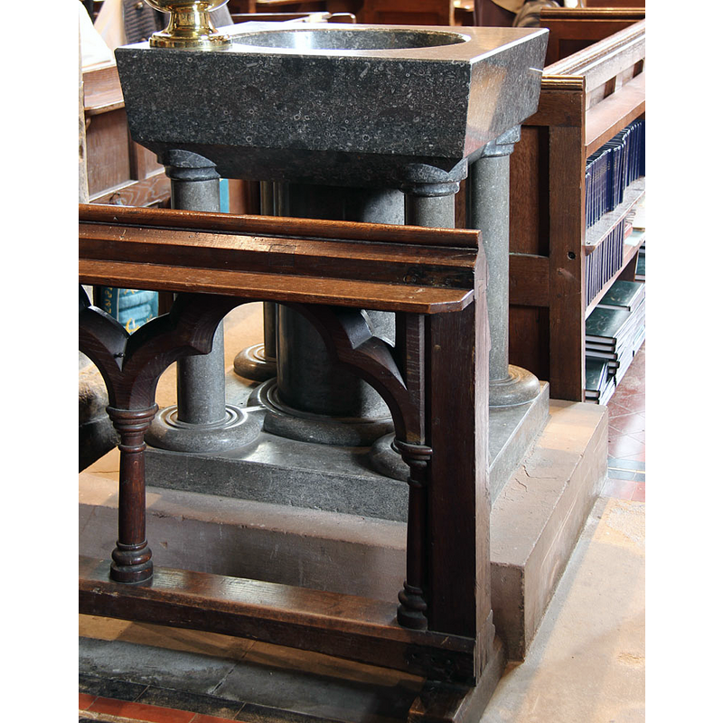
Image copyright © John Salmon, 2014
CC-BY-SA-2.0
Results: 4 records
view of font in context
Scene Description: [cf. FontNotes]
Copyright Statement: Image copyright © John Salmon, 2014
Image Source: digital photograph taken 25 September 2014 by John Salmon [www.geograph.org.uk/photo/4190341] [accessed 17 December 2015]
Copyright Instructions: CC-BY-SA-2.0
view of church exterior - northwest view
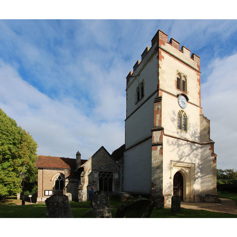
Copyright Statement: Image copyright © John Salmon, 2014
Image Source: digital photograph taken 25 September 2014 by John Salmon [www.geograph.org.uk/photo/4190366] [accessed 17 December 2015]
Copyright Instructions: CC-BY-SA-2.0
view of church exterior - south view
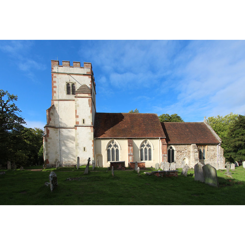
Copyright Statement: Image copyright © John Salmon, 2014
Image Source: digital photograph taken 25 September 2014 by John Salmon [www.geograph.org.uk/photo/4190368] [accessed 17 December 2015]
Copyright Instructions: CC-BY-SA-2.0
view of church interior - nave - looking east
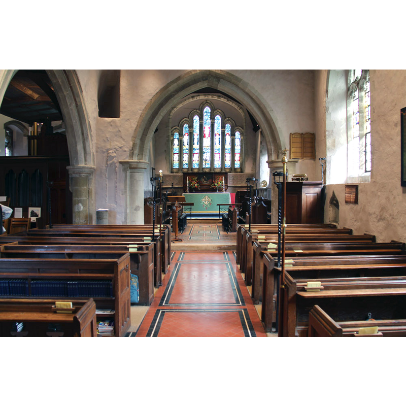
Copyright Statement: Image copyright © John Salmon, 2014
Image Source: digital photograph taken 25 September 2014 by John Salmon [www.geograph.org.uk/photo/4190361] [accessed 17 December 2015]
Copyright Instructions: CC-BY-SA-2.0
INFORMATION
Font ID: 05503OCK
Object Type: Baptismal Font1, fragment
Font Century and Period/Style: 13th century [fragment], Medieval
Church / Chapel Name: Parish Church of All Saints
Font Location in Church: [cf. FontNotes]
Church Patron Saint(s): All Saints
Church Address: Ockham Road North, Ockham, Woking GU23 6NL Surrey, United Kingdom -- Tel.: +44 1483 210167
Site Location: Surrey, South East, England, United Kingdom
Directions to Site: Located about 8 km E of Woking, just NW of East Horsley, on the B2039, before the link with the A3, 12 km NE of Guildford
Ecclesiastic Region: Diocese of Guildford
Historical Region: Hundred of Woking
Additional Comments: disappeared fonts? (the one from the Domesday-time church here, and the 17thC (?) font reported by Bond ca.1908 [cf. FontNotes])
Font Notes:
Click to view
There is an entry for Ockham [variant spelling] in the Domesday survey [http://opendomesday.org/place/TQ0756/ockham/] [accessed 17 December 2015]; it mentions a church in it. Bond (1908) lists the one here as one of several "well meant fonts put up between the Reformation and the Rebellion". The Victoria County History (Surrey, vol. 3, 1911) notes: "There was a church on the manor of Ockham at the time of Domesday. [...] The plan of the nave probably represents that of a 12th-century church, the chancel of which gave place at the beginning of the 13th century to that now standing [...] The font now in use is modern, but placed in the chancel are the remains of one of early 13th-century date, consisting of a circular Purbeck-marble stem on a square base-stone, on which are the moulded bases of four detached shafts." The entry for Ockham in English Heritage [Listing NGR: TQ0664856538] (1967) notes: "C19 font, with remains of old C13 font in chancel. Circular Purbeck marble stem on square stone base with moulded plinth and 4 detached shafts." Noted in Leach (1975) as a font made of Purbeck marble: "central stem, subsidiary shafts and base only" [source given: VCH, 3, 1911].
COORDINATES
UTM: 30U 676359 5686052
Latitude & Longitude (Decimal): 51.298438, -0.470233
Latitude & Longitude (DMS): 51° 17′ 54.38″ N, 0° 28′ 12.84″ W
MEDIUM AND MEASUREMENTS
Material: stone, limestone (Purbeck marble)
REFERENCES
- Victoria County History [online], University of London, 1993-. URL: https://www.british-history.ac.uk.
- Bond, Francis, Fonts and Font Covers, London: Waterstone, 1985 c1908, p. 265
- Leach, Rosemary, A Investigation into the use of Purbeck Marble in Medieval England, Hartlepool: E.W. Harrisons & Sons, 1975, p. 72-73