Dodington nr. Stringston / Dodintone
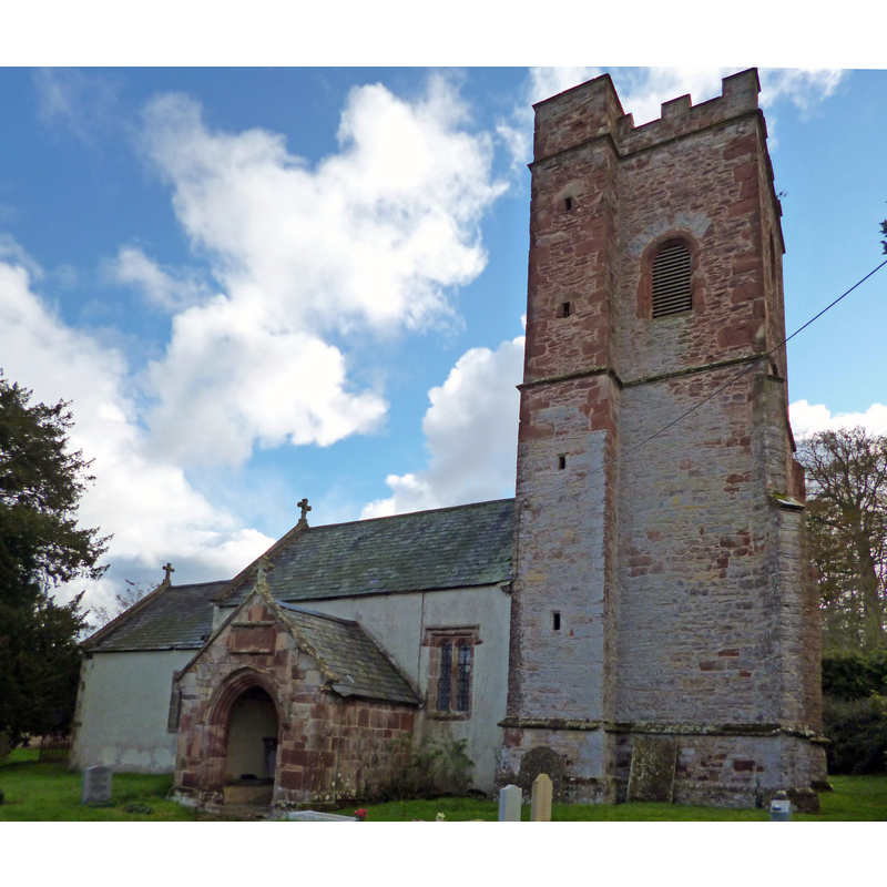
Image copyright © Dave Kelly, 2014
CC-BY-SA-2.0
Results: 1 records
view of church exterior - northwest view
Copyright Statement: Image copyright © Dave Kelly, 2014
Image Source: digital photograph taken 4 November 2014 by Dave Kelly [www.geograph.org.uk/photo/4233174] [accessed 6 March 2018]
Copyright Instructions: CC-BY-SA-2.0
INFORMATION
Font ID: 05238DOD
Object Type: Baptismal Font1
Font Century and Period/Style: 12th century, Late Norman
Church / Chapel Name: Parish Church of All Saints
Font Location in Church: Inside the church
Church Patron Saint(s): All Saints
Church Address: Dodington, Bridgwater TA5 1LF, UK
Site Location: Somerset, South West, England, United Kingdom
Directions to Site: Located off (N) the A39, S of Stringston, SE of Holford, NW of Over- and Nether-Stowey
Ecclesiastic Region: Diocese of Bath & Wells
Historical Region: Hundred of Williton and Freemanors (eastern)
Additional Comments: disappeared font? (the one from the 12thC church here)
Font Notes:
Click to view
There is one entry for this Dodington in the Domesday survey [http://opendomesday.org/place/ST1740/dodington/] [accessed 6 March 2018], but it mentions neither cleric nor church in it. The entry for this church in Historic England [IoE Number: 265139] mentions a 15th-century enlargement of the earlier medieval church, but mentions neither font nor stoup in it. The entry for this parish in the Victoria County History (Somerset, vol. 5, 1985) notes: "There was a church at Dodington by the late 12th century [...] The small nave may retain the 12th-century plan, the porch and the lower stages of the tower were added in the 15th century when the chancel was rebuilt. The nave was given new windows and a new roof in the 16th century"; there is no mention of font or stoup in the VCH entry. An article by Judy Nash in 'Somerset Magazine' (4/99) [http://www.dodingtonfamily.org/DHvillageHistory.htm] [accessed 18 September 2009] notes: "Close to the tower stands a well carved font with wooden cover." In an excerpt from Berta Lawrence 'Quantock Country' [ibid.] a holy-water stoup is described: "The great stone porch, where again the forester’s bugle-horns are sculptured, contains a stoup like a font, set on the grey stone bench and roughly canopied, its sides sculptured with quatrefoils enclosing a flower-motif." Neither font nor stoup is mentioned in Pevsner (1958).
COORDINATES
UTM: 30U 487063 5667467
Latitude & Longitude (Decimal): 51.1585, -3.185
Latitude & Longitude (DMS): 51° 9′ 30.6″ N, 3° 11′ 6″ W
REFERENCES
- Victoria County History [online], University of London, 1993-. URL: https://www.british-history.ac.uk.