Henley nr. Ipswich
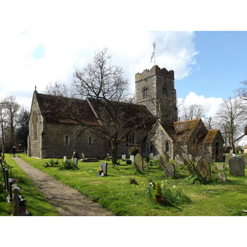
Image copyright © Adrian Cable, 2016
CC-BY-SA-2.5
Results: 2 records
view of church exterior - northeast view
Copyright Statement: Image copyright © Adrian Cable, 2016
Image Source: digital photograph taken 17 April 2016 by Adrian Cable [www.geograph.org.uk/photo/4923154] [accessed 10 January 2018]
Copyright Instructions: CC-BY-SA-2.5
view of church exterior - southeast view
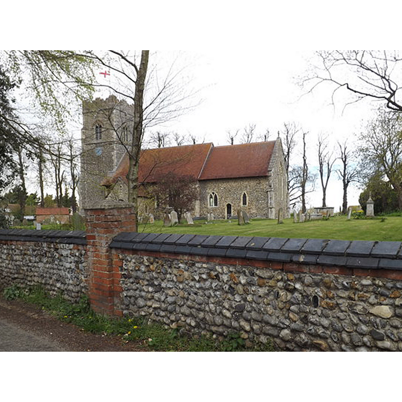
Copyright Statement: Image copyright © Adrian Cable, 2016
Image Source: digital photograph taken 26 April 2016 by Adrian Cable [www.geograph.org.uk/photo/4943323] [accessed 10 January 2018]
Copyright Instructions: CC-BY-SA-2.5
INFORMATION
Font ID: 05203HEN
Object Type: Baptismal Font1?
Font Century and Period/Style: 11th century, Pre-Conquest? / Norman
Church / Chapel Name: Parish Church of St. Peter
Church Patron Saint(s): St. Peter
Church Address: Church Lane, Henley, Ipswich IP6 0RQ , UK -- Tel.: (01473) 831930
Site Location: Suffolk, East Anglia, England, United Kingdom
Directions to Site: Located off (E) the A14, NE of Claydon, 8-10 km N of Ipswich
Ecclesiastic Region: Diocese of St.Edmundsbury & Ipswich
Historical Region: Hundred of Claydon
Additional Comments: recycled font? (the base is believed to be from an earlier font) -- disappeared font(s)? (from the two Domesday-time churches here)
Font Notes:
Click to view
There are seven entries for this Henley in the Domesday survey [http://opendomesday.org/place/TM1551/henley/] [accessed 10 January 2018], two of which report churches in it [1)"1 church. 0.06 church lands" and 2)"1 church. 0.01 church lands"]. "The eight sided font was a replacement in the 1840s although it is considered that an earlier base was reused." (<members.netscapeonline.co.uk/henleysuffolk/church.htm>)
COORDINATES
UTM: 31U 373446 5775785
Latitude & Longitude (Decimal): 52.1181, 1.1516
Latitude & Longitude (DMS): 52° 7′ 5.16″ N, 1° 9′ 5.76″ E