Chillesford / Cesefortda
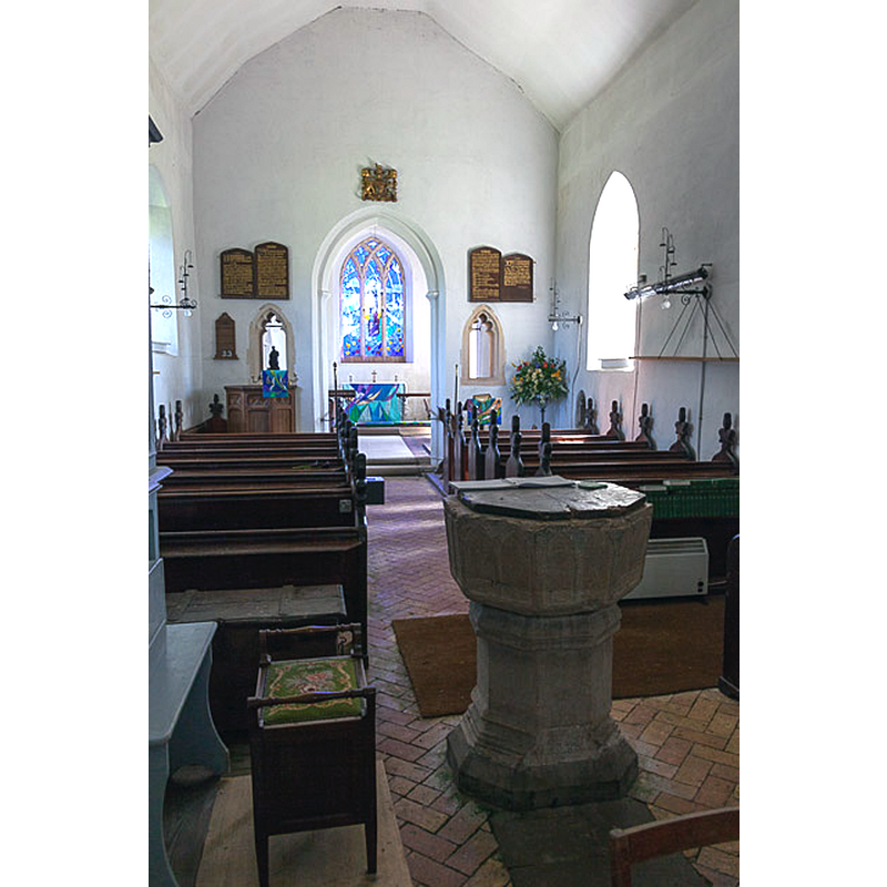
Image copyright © Peter Facey, 2014
CC-BY-SA-2.5
Results: 3 records
design element - architectural - arcade - blind - pointed arches - 16
Scene Description: two per side of the octagonal basin
Copyright Statement: Image copyright © Peter Facey, 2014
Image Source: digital photograph 3 June 2014 by Peter Facey [https://www.geograph.org.uk/photo/4021441] [accessed 27 February 2023]
Copyright Instructions: CC-BY-SA-2.5
view of church exterior - southeast view
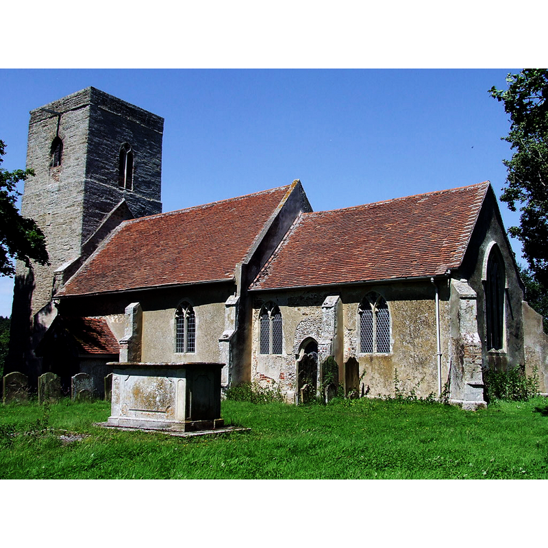
Scene Description: Source caption: "The village church of St Peter Chillesford, Suffolk."
Copyright Statement: Image copyright © Keith Evans, 2014
Image Source: digital photograph 3 July 2014 by Keith Evans [https://www.geograph.org.uk/photo/4062362] [accessed 27 February 2023]
Copyright Instructions: CC-BY-SA-2.5
view of font and cover in context - west side
Scene Description: Source caption: "Interior of St. Peter's Church, Chillesford"
Copyright Statement: Image copyright © Peter Facey, 2014
Image Source: digital photograph 3 June 2014 by Peter Facey [https://www.geograph.org.uk/photo/4021441] [accessed 27 February 2023]
Copyright Instructions: CC-BY-SA-2.5
INFORMATION
Font ID: 05188CHI
Object Type: Baptismal Font1
Font Century and Period/Style: 13th century [basin only] [composite font], Transitional / Early English [altered]
Church / Chapel Name: Parish Church of St. Peter
Font Location in Church: Inside the church, at the W end of the nave
Church Patron Saint(s): St. Peter
Church Address: Church Farm, Woodbridge IP12 3PS, United Kingdom -- Tel.: +44 1394 450610
Site Location: Suffolk, East Anglia, England, United Kingdom
Directions to Site: Located off the B1084, 5 km NW of Orford, 10 km S of Saxmundham, 9 km ESE of Wickham Market
Ecclesiastic Region: Diocese of St Edmundsbury and Ipswich
Historical Region: Hundred of Plomesgate [in Domesday]
Additional Comments: altered font? (the base is probably a later replacement) -- disappeared font? (the one from the Domesday-time church here)
Font Notes:
Click to view
There is an entry for Chillesford [variant spelling] in the Domesday survey [https://opendomesday.org/place/TM3852/chillesford/] [accessed 27 February 2023]; it reports "1 church. 0.04 church lands" in it. The entry for this church in Historic England [Listing NGR: TM3826752275] notes: "Parish Church. C14, much restored in the mid C19 [...] The font is C13 with octagonal bowl in Purbeck marble." Noted in Leach (1975) as a font made of Purbeck marble, Polygonal I Type (Octagonal): no details [source given: Pevsner]. The octagonal basin is now supported by a broad octagonal moulded base, a later replacement. The wooden cover is octagonal, flat and plain; date unknown.
COORDINATES
UTM: 31U 395843 5775214
Latitude & Longitude (Decimal): 52.117639, 1.478757
Latitude & Longitude (DMS): 52° 7′ 3.5″ N, 1° 28′ 43.52″ E
MEDIUM AND MEASUREMENTS
Material: stone, limestone (Purbeck marble)
Font Shape: octagonal, mounted
Basin Interior Shape: round
Basin Exterior Shape: octagonal
LID INFORMATION
Material: wood
Apparatus: no
Notes: [cf. FontNotes]
REFERENCES
- Leach, Rosemary, A Investigation into the use of Purbeck Marble in Medieval England, Hartlepool: E.W. Harrisons & Sons, 1975, p. 76