Nibbixwoud / Nuweboxwoude
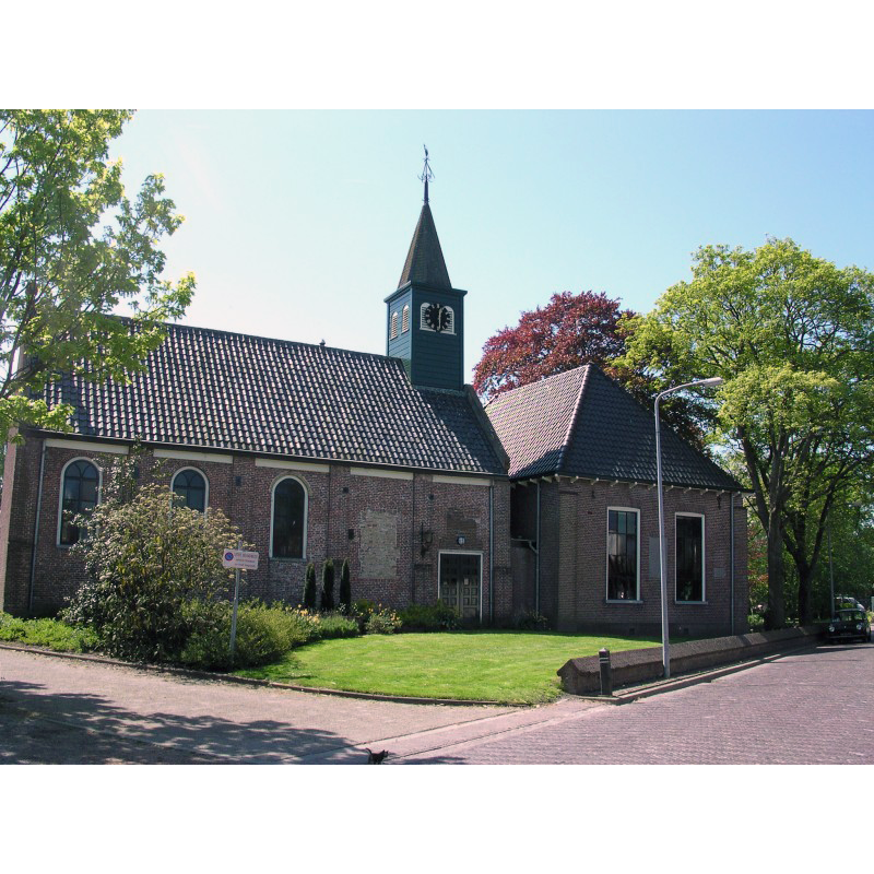
Image copyright © Dolfy, 2006
GFDL / CC-BY-SA-3.0
Results: 4 records
view of church exterior in context
Scene Description: Source caption: "De kerk Bessie in het dorp Nibbixwoud." -- the 1834 church was decommissioned in 1980; became a cultural centre; church and town hall converted into a single building 1982
Copyright Statement: Image copyright © Dolfy, 2006
Image Source: digital photograph 9 May 2006 by Dolfy [https://commons.wikimedia.org/wiki/File:Nibbixwoud-Kerk_Bessie.jpg] [accessed 8 February 2025]
Copyright Instructions: GFDL / CC-BY-SA-3.0
view of church exterior - south view
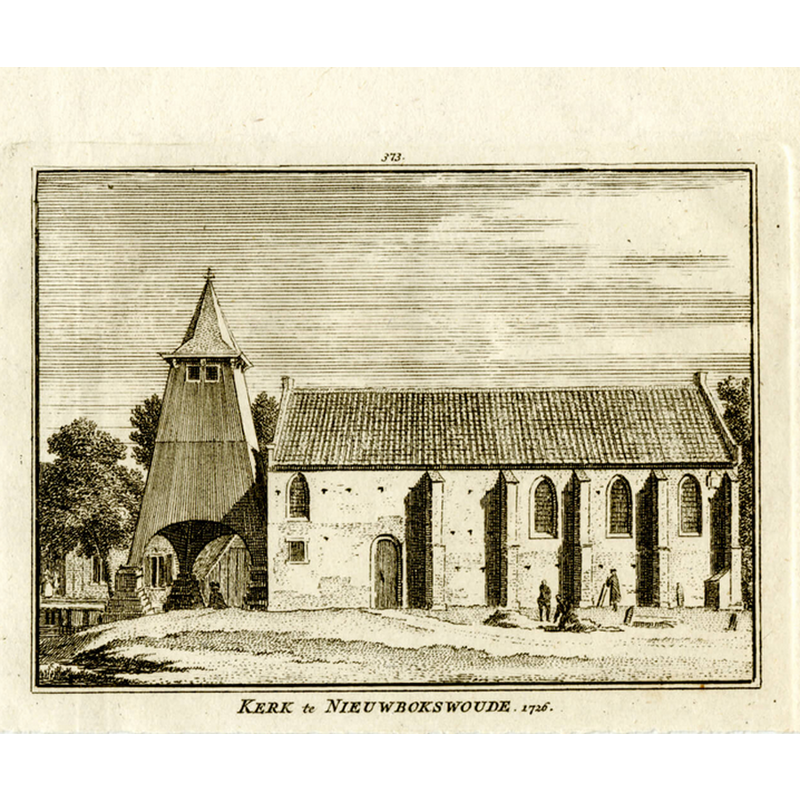
Scene Description: the earlier church replaced in 1834 by the present building
Copyright Statement: Image copyright © [in the public domain]
Image Source: digital image of an illustration in Het verheerlykt Nederland, of Kabinet van Hedendaagsche gezigten van steden, dorpen, sloten, adelyke huizen […] (1745-1774), reproduced in https://prentkunst.net/index.php/product/de-kerk-van-nibbixwoud-in-1726-uit-het-verheerlykt-nederland/ [accessed 8 February 2025]
Copyright Instructions: PD


INFORMATION
Font ID: 05158NIB
Object Type: Baptismal Font1
Font Century and Period/Style: 14th century (?), Medieval
Church / Chapel Name: Nibbixwoud Kerk [deconsecrated]
Font Location in Church: [cf. FontNotes]
Church Notes: present church built in 1834 to replace a 14thC predecessor; church decommissioned in 1980; became a cultural centre; church and town hall converted into a single building 1982
Church Address: Dorpsstraat 62, 1688CE Nibbixwoud, Netherlands
Site Location: Nord Holland, Netherlands
Directions to Site: Located off (N) road N307, the municipality of Medemblik, 5 km N of Hoorn, 18-20 km W of Enkhuizen
Additional Comments: disappeared font? [cf. FontNotes]
Font Notes:
Click to view
A communication to BSI from Pol Herman (e-mail of 2 February 2025) refers to a 1997 exhibition catalogue of drawings by Andries and Gerrit Schaemaker, Beschryving en Afbeelding der Steden; Dorpen; Geheugten; Adelyke en andere Gebouwen in WestFriesland, Waterland, Kennemerland en Aankleve van Dien, Dus beschreven en by Een Versamelt; mitsgaders in Alphabetise Ordre Geschikt door Andries Schoemaker. Deze beschrijving is in 1996 gemaakt door Jeanine Otten ter voorbereiding van haar hoofdstuk 'Opdrachtgevers Andries en Gerrit Schoemaker' in L. Kooijmans e.a. (red.), Pronk met Pen en Penseel, 1997, catalogus bij de gelijknamige tentoonstelling, p. 109-126. De indeling is voor deze publicatie aangepast." The catalogue, contains two references to drawings that include a reference to a very old font in the church, octagonal in shape and made of white stone ["aan de kerk stond een seer oude stene doopvont [...] de doopvont daar boven van gesproken is achtkant en van witte steen"]. Unfortunately, adds Pol Herman, there is no trace of this font now.
COORDINATES
UTM: 31U 638900 5840077
Latitude & Longitude (Decimal): 52.692778, 5.055278
Latitude & Longitude (DMS): 52° 41′ 34″ N, 5° 3′ 19″ E
MEDIUM AND MEASUREMENTS
Material: stone, limestone?
Font Shape: octagonal
Basin Exterior Shape: octagonal