Ashwell / Aiswell / Asewell / Ashewell / Ashwelle / Asewell / Ayswell / Exewelle / Exuuelle / Exwell / Exwelle
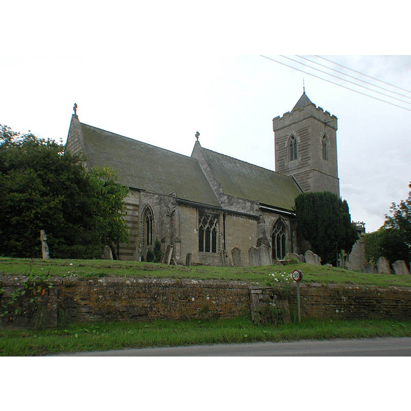
Image copyright © John Salmon, 2002
CC-BY-SA-2.0
Results: 3 records
view of church exterior - northeast view
Copyright Statement: Image copyright © John Salmon, 2002
Image Source: digital photograph taken 15 June 2002 by John Salmon [www.geograph.org.uk/photo/2235376] [accessed 15 July 2015]
Copyright Instructions: CC-BY-SA-2.0
view of church exterior - southeast view
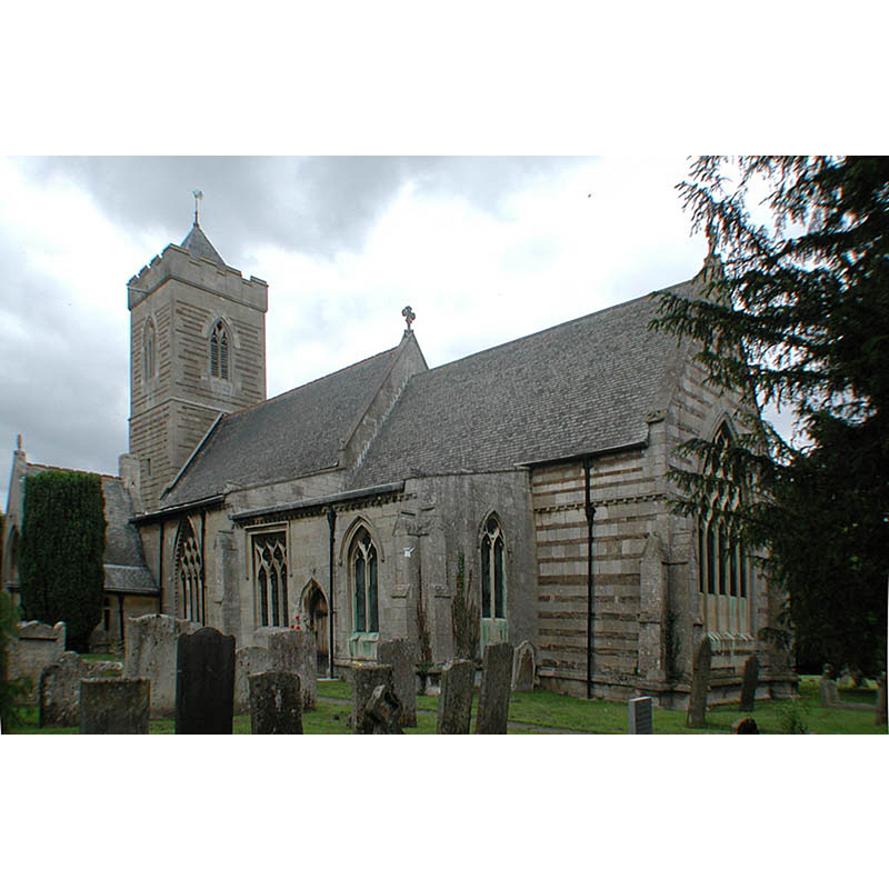
Copyright Statement: Image copyright © John Salmon, 2002
Image Source: digital photograph taken 15 June 2002 by John Salmon [www.geograph.org.uk/photo/2235379] [accessed 15 July 2015]
Copyright Instructions: CC-BY-SA-2.0
view of font and cover in context
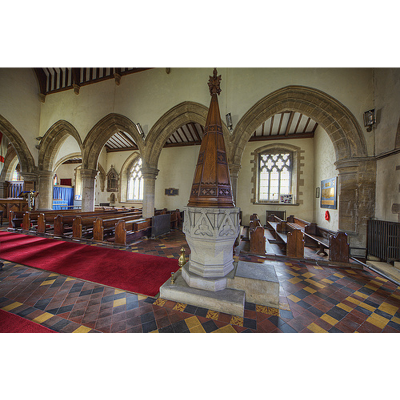
Scene Description: the modern font and cover
Copyright Statement: Image copyright © Chris Jones, 2015
Image Source: digital phtograph taken by Chris Jones [www.leicestershirechurches.co.uk/ashwell-church-st-mary/] [accessed 24 July 2015]
Copyright Instructions: Standing permission
INFORMATION
Font ID: 05083ASH
Object Type: Baptismal Font1?
Font Century and Period/Style: 12th century, Late Norman? / Transitional?
Church / Chapel Name: Parish Church of St. Mary
Church Patron Saint(s): St. Mary the Virgin
Church Address: Church Close, Ashwell, Rutland, LE15 7LP
Site Location: Rutland, East Midlands, England, United Kingdom
Directions to Site: Located off (E) the A606, 5 kms NNE of Oakham, SE of Melton Mowbray
Ecclesiastic Region: Diocese of Peterborough
Historical Region: Hundred of Alstoe
Additional Comments: disappeared font or fonts: [cf. FontNotes]
Font Notes:
Click to view
There are two entries for this Ashwell [variant spelling] in the Domesday survey [http://opendomesday.org/place/SK8613/ashwell/] [accessed 15 July 2015], neither of which mentions cleric or church in it. A "pewter baptismal ewer" mentioned in Bond (1908) "which at one time has been gilt, was scheduled by Mr. R.C. Hope at Ashwell, Rutland." It had probably disappeared by Bond's time. [NB: the town's name in Bond's index appears spelled as "Askwell", but correctly spelled in the body of the text]. The Victoria County History (Rutland, vol. 2, 1935) notes: "The church is mainly of 13th and 14th century date, but has developed from a 12th-century building to which a north aisle appears to have been added c. 1190. [...] The font is modern, with octagonal stone bowl, in the style of the 14th century, given in 1851 by Viscountess Downe." Pevsner & Williamson (1984) note: "Font. 1851. Heavy, octagonal, with triangular gables and shafts at the angles. Tapering octagonal cover [...] by Butterfield" [i.e., William Butterfield (1814-1900)]. The present font is located at the west end of the nave. [NB: the fabric of the church goes back to the 12th century, but we have no information on the earlier font(s) of St Mary's]
COORDINATES
UTM: 30U 654075 5842881
Latitude & Longitude (Decimal): 52.713855, -0.719051
Latitude & Longitude (DMS): 52° 42′ 49.88″ N, 0° 43′ 8.59″ W
REFERENCES
- Victoria County History [online], University of London, 1993-. URL: https://www.british-history.ac.uk.
- Bond, Francis, Fonts and Font Covers, London: Waterstone, 1985 c1908, p. 271
- Pevsner, Nikolaus, Leicestershire and Rutland, Harmondsworth: Penguin Books, 1984, p. 453