Chaldon / Calvedone [Domesday] / Chaldron / Chalvedon
![Main image for Chaldon / Calvedone [Domesday] / Chaldron / Chalvedon](/static-50478a99ec6f36a15d6234548c59f63da52304e5/compressed/1160318007_compressed.png)
Image copyright © Michael Garlick, 2015
CC-BY-SA-2.0
Results: 6 records
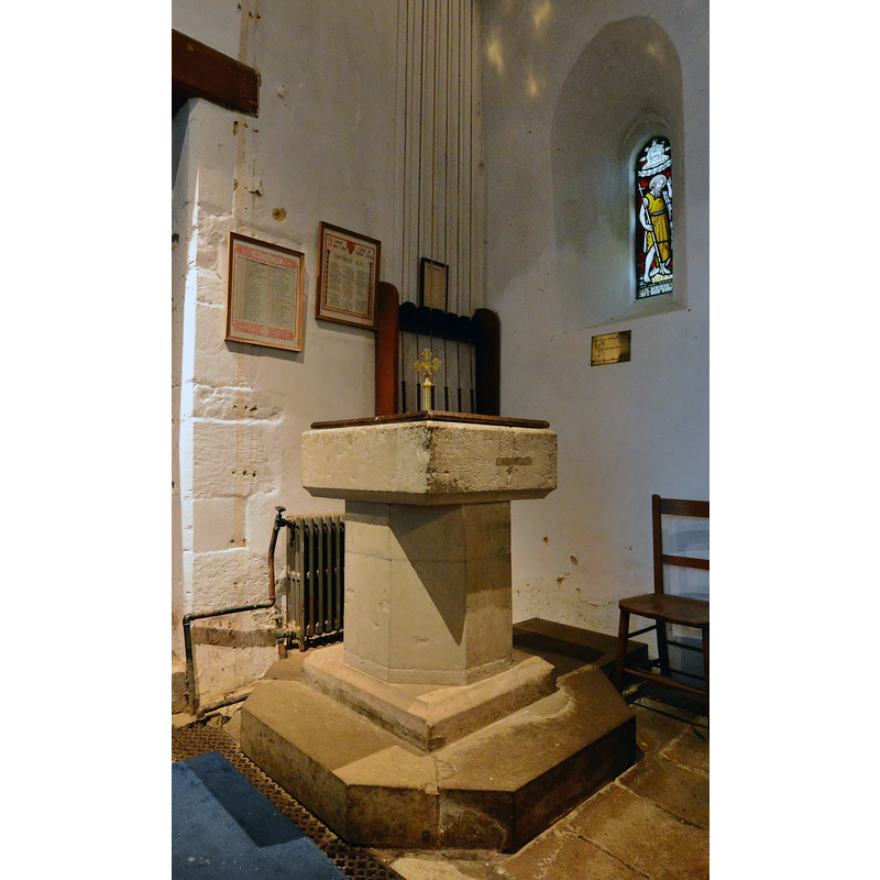
view of font and cover
Copyright Statement: Image copyright © Michael Garlick, 2015
Image Source: digital photograph taken 10 February 2015 by Michael Garlick [www.geograph.org.uk/photo/4345791] [accessed 16 March 2016]
Copyright Instructions: CC-BY-SA-2.0
view of church exterior - south view
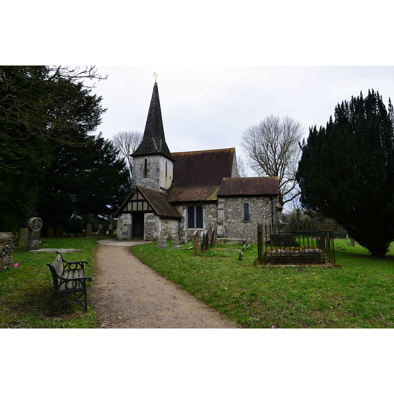
Scene Description: Source caption: "Chaldon: The Church of St Peter and St Paul. The church is Norman with the famous Chaldon Mural on the west wall; it was later added to. The west tower and spire date from 1843."
Copyright Statement: Image copyright © Michael Garlick, 2015
Image Source: digital photograph taken 10 February 2015 by Michael Garlick [www.geograph.org.uk/photo/4345822] [accessed 16 March 2016]
Copyright Instructions: CC-BY-SA-2.0
view of font and cover in context
Copyright Statement: Image copyright © Michael Garlick, 2015
Image Source: digital photograph taken 10 February 2015 by Michael Garlick [www.geograph.org.uk/photo/4345788] [accessed 16 March 2016]
Copyright Instructions: CC-BY-SA-2.0
view of church interior - west end - painting
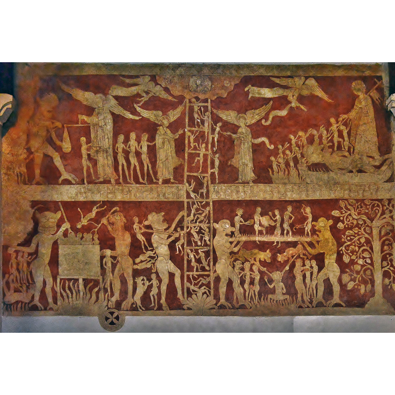
Scene Description: Source caption: "Chaldon: The Church of St Peter and St Paul. The famous Chaldon Mural painted around 1200 and situated on the Norman west wall of the church."
Copyright Statement: Image copyright © Michael Garlick, 2015
Image Source: digital photograph taken 10 February 2015 by Michael Garlick [www.geograph.org.uk/photo/4345936] [accessed 16 March 2016]
Copyright Instructions: CC-BY-SA-2.0
view of church interior - nave - looking west
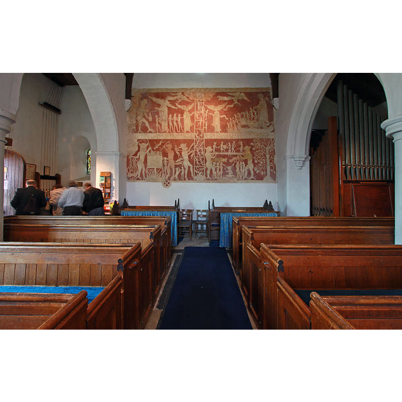
Scene Description: with the medieval mural on the west wall
Copyright Statement: Image copyright © John Salmon, 2010
Image Source: digital photograph taken 15 April 2010 by John Salmon [www.geograph.org.uk/photo/1813817] [accessed 16 March 2016]
Copyright Instructions: CC-BY-SA-2.0
view of church interior - nave - looking east
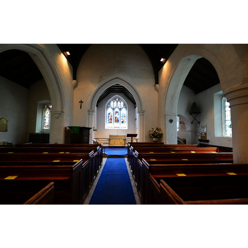
Copyright Statement: Image copyright © Michael Garlick, 2015
Image Source: digital photograph taken 10 February 2015 by Michael Garlick [www.geograph.org.uk/photo/4345894] [accessed 16 March 2016]
Copyright Instructions: CC-BY-SA-2.0
INFORMATION
Font ID: 04774CHA
Object Type: Baptismal Font1
Font Century and Period/Style: 12th - 13th century [alteredfont? / composite font?], Medieval
Church / Chapel Name: Parish Church of St. Peter and St. Paul
Font Location in Church: Inside the church, at the W end, S side
Church Patron Saint(s): St. Peter & St. Paul [one source has it dedicated to St. John; otherwise St. Peter, or Saints Peter & Paul]
Church Notes: This church has a large mural (on the west wall) depicting the "Ladder of Salvation", described by Hutton (1957, p. 41 and pl. 55) as "the finest complete example in England of so early a work."
Church Address: Ditches Lane, Chaldon, Whyteleafe, Surrey CR3 5AL
Site Location: Surrey, South East, England, United Kingdom
Directions to Site: Located off (N) the B203, just W of the Surrey National Golf Club, 9 kms SSW of Croydon
Ecclesiastic Region: Diocese of Southwark
Historical Region: Hundred of Wallington
Additional Comments: altered font (the present font: basin, stem and lower base of different periods?) -- disappeared font? (the original font from the Domesday-time church here)
Font Notes:
Click to view
There is an entry for this Chaldon [variant spelling] in the Domesday survey [http://opendomesday.org/place/TQ3055/chaldon/] [accessed 16 March 2016]; it reports a church in it. Allen (1831) writes: "The font is a plain square basin, on an octagonal pillar." In Brayley (1850): "The font is an ancient square basin, with an octagon shaft, of Merstham freestone." [NB: Merstham is a calcareous greenish-grey sandstone that gets its name from the Surrey town of the same name]. Listed in Cox & Harvey (1907) as a baptismal font of the Norman period. The Victoria County History (Surrey, vol. 4, 1912) notes that the church goes back to the 11th century, but the font is of a later date and was altered even later: "The font, in local firestone, with shallow, square basin (plain, except for a chamfer and hollow on the upper and lower edge), and octagonal stem on a square plinth, having a hollow on its upper edge, is probably of the 13th century, altered at a later date." Described and illustrated in Hutton (1957) as a Norman baptismal font with an octagonal base.
COORDINATES
UTM: 30U 700426 5685390
Latitude & Longitude (Decimal): 51.284529, -0.125817
Latitude & Longitude (DMS): 51° 17′ 4.3″ N, 0° 7′ 32.94″ W
MEDIUM AND MEASUREMENTS
Material: stone, sandstone (Merstham stone]
Font Shape: square, mounted
Basin Exterior Shape: square
LID INFORMATION
Date: modern
Material: wood
Apparatus: no
Notes: square, flat and plain, with a metal trefoiled cross on a stand; modern
REFERENCES
- Victoria County History [online], University of London, 1993-. URL: https://www.british-history.ac.uk.
- Allen, Thomas, A History of the County of Surrey ; comprising every object of topographical, geological, or historical interest, London: Isaac Taylor Hinton, 1831, vol. 2: 321
- Brayley, Edward Wedlake, A topographical history of Surrey, London: G. Willis, 1850, vol. 4: 35
- Hutton, Graham, English Parish Churches, London: Thames & Hudson, 1976, p. 41