Saverne No. 3 / Castrum Borra / Haut-Barr / Hohbarr
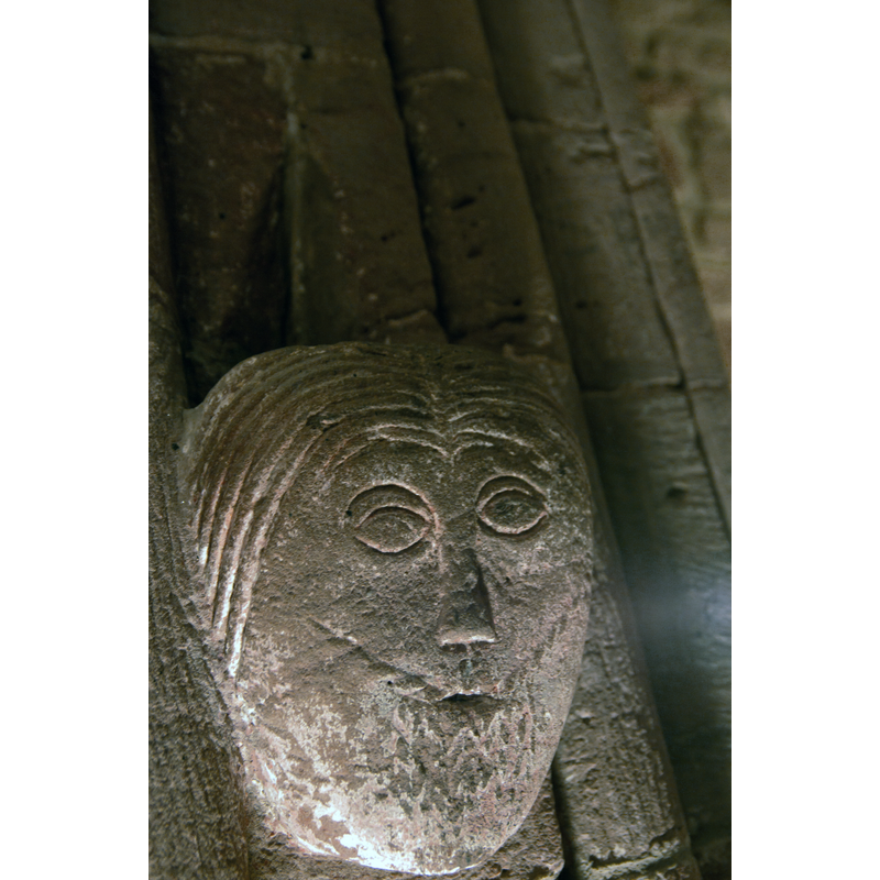
Image copyright © Antoine Taveneaux, 2012
CC-BY-SA-3.0
Results: 7 records
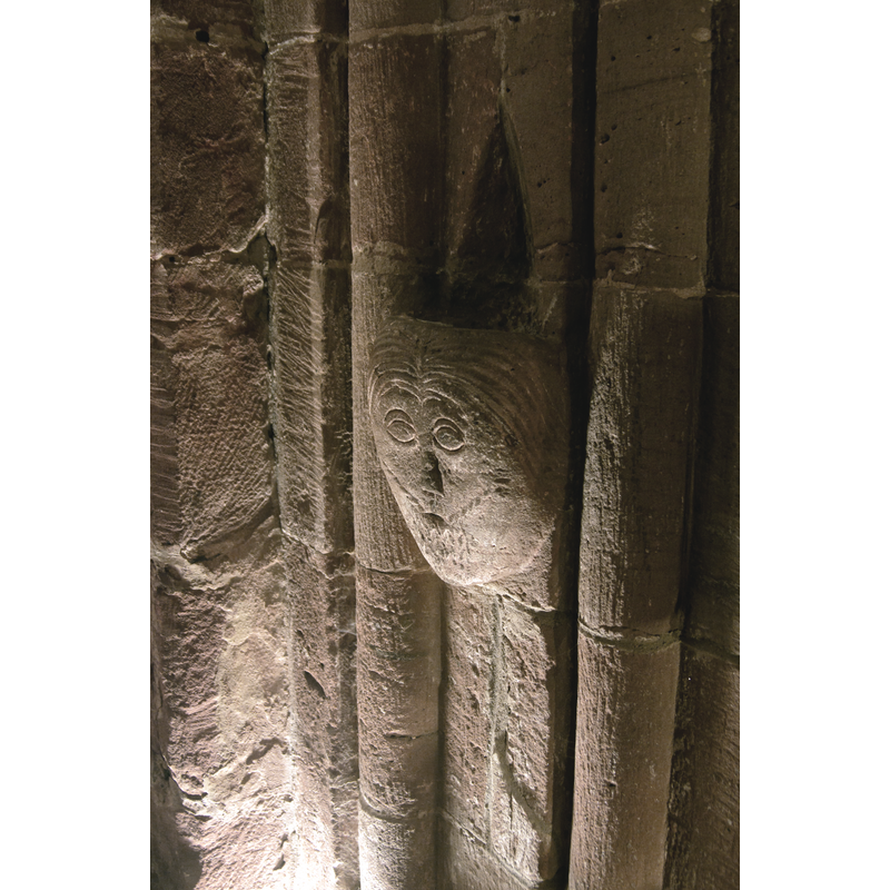
B01: human figure - male - head - bearded

Scene Description: a/p description in the Inventaire général... (1978)

human figure - head - male - bearded
Scene Description: Source caption: "détail intérieure de la Chapelle du château du Haut-Barr".
Copyright Statement: Image copyright © Antoine Taveneaux, 2012
Image Source: edited detail of a digital photograph taken 3 November 2012 by Antoine Taveneaux [https://commons.wikimedia.org/wiki/File:Château_du_Haut-Barr_02.jpg] [accessed 25 January 2018]
Copyright Instructions: CC-BY-SA-3.0
view of church exterior - southeast end - detail
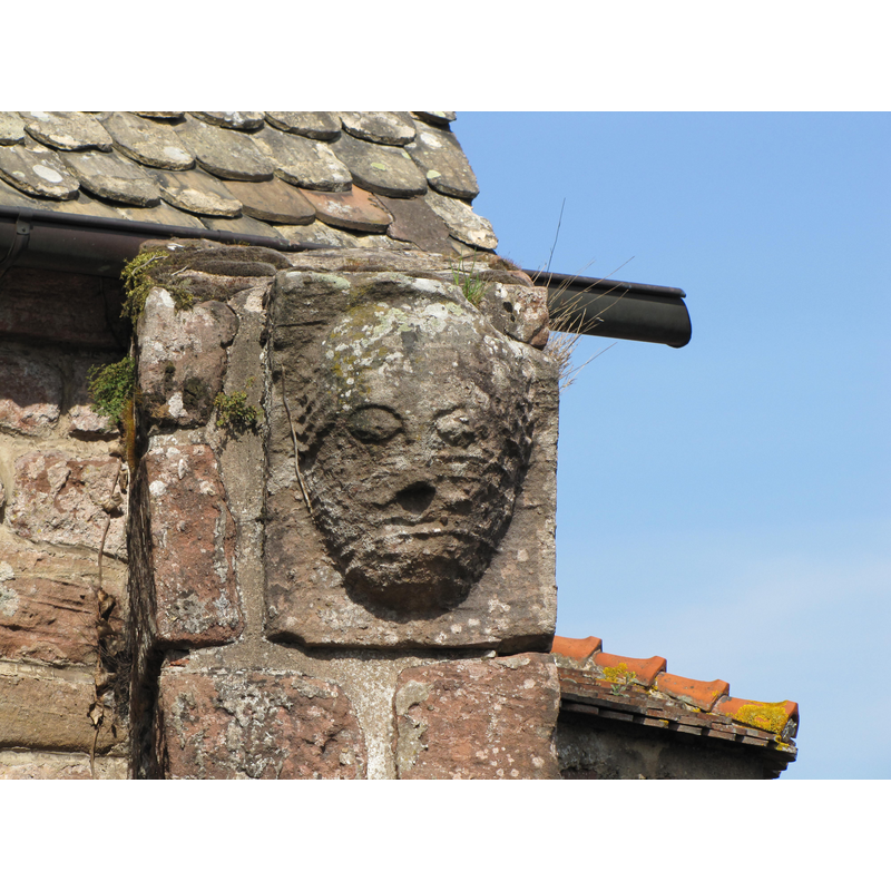
Copyright Statement: Image copyright © Ralph Hammann, 2010
Image Source: digital photograph taken 6 April 2010 by Ralph Hammann [https://commons.wikimedia.org/wiki/File:Haut-Barr_Chapelle_3.JPG] [accessed 25 January 2018]
Copyright Instructions: CC-BY-SA-4.0
view of church exterior - west façade - detail
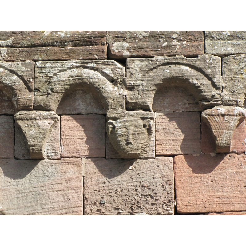
Copyright Statement: Image copyright © Ralph Hammann, 2010
Image Source: digital photograph taken 6 April 2010 by Ralph Hammann [https://commons.wikimedia.org/wiki/File:Haut-Barr_Chapelle_2.JPG] [accessed 25 January 2018]
Copyright Instructions: CC-BY-SA-4.0
view of church exterior - southwest view
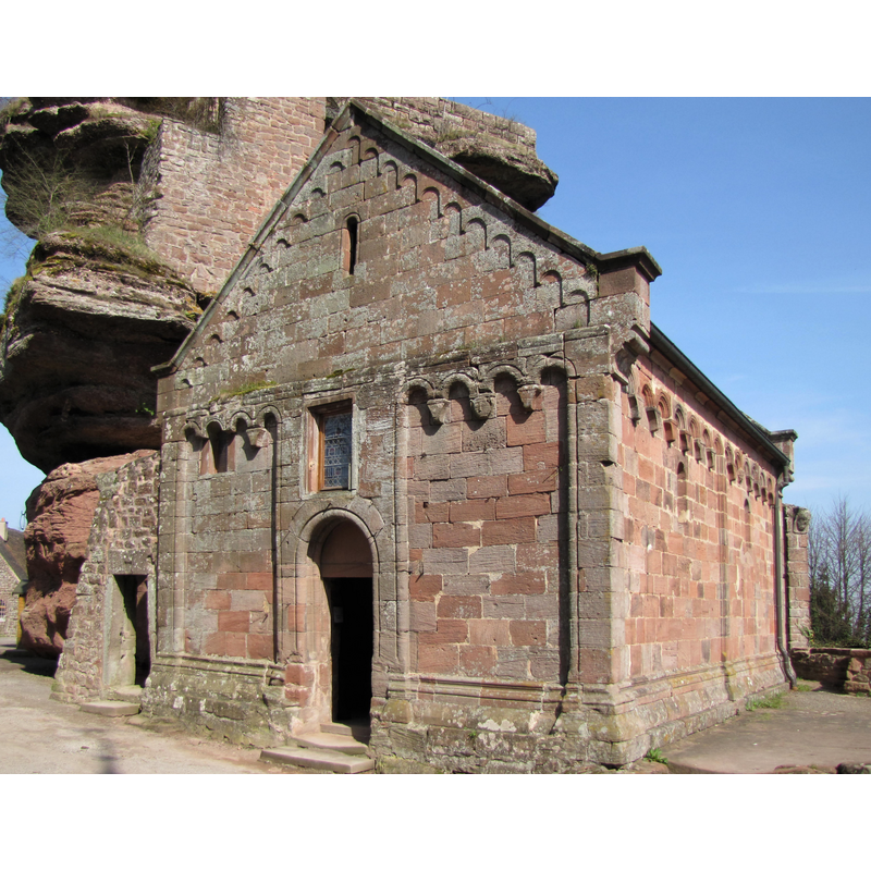
Copyright Statement: Image copyright © Ralph Hammann, 2010
Image Source: edited detail of a digital photograph taken 6 April 2010 by Ralph Hammann [https://commons.wikimedia.org/wiki/File:Haut-Barr_Chapelle_1.JPG] [accessed 25 January 2018]
Copyright Instructions: CC-BY-SA-4.0
view of church exterior in context - southwest view
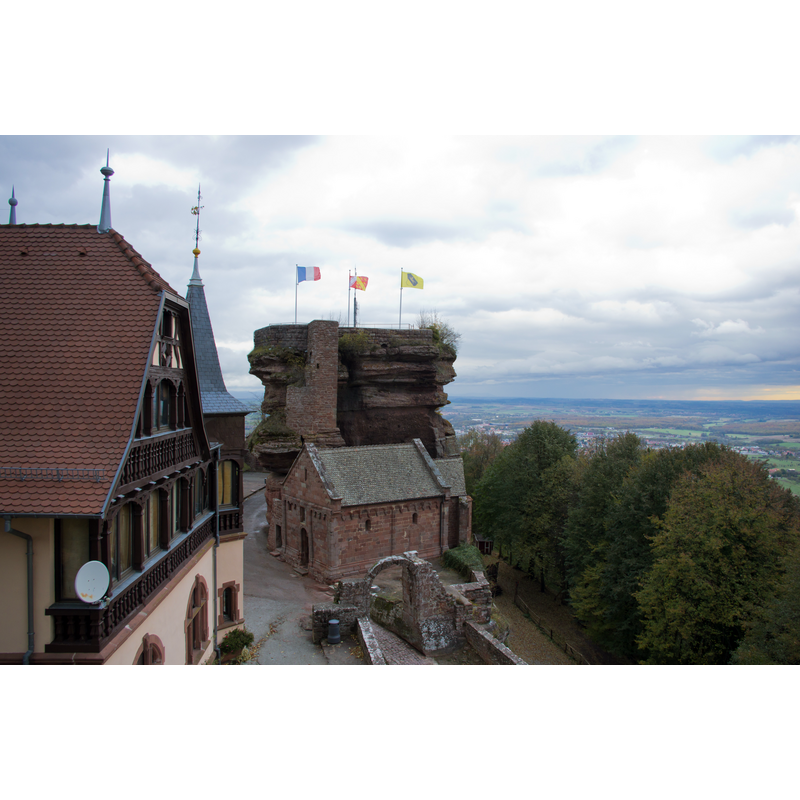
Scene Description: the old chapel in the context of the castle of Haut-Barr / Hohbarr
Copyright Statement: Image copyright © Antoine Taveneaux, 2012
Image Source: digital photograph taken 3 November 2012 by Antoine Taveneaux [https://commons.wikimedia.org/wiki/File:Château_du_Haut-Barr_02.jpg] [accessed 25 January 2018]
Copyright Instructions: CC-BY-SA-3.0
view of stoup in context
Scene Description: Source caption: "détail intérieure de la Chapelle du château du Haut-Barr".
Copyright Statement: Image copyright © Antoine Taveneaux, 2012
Image Source: edited detail of a digital photograph taken 3 November 2012 by Antoine Taveneaux [https://commons.wikimedia.org/wiki/File:Château_du_Haut-Barr_01.jpg] [accessed 25 January 2018]
Copyright Instructions: CC-BY-SA-3.0
INFORMATION
Font ID: 04508SAV
Object Type: Stoup
Font Date: ca. 1150-1180
Font Century and Period/Style: 12th century (mid to late?), Romanesque
Church / Chapel Name: Chapelle castrale [aka Notre-Dame-de-la-Paix], Château-fort du Haut-Barr Hohbarr
Font Location in Church: Wall-mounted on the chancel arch
Church Patron Saint(s): St. Mary the Virgin [formerly dedicated to the Holy Trinity and St. Nicholas]
Church Notes: chapel of a medieval castle now in ruins; both listed in Mérimée [ref.: PA00084952. IA00055462]: "Les ruines du château et la chapelle [...] Existence dès le début 12e siècle ; agrandissement vers 1168 : donjon mur bouclier ; chapelle entre 1170 et 1180".
Church Address: Château du Haut-Barr, 67700 Saverne, France -- Tel.: 03 88 91 80 47
Site Location: Bas-Rhin, Grand Est, France, Europe
Directions to Site: Saverne is located at the D1004-D1404 crossroads, about 45 km NW of Strasbourg. Other listed fonts also in this area (e.g.: Neuwiller-l-S., etc.). The castle is located SW of Saverne, at the end of the D171, between the D132 (W) and the D102 (E)
Ecclesiastic Region: Diocèse de Strasbourg
Historical Region: Alsace
Font Notes:
Click to view
Described in the Inventaire général... (1978) as a wall-mounted holy-water stoup from the mid to late 1100s, made of sandstone and ornamented with a bearded human head. Palissy [ref.: IM67004473] lists a later-date sandstone holy-water stoup: "bénitier [...] grès [...] tête : homme, barbe [...] 4e quart 18e siècle". The reddish sandstone stoup is mounted on the chancel arch.
COORDINATES
UTM: 32U 377817 5398209
Latitude & Longitude (Decimal): 48.724919, 7.338626
Latitude & Longitude (DMS): 48° 43′ 29.71″ N, 7° 20′ 19.06″ E
MEDIUM AND MEASUREMENTS
Material: stone, sandstone
Number of Pieces: one
Basin Total Height: 28 cm
Notes on Measurements: Inventaire général... (1978)
REFERENCES
- Inventaire général des monuments et des richesses artistiques de la France: Commission régionale d'Alsace, Bas-Rhin: canton Saverne, Paris: Imprimérie nationale, 1978, p. 364