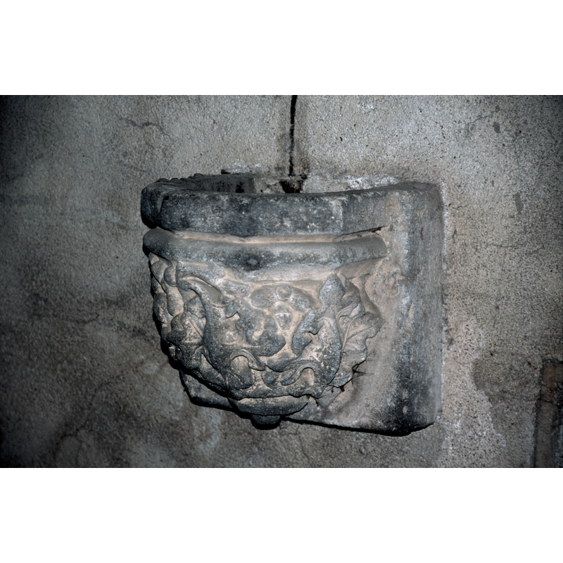
Huriel No. 2

Image copyright © Baptisteria Sacra Index, 2023
CC-BY-NC-ND-4.0
Results: 3 records
design element - motifs - foliage
design element - motifs - torus-scotia-torus
INFORMATION
Font ID: 03880HUR
Object Type: Stoup
Date Visited: 2001-07-02
Font Century and Period/Style: 12th century / 15th century, Medieval
Church / Chapel Name: Église paroissiale Notre-Dame d'Huriel
Font Location in Church: Wall-mounted on the S side of the W doorway
Church Patron Saint(s): St. Mary the Virgin
Church Notes: The church of Notre-Dame was, according to the source, (Le Patrimoine des communes de l'Allier, 1999, v. 1, p. 483) an ancient priory belonging to l' Abbaye de Déols. There is an interesting font of about the same period listed in the Index for this church [cf. Huriel No. 1] and an interesting 12th-13th century "grille du choeur" with spiral patern.
Church Address: 03380 Huriel, France
Site Location: Allier, Auvergne-Rhône-Alpes, France, Europe
Directions to Site: Located 12 km NW of Monteluçon
Ecclesiastic Region: Diocèse de Bourges
Historical Region: Pays d'Huriel -- Le Bocage bourbonnais
Additional Comments: recycled stoup?: formerly a Romanesque capital (?), now hollowed out to serve as stoup?
Font Notes:
Click to view
Listed in Le Patrimoine des communes de l'Allier (1999, v. 1, p. 483) as a holy-water stoup carved out of a Romanesque capital. The basin has a polygonal shape and is ornamented with acanthus leaves around the sides, forming one piece with the square backdrop. On-site notes: the granite stoup is wall-mounted and does not really appear to have ever been a capital (?); the date of it, as it now shows, is probably 15th-century.
COORDINATES
UTM: 31T 459626 5135916
Latitude & Longitude (Decimal): 46.375611, 2.475028
Latitude & Longitude (DMS): 46° 22′ 32.2″ N, 2° 28′ 30.1″ E
MEDIUM AND MEASUREMENTS
Material: stone, granite
Number of Pieces: one
Font Shape: polygonal (mounted on a square backdrop)
Basin Interior Shape: polygonal
Basin Exterior Shape: polygonal
Drainage System: no drainage system
Notes on Measurements: [BSI: no measurements taken]
REFERENCES
- Le Patrimoine des communes de l'Allier, Charenton-le-Pont: FLOHIC, 1999, vol. 1, p. 483