Chateauneuf-Grasse No. 1 / Châteauneuf-Grasse
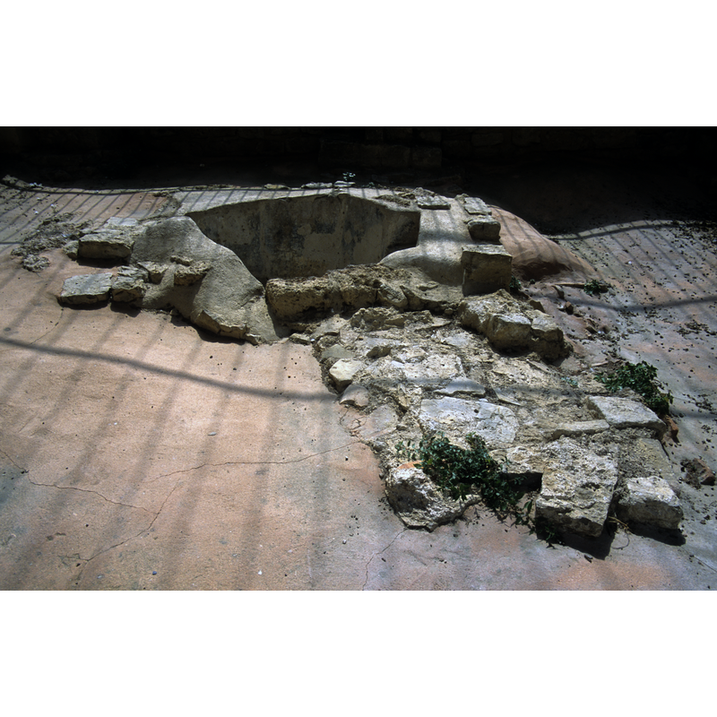
Image copyright © Baptisteria Sacra Index, 2023
CC-BY-NC-ND-4.0
Results: 23 records
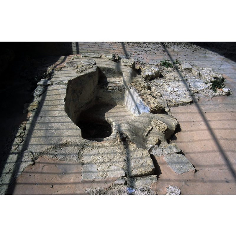
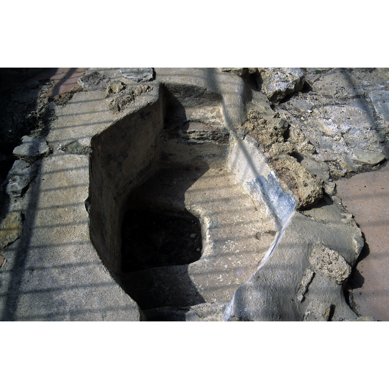
view of font
Copyright Statement: Image copyright © Baptisteria Sacra Index, 2023
Image Source: digital image of a photograph taken 14 June 2001 by BSI
Copyright Instructions: CC-BY-NC-ND-4.0
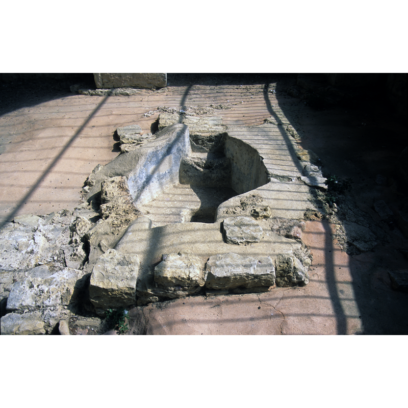
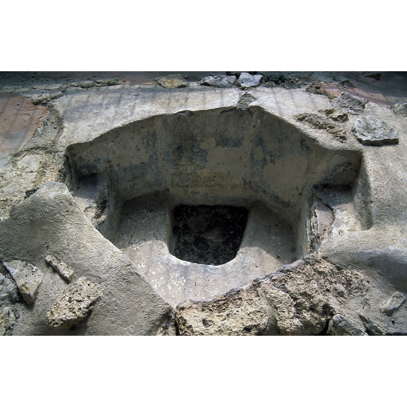
view of font
Copyright Statement: Image copyright © Baptisteria Sacra Index, 2023
Image Source: digital image of a photograph taken 14 June 2001 by BSI
Copyright Instructions: CC-BY-NC-ND-4.0
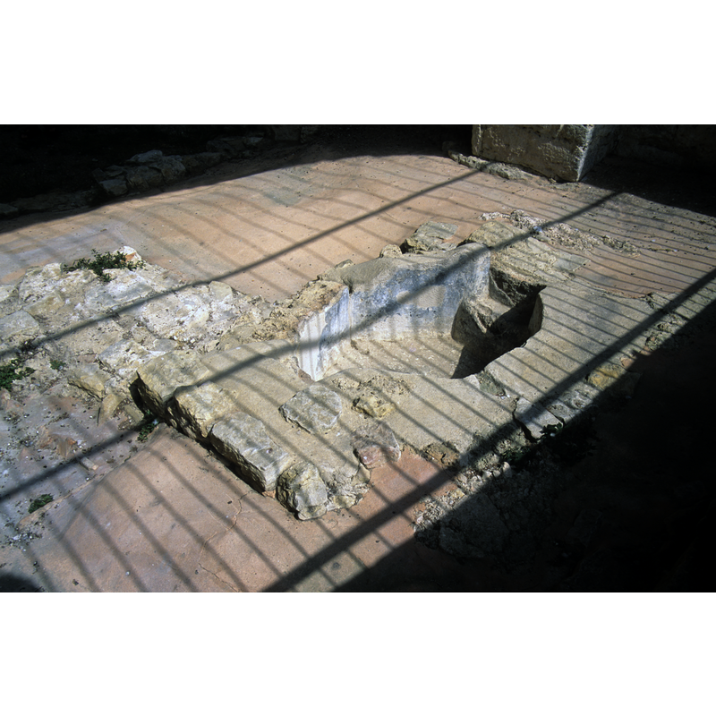
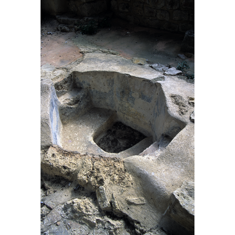
view of font
Copyright Statement: Image copyright © Baptisteria Sacra Index, 2023
Image Source: digital image of a photograph taken 14 June 2001 by BSI
Copyright Instructions: CC-BY-NC-ND-4.0
view of font
Copyright Statement: Image copyright © Baptisteria Sacra Index, 2023
Image Source: digital image of a photograph taken 14 June 2001 by BSI
Copyright Instructions: CC-BY-NC-ND-4.0
view of font
Copyright Statement: Image copyright © Baptisteria Sacra Index, 2023
Image Source: digital image of a photograph taken 14 June 2001 by BSI
Copyright Instructions: CC-BY-NC-ND-4.0
view of font
Copyright Statement: Image copyright © Baptisteria Sacra Index, 2023
Image Source: digital image of a photograph taken 14 June 2001 by BSI
Copyright Instructions: CC-BY-NC-ND-4.0
view of font
Copyright Statement: Image copyright © Baptisteria Sacra Index, 2023
Image Source: digital image of a photograph taken 14 June 2001 by BSI
Copyright Instructions: CC-BY-NC-ND-4.0
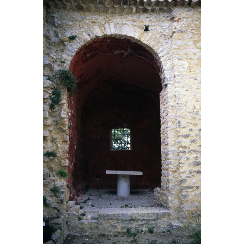
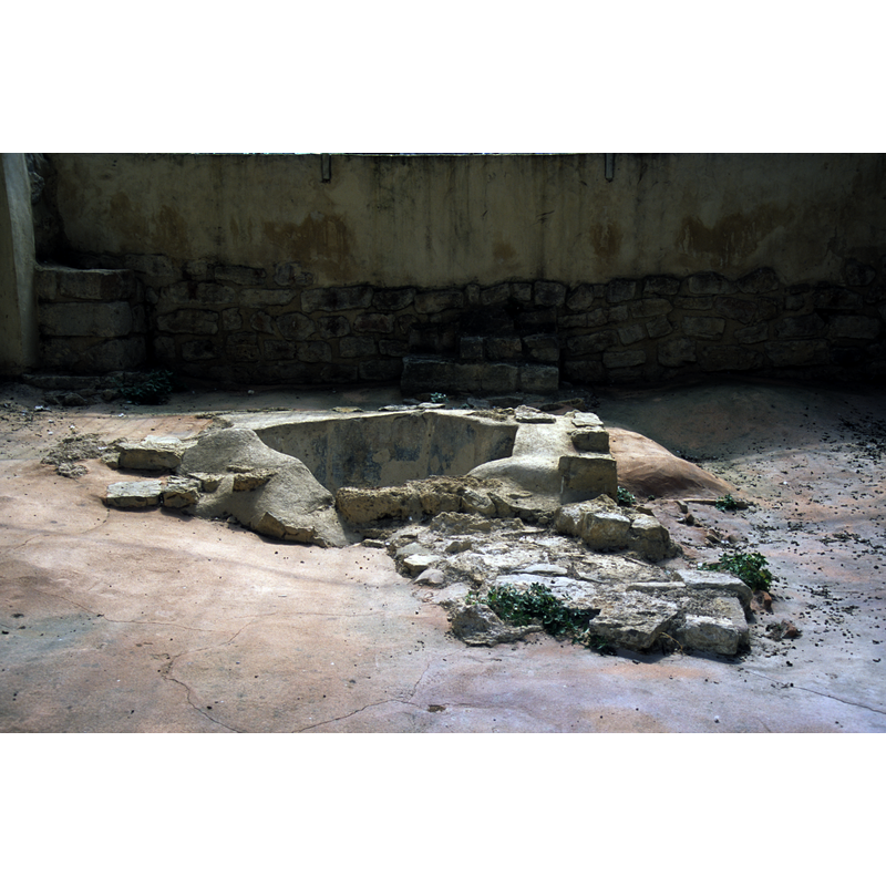
view of font in context
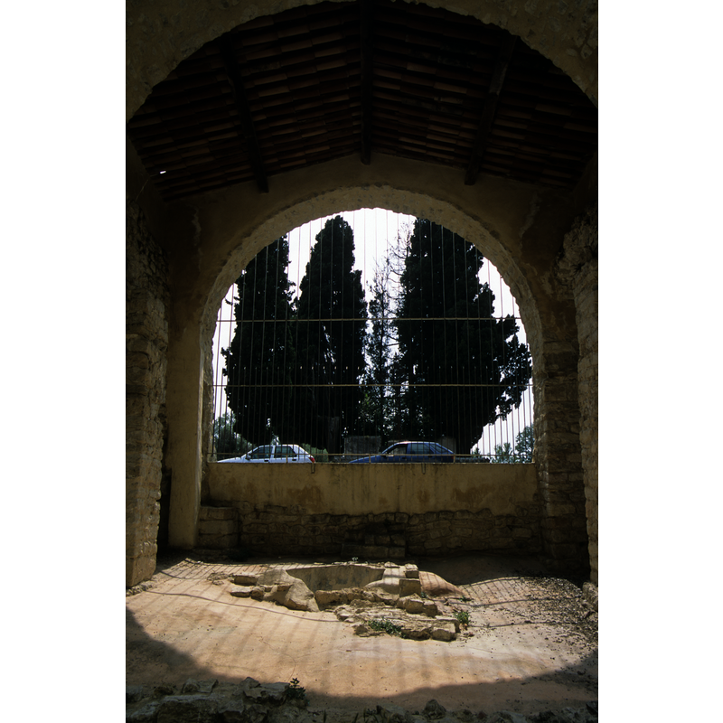
Scene Description: the present structure housing the font is not the original baptistery
Copyright Statement: Image copyright © Baptisteria Sacra Index, 2023
Image Source: digital image of a photograph taken 14 June 2001 by BSI
Copyright Instructions: CC-BY-NC-ND-4.0
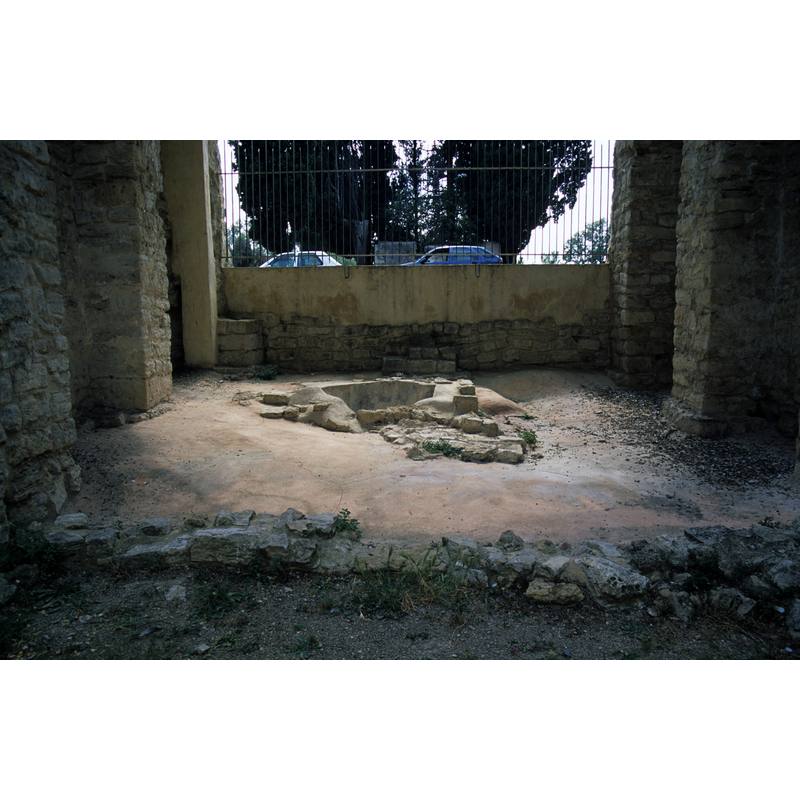
view of context
Copyright Statement: Image copyright © Baptisteria Sacra Index, 2023
Image Source: digital image of a photograph taken 14 June 2001 by BSI
Copyright Instructions: CC-BY-NC-ND-4.0
view of context
Copyright Statement: Image copyright © Baptisteria Sacra Index, 2023
Image Source: digital image of a photograph taken 14 June 2001 by BSI
Copyright Instructions: CC-BY-NC-ND-4.0
view of context
Copyright Statement: Image copyright © Baptisteria Sacra Index, 2023
Image Source: digital image of a photograph taken 14 June 2001 by BSI
Copyright Instructions: CC-BY-NC-ND-4.0
view of font in context
Copyright Statement: Image copyright © Baptisteria Sacra Index, 2023
Image Source: digital image of a photograph taken 14 June 2001 by BSI
Copyright Instructions: CC-BY-NC-ND-4.0
view of font in context
Copyright Statement: Image copyright © Baptisteria Sacra Index, 2023
Image Source: digital image of a photograph taken 14 June 2001 by BSI
Copyright Instructions: CC-BY-NC-ND-4.0
view of font in context
Copyright Statement: Image copyright © Baptisteria Sacra Index, 2023
Image Source: digital image of a photograph taken 14 June 2001 by BSI
Copyright Instructions: CC-BY-NC-ND-4.0
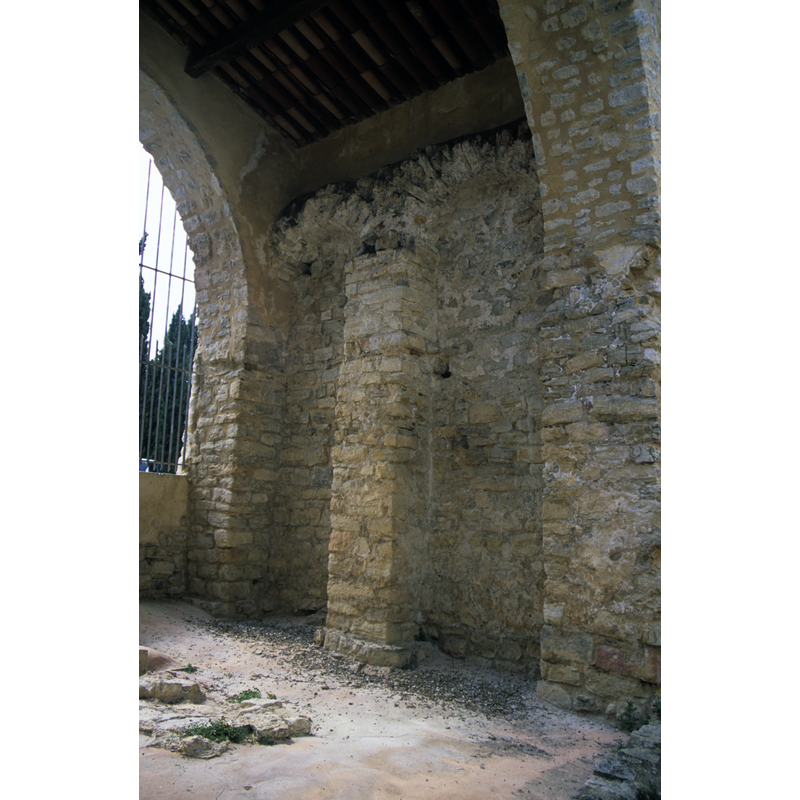
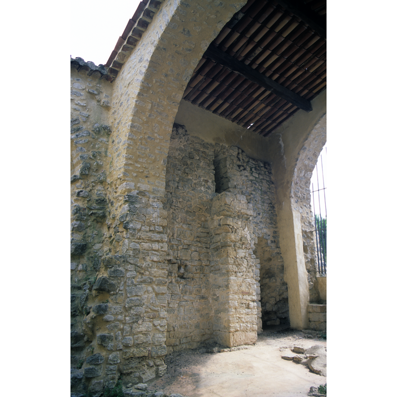
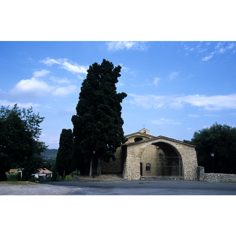
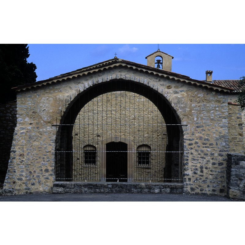
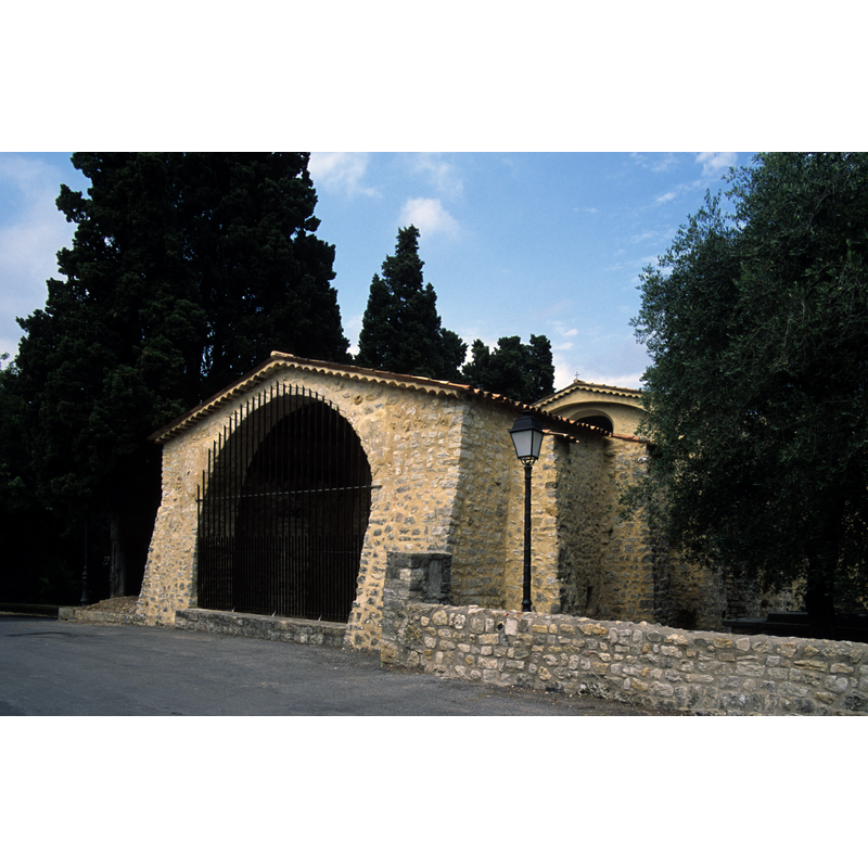
view of church exterior - detail
Copyright Statement: Image copyright © Baptisteria Sacra Index, 2023
Image Source: digital image of a photograph taken 14 June 2001 by BSI
Copyright Instructions: CC-BY-NC-ND-4.0
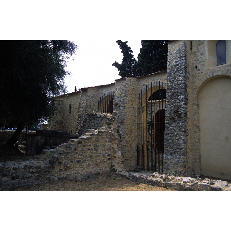
view of church exterior - detail
Copyright Statement: Image copyright © Baptisteria Sacra Index, 2023
Image Source: digital image of a photograph taken 14 June 2001 by BSI
Copyright Instructions: CC-BY-NC-ND-4.0
view of church exterior - detail
Copyright Statement: Image copyright © Baptisteria Sacra Index, 2023
Image Source: digital image of a photograph taken 14 June 2001 by BSI
Copyright Instructions: CC-BY-NC-ND-4.0
view of church exterior - detail
Copyright Statement: Image copyright © Baptisteria Sacra Index, 2023
Image Source: digital image of a photograph taken 14 June 2001 by BSI
Copyright Instructions: CC-BY-NC-ND-4.0
view of church exterior - detail
Copyright Statement: Image copyright © Baptisteria Sacra Index, 2023
Image Source: digital image of a photograph taken 14 June 2001 by BSI
Copyright Instructions: CC-BY-NC-ND-4.0
view of church exterior - detail
Copyright Statement: Image copyright © Baptisteria Sacra Index, 2023
Image Source: digital image of a photograph taken 14 June 2001 by BSI
Copyright Instructions: CC-BY-NC-ND-4.0
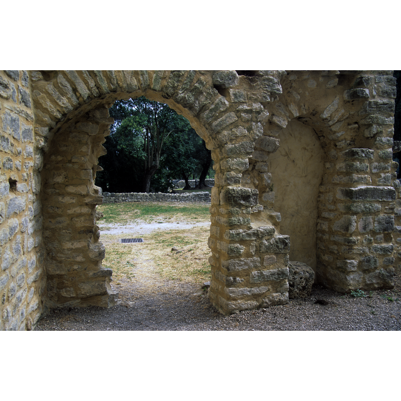
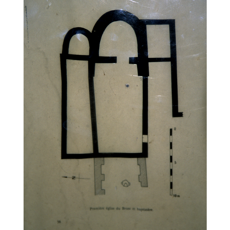
view of church interior - plan
Copyright Statement: Image copyright © Baptisteria Sacra Index, 2023
Image Source: digital image of a photograph taken 14 June 2001 by BSI
Copyright Instructions: CC-BY-NC-ND-4.0
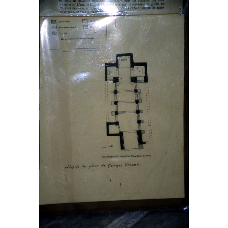
view of church interior - plan
Copyright Statement: Image copyright © Baptisteria Sacra Index, 2023
Image Source: digital image of a photograph taken 14 June 2001 by BSI
Copyright Instructions: CC-BY-NC-ND-4.0
information
Copyright Statement: Image copyright © Baptisteria Sacra Index, 2023
Image Source: digital image of a photograph taken 14 June 2001 by BSI
Copyright Instructions: CC-BY-NC-ND-4.0
INFORMATION
Font ID: 03671CHA
Object Type: Baptismal Font3
Date Visited: 2001-06-14
Font Century and Period/Style: 5th - 6th century, Early Christian
Church / Chapel Name: Baptistery [disappeared] now part of Notre-Dame-du-Brusc
Font Location in Church: Originally the baptistery was attached to the west wall of the church, later under a porch
Church Patron Saint(s): Notre-Dame
Church Notes: It is now in the church of Notre-Dame-de-Brusc; the church is listed in Mérimée [ref.: PA00080703]
Church Address: Chemin de Notre Dame du Brusc, 06740 Châteauneuf-Grasse, France -- Tel.: +33 4 92 60 36 03
Site Location: Alpes-Martimes, Provence-Alpes-Côte d'Azur, France, Europe
Directions to Site: In the Canton de Bas-sur-Loup, NW of Antibes
Additional Comments: disappeared font? (the one from the 11thC church here)
Font Notes:
Click to view
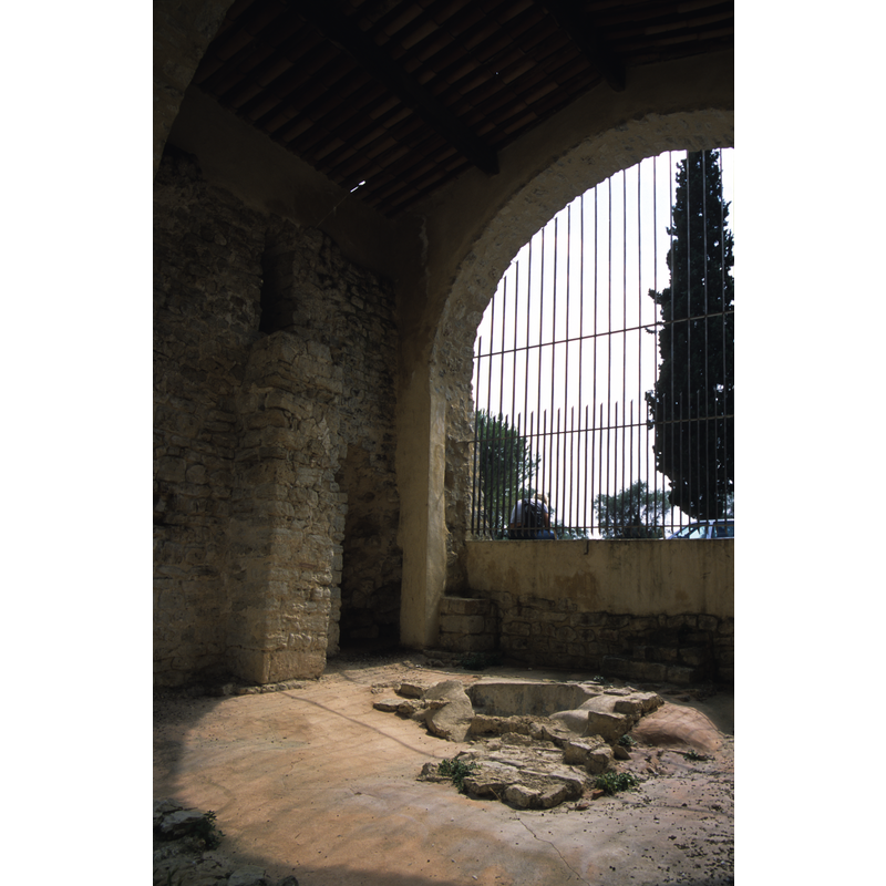
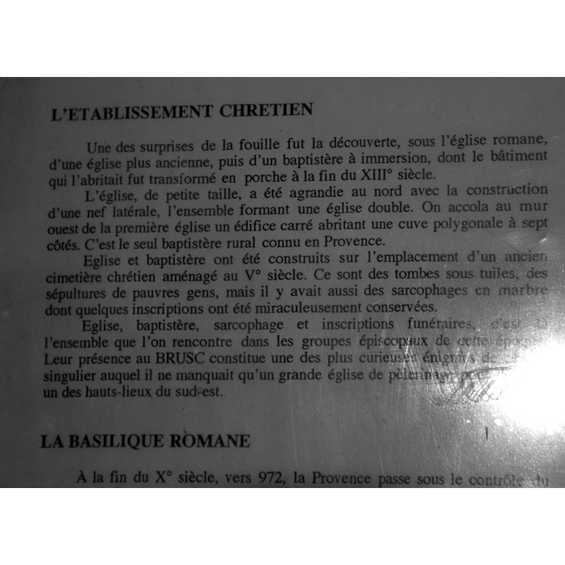
Only the heptagonal sunken basin remains now of what is the first rural baptistery discovered in Provence. The well has two steps leading to a deeper well to fit the feet of one cathecumen [cf. Chateauneuf No. 2 for details of the disappeared baptistery] (Patrimoine…Alpes-Maritimes, 2000, v. 1, p. 90). On-site notes: the reconstructed site has little more than the sunken font with its two steps onm both sides leading to a narrow hole in which the baptizand's feet would stand. Although we describe the basin shape as heptagonal, it is quite irregular and perhaps more appropiately described as "oblong". [NB: the site is only accessible when the church is open; the Mairie is not keen on providing the keys otherwise, but the piscina is visible from the outside through the iron bars.]
COORDINATES
Latitude & Longitude (Decimal): 43.6542, 6.98522
Latitude & Longitude (DMS): 43° 39′ 15.12″ N, 6° 59′ 6.79″ E
MEDIUM AND MEASUREMENTS
Material: stone, limestone
Font Shape: sunken font, heptagonal
Basin Interior Shape: heptagonal
Basin Exterior Shape: heptagonal
Diameter (inside rim): 100 x 107 cm*
Basin Depth: 56 cm*
Notes on Measurements: BSI *[NB: the piscina is very irregular: the depth varies between 56 cm and 68 at the deepest place where the feet of the baptizand would be placed; the longest side is 65 cm and the shortest 33 cm; the steps themselves are also of uneven measurements]
REFERENCES
- Le Patrimoine des communes des Alpes-Maritimes, Charenton: FLOHIC, 2000, vol. 1, p. 90
- Les premiers monuments chrétiens de la France, Paris: A. Picard ; Ministère ce la culture et de la francophonie, Direction du patrimoine, Sous-direction de l'archéologue, 1995-1998, vol. 1: p. 100-102