Melas No. 1 / Mélas No. 1
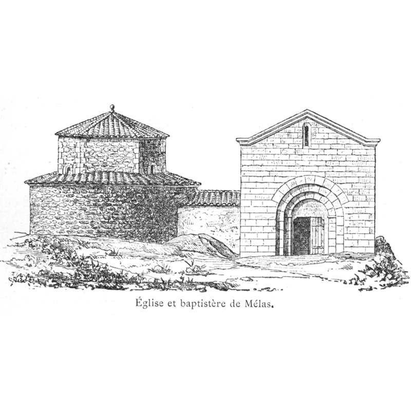
Image copyright © [in the public domain]
PD
Results: 2 records
view of church exterior
Scene Description: Illustration in Corblet (1881) showing the baptistery and the contiguous church
Copyright Statement: Image copyright © [in the public domain]
Image Source: Corblet (1881: v. 2, p. 67)
Copyright Instructions: PD
view of church interior
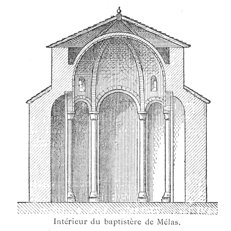
Scene Description: Illustration in Corblet (1881) showing a section of the baptistery building
Copyright Statement: Image copyright © [in the public domain]
Image Source: Corblet (1881: v. 2, p. 68)
Copyright Instructions: PD
INFORMATION
Font ID: 03623MEL
Object Type: Baptistery
Font Century and Period/Style: 4th - 5th century, Early Christian
Church / Chapel Name: Baptistery, now the Chapelle de catéchisme adjointe à l'église de Mélas
Church Address: [NB: address & coordinates given for the Eglise Saint-Étienne] 14 Av. Vaillant Couturier, 07400 Le Teil, France
Site Location: Ardèche, Auvergne-Rhône-Alpes, France, Europe
Directions to Site: Mélas is located S of Valence, 5 km W of Montélimar.
Additional Comments: recycled 5th cent.baptistery into a funerary chapel [7th cent.]; later converted into a catechism chapel.
Font Notes:
Click to view
Described in Saint-Andéol (1862). Corblet (1881-1882, vol. 2: 67-68) [after Saint-Andéol] reports that a baptistery existed in Mélas since the time of bishop Auxonne in the 5th century. The octagonal building, which still exists, was made of a schistous limestone; each of its eight sides had an apse separated from the next by a column topped with a corinthian capital. The baptistery was abandoned ca. 430 A.D. when the episcopal see was moved to Viviers. In the 7th century a convent of nuns was established in the area and it turned the baptistery into a funerary chapel redoing the floor. In the 13th century it was annexed to the northern side of the parish church via a short vaulted corridor. In 1862, reports Corblet, the viscount of Saint-Andéol, an archaeologist who discovered several ancient baptisteries, described and illustrated the church and the attached baptistery in the 'Revue de l'art chrétien' and, five years later, he was able to confirm his previous conjectures with the discovery of a square basin, the original "piscine" of the baptistery. Corblet states that the former baptistery is now [i.e., ca. 1881] being used as a "chapelle de catéchisme".
COORDINATES
UTM: 31T 632831 4933534
Latitude & Longitude (Decimal): 44.5429, 4.6721
Latitude & Longitude (DMS): 44° 32′ 34.44″ N, 4° 40′ 19.56″ E
MEDIUM AND MEASUREMENTS
Material: stone, limestone (base)
REFERENCES
- Corblet, Jules, Histoire dogmatique, liturgique et archéologique du sacrement de baptême, Paris: V. Palme, 1881-1882, vol. 2, p. 67-68
- Davies, J.G., The Architectural Setting of Baptism, London: Barrie and Rockliff, 1962, p. 4-5 and fn1
- Roustan, F., Le Major et le premier baptistère de Marseille, 1905, p. 169-187