Angers No. 2
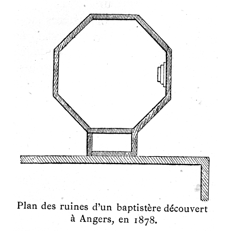
Image copyright © [in the public domain]
PD
Results: 1 records
view of baptistery - plan
Copyright Statement: Image copyright © [in the public domain]
Image Source: digital image of an illustration in Corblet (1881: v. 2, p. 52)
Copyright Instructions: PD
INFORMATION
Font ID: 03582ANG
Object Type: Baptistery
Font Century and Period/Style: 4th - 5th century, Early Christian
Church / Chapel Name: Baptistery [disappeared]
Church Address: [NB: address & coordonates given for the reports location of the original site] Pl. du Ralliement, 49100 Angers, France [cf. Directions (Geo) field]
Site Location: Maine-et-Loire, Pays de la Loire, France, Europe
Directions to Site: Reported to have existed in or near the place du Ralliement, near the site of the "ancienne église de Saint-Maurille", Angers.
Font Notes:
Click to view
Corblet (1881-1882) informs that, towards the end of 1878, during road works at the place du Ralliement, near the site of the old church of St-Maurille, the ruins of an ancient baptistery, about 5 m. in diameter, were unearthed. Corblet quotes the description done for the Bulletin monumental , 1879, p. 104, by M[onsieur]. G. d'Espinay, which identified the buiding as an octagonal structure made of a tufaceous stone, with an entrance probably on the north side and three descending steps into the interior, which had a concrete floor. These steps were removed and a further set of previous steps covered in red cement was found, but extended excavation of the area failed to turn up anything else of consequence. There appear to have been a rectangular compartment, off one of the walls of the octagon, which would have attached the baptistery to the church of St-Maurille (description and plan on Corblet, 1881-1882, v. 2, p. 51-52)
COORDINATES
UTM: 30T 684481 5260937
Latitude & Longitude (Decimal): 47.475722, -0.551561
Latitude & Longitude (DMS): 47° 28′ 32.6″ N, 0° 33′ 5.62″ W
MEDIUM AND MEASUREMENTS
Material: stone, tufa
Trapezoidal Basin: 5 m. (diameter of the octagonal building)*
Notes on Measurements: a/p G. d'Espinay's description in Corblet, 1881-1882, v. 2, p. 52
REFERENCES
- Corblet, Jules, Histoire dogmatique, liturgique et archéologique du sacrement de baptême, Paris: V. Palme, 1881-1882, vol. 2, p. 51-52