Wittering / Witheringem
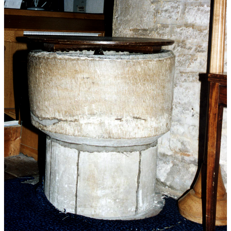
Image copyright © John Salmon, 2011
CC-BY-SA-2.0
Results: 10 records
view of font and cover
Copyright Statement: Image copyright © John Salmon, 2011
Image Source: digital image of a photograph taken in July 1994 by John Salmon [www.geograph.org.uk/photo/2218210] [accessed 20 February 2018]
Copyright Instructions: CC-BY-SA-2.0
view of church exterior - northwest view
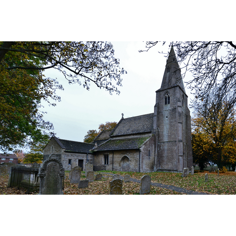
Scene Description: Source caption: "Wittering, All Saints Church: North western aspect".
Copyright Statement: Image copyright © Michael Garlick, 2016
Image Source: digital photograph taken 1 November 2016 by Michael Garlick [www.geograph.org.uk/photo/5206569] [accessed 20 February 2018]
Copyright Instructions: CC-BY-SA-2.0
view of church exterior - southeast view
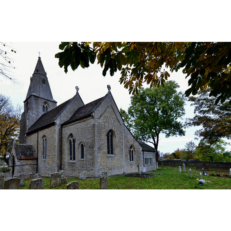
Scene Description: Source caption: "Wittering, All Saints Church: South eastern aspect showing Saxon long and short work on the quoins"
Copyright Statement: Image copyright © Michael Garlick, 2016
Image Source: digital photograph taken 1 November 2016 by Michael Garlick [www.geograph.org.uk/photo/5206575] [accessed 20 February 2018]
Copyright Instructions: CC-BY-SA-2.0
view of church exterior - southeast end
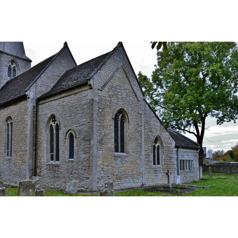
Scene Description: Source caption: "Wittering, All Saints Church: South eastern aspect showing Saxon long and short work on the quoins. The position of the original roof can be seen."
Copyright Statement: Image copyright © Michael Garlick, 2016
Image Source: digital photograph taken 1 November 2016 by Michael Garlick [www.geograph.org.uk/photo/5206579] [accessed 20 February 2018]
Copyright Instructions: CC-BY-SA-2.0
view of church interior - nave - looking east
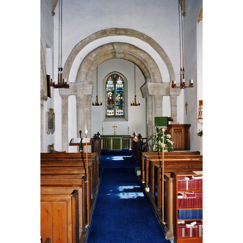
Copyright Statement: Image copyright © John Salmon, 2011
Image Source: digital image of a photograph taken in July 1994 by John Salmon [www.geograph.org.uk/photo/2218199] [accessed 20 February 2018]
Copyright Instructions: CC-BY-SA-2.0
view of font and cover

Copyright Statement: Image copyright © Digital Atlas of England, 2005
Image Source: digital image in the Digital Atlas of England [www.viewbuildings.com]
Copyright Instructions: PERMISSION NOT AVAILABLE -- IMAGE NOT FOR PUBLIC USE
view of font and cover
Copyright Statement: Image copyright © Digital Atlas of England, 2005
Image Source: digital image in the Digital Atlas of England [www.viewbuildings.com]
Copyright Instructions: PERMISSION NOT AVAILABLE -- IMAGE NOT FOR PUBLIC USE
view of font and cover
Copyright Statement: Image copyright © Digital Atlas of England, 2005
Image Source: digital image in the Digital Atlas of England [www.viewbuildings.com]
Copyright Instructions: PERMISSION NOT AVAILABLE -- IMAGE NOT FOR PUBLIC USE
view of font
Copyright Statement: Image copyright © The British Academy & Ron Baxter, 2004
Image Source: CRSBI [www.crsbi.ac.uk/ed/hu/witte/]
Copyright Instructions: PERMISSION NOT AVAILABLE -- IMAGE NOT FOR PUBLIC USE
view of basin
Copyright Statement: Image copyright © The British Academy & Ron Baxter, 2004
Image Source: CRSBI [www.crsbi.ac.uk/ed/hu/witte/]
Copyright Instructions: PERMISSION NOT AVAILABLE -- IMAGE NOT FOR PUBLIC USE
INFORMATION
Font ID: 03489WIT
Object Type: Baptismal Font1
Font Century and Period/Style: 11th - 12th century [basin only], Medieval / composite
Church / Chapel Name: Parish Church of All Saints
Font Location in Church: Inside the church, W end, under the tower
Church Wikidata: https://www.wikidata.org/wiki/Q17528761
Church Patron Saint(s): All Saints
Church Address: Church Road, Wittering, PE8 6AF, UK -- Tel.: (01780) 740234
Site Location: Cambridgeshire, East, England, United Kingdom
Directions to Site: Located off the A1, 5 km S of Stamford, 15 km WNW of Peterborough, in the "Soke"
Historical Region: Hundred of Upton -- formerly Huntingdonshire and Northamptonshire
Additional Comments: recycled font: now raised on a modern base
Font Notes:
Click to view
There is an entry for Wittering, Northamptonshire, [variant spelling] in the Domesday survey [https://opendomesday.org/place/TF0502/wittering/] [accessed 20 February 2018], but it mentions neither cleric nor church in it. A font in this church is described and illustrated in the CRSBI (2018): "a circular tub-font on a modern cylindrical pedestal. The lower rim is chamfered and the basin is lead-lined". The lower side of the basin shows considerable damage that has been repaired; some other damage, though minor, shows up at the upper rim. The wooden font cover, round and plain but for a cross-shaped raised decoration, appears modern. Listed and illustrated in The Digital Atlas of England [www.viewbuildings.com]
COORDINATES
Latitude & Longitude (DMS): 52° 36′ 18.55″ N, 0° 26′ 26.74″ W
MEDIUM AND MEASUREMENTS
Material: stone, unknown
Font Shape: cylindrical, mounted
Basin Interior Shape: round
Basin Exterior Shape: round
Rim Thickness: 8.25 cm [calculated]
Diameter (inside rim): 63.5 cm*
Diameter (includes rim): 79 cm*
Basin Total Height: 43 cm*
Height of Base: 36 cm [calculated -- modern base]
Font Height (less Plinth): 79 cm*
Notes on Measurements: * CRSBI (2018)
LID INFORMATION
Date: modern
Material: wood
Apparatus: no
Notes: round, flat and plain; appears modern
REFERENCES
- Corblet, Jules, Histoire dogmatique, liturgique et archéologique du sacrement de baptême, Paris: V. Palme, 1881-1882, vol. 2, p. 120-121
- Corpus of Romanesque Sculpture in Britain and Ireland, The Corpus of Romanesque Sculpture in Britain and Ireland, The Corpus of Romanesque Sculpture in Britain and Ireland. URL: http://www.crsbi.ac.uk.