Notre-Dame-du-Touchet / Thuscheio / Toscheit / Toschet / Tuscheto / Tuschueio
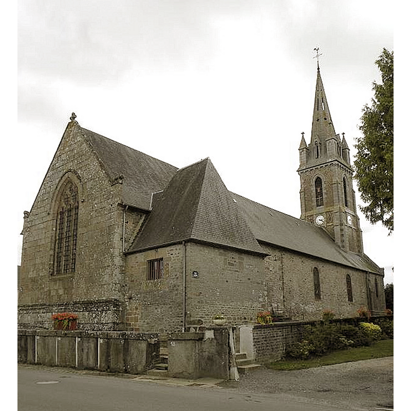
Image copyright © [in the public domain]
CC-Zero
Results: 3 records
view of church exterior - northeast view
Scene Description: Source caption: "Église paroissiale Notre-Dame, à Notre-Dame-du-Touchet"
Copyright Statement: Image copyright © [in the public domain]
Image Source: digital photograph 21 July 2011 by GO69 [https://commons.wikimedia.org/wiki/File:Notre-Dame-du-Touchet_(50)_Église_01.jpg] [accessed 10 August 2023]
Copyright Instructions: CC-Zero
view of church exterior - southeast view
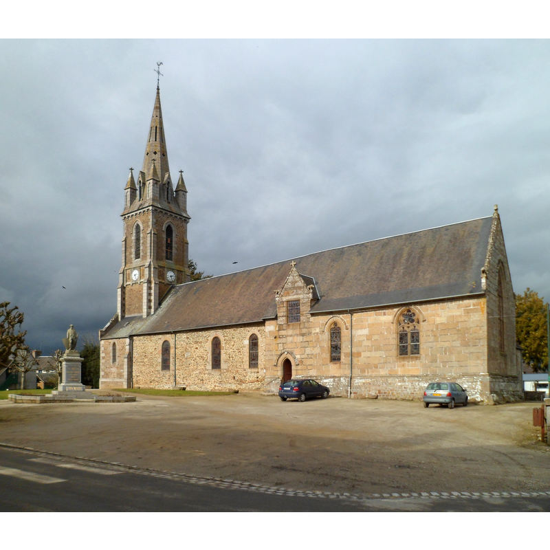
Scene Description: Source caption: "Église Notre-Dame de Notre-Dame-du-Touchet"
Copyright Statement: Image copyright © Xfigpower, 2012
Image Source: digital photograph 18 Fberuary 2012 by Xfigpower [https://commons.wikimedia.org/wiki/File:Église_Notre-Dame_de_Notre-Dame-du-Touchet_(2).JPG] [accessed 10 August 2023]
Copyright Instructions: CC-BY-SA-3.0
view of church interior - looking east
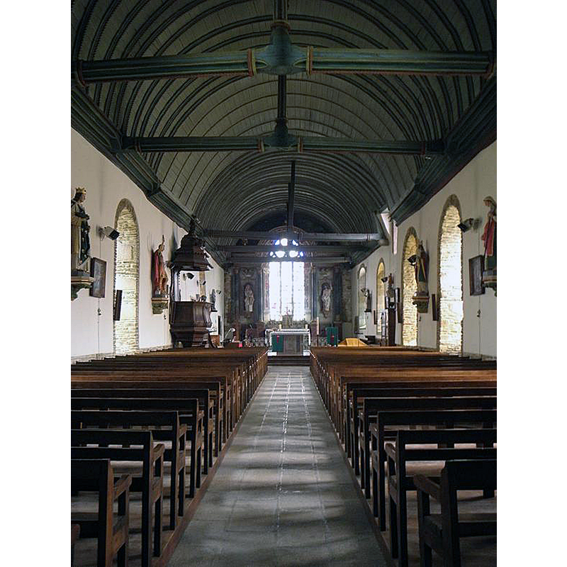
Scene Description: Source caption: "Intérieur de l'église Notre-Dame, à Notre-Dame-du-Touchet"
Copyright Statement: Image copyright © [in the public domain]
Image Source: digital photograph 21 July 2011 by GO69 [https://commons.wikimedia.org/wiki/File:Notre-Dame-du-Touchet_(50)_Église_02.jpg] [accessed 10 August 2023]
Copyright Instructions: CC-Zero
INFORMATION
Font ID: 03320NOT
Object Type: Baptismal Font1
Font Century and Period/Style: 16th - 17th century, Renaissance
Cognate Fonts: Saint-Jean-du-Corail, nearby
Church / Chapel Name: Église paroissiale Notre-Dame
Font Location in Church: Inside the church
Church Patron Saint(s): St. Mary the Virgin
Church Notes: church here documented mid-12thC; present church 16thC with later modifications
Church Address: 18 Le Bourg, 50140 Mortain-Bocage, France
Site Location: Manche, Normandie, France, Europe
Directions to Site: Located off the D45-D84 crossroads, 4 km E of Lapenty, in the municipality and 6-7 km S of Mortain-Bocage
Ecclesiastic Region: Diocèse de Coutances et Avranches
Additional Comments: disappeared font? (the one from the medieval church here?)
Font Notes:
Click to view
Vivier-Seguin (1941) report a similar font to the one in neighbouring Saint-Jean-du-Corail: rectangular basin with double well inside but without any exterior sign of it; the lower part shaped like a truncated pyramid, and simple mouldings at bottom; it is supported on two plain quadrangular blocks, the upper larger than the lower. V-S suggest that the font could very well be dated either to after the major restoration of the church ca. 1537 or after the religious wars which so badly affected this area. There is an old holy-water stoup in an interior corner, perhaps a re-purposed object [cf. ImagesArea]
COORDINATES
UTM: 30U 650685 5383057
Latitude & Longitude (Decimal): 48.58246, -0.95681
Latitude & Longitude (DMS): 48° 34′ 56.86″ N, 0° 57′ 24.52″ W
MEDIUM AND MEASUREMENTS
Material: stone, granite (Vivier-Seguin)
Font Shape: rectangular, mounted
Basin Interior Shape: double basins
Basin Exterior Shape: rectangular
REFERENCES
- Vivier, Em., Les Anciens fonts baptismaux du Département de la Manche, Avranches: Presses de "L'Opinion de la Manche", 1941, p. 67