Pontaubault / Ponteaubaud
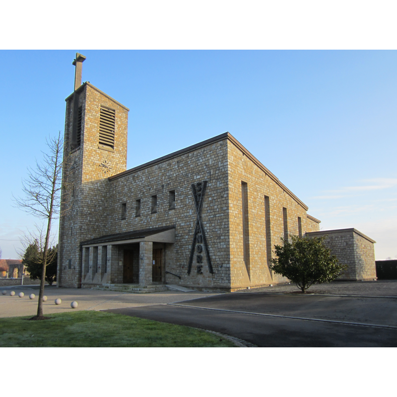
Image copyright © Xfigpower, 2013
CC-BY-SA-3.0
Results: 3 records
view of church exterior
Scene Description: Source caption: "Église Saint-André de Pontaubault" -- the new church of 1956
Copyright Statement: Image copyright © Xfigpower, 2013
Image Source: digital photograph 16 February 2013 by Xfigpower [https://commons.wikimedia.org/wiki/File:Église_Saint-André_de_Pontaubault_(2).JPG] [accessed 22 March 2025]
Copyright Instructions: CC-BY-SA-3.0
view of church exterior - portal
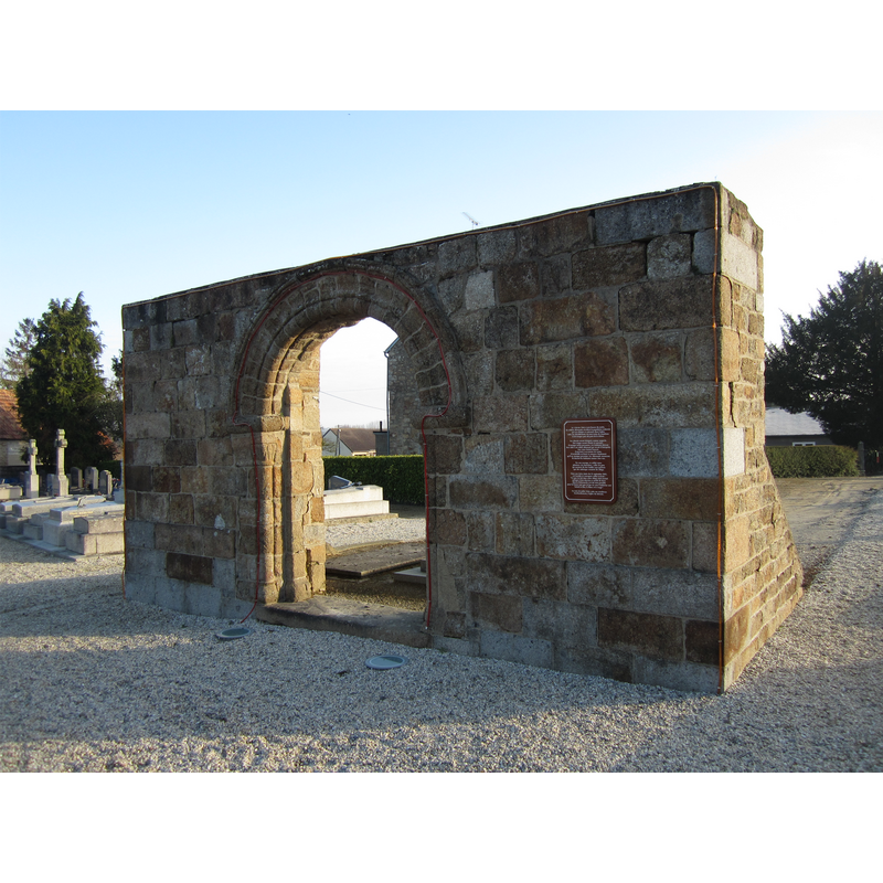
Scene Description: Source caption: "Pontaubault - Portail de l'ancienne église Saint-André" -- the church was destroyed in 1944, WWII
Copyright Statement: Image copyright © Xfigpower, 2013
Image Source: digital photograph 16 February 2013 by Xfigpower [https://commons.wikimedia.org/wiki/File:Pontaubault_-_Portail_de_l'ancienne_église_Saint-André.JPG] [accessed 22 March 2025]
Copyright Instructions: CC-BY-SA-3.0
view of font and cover in context
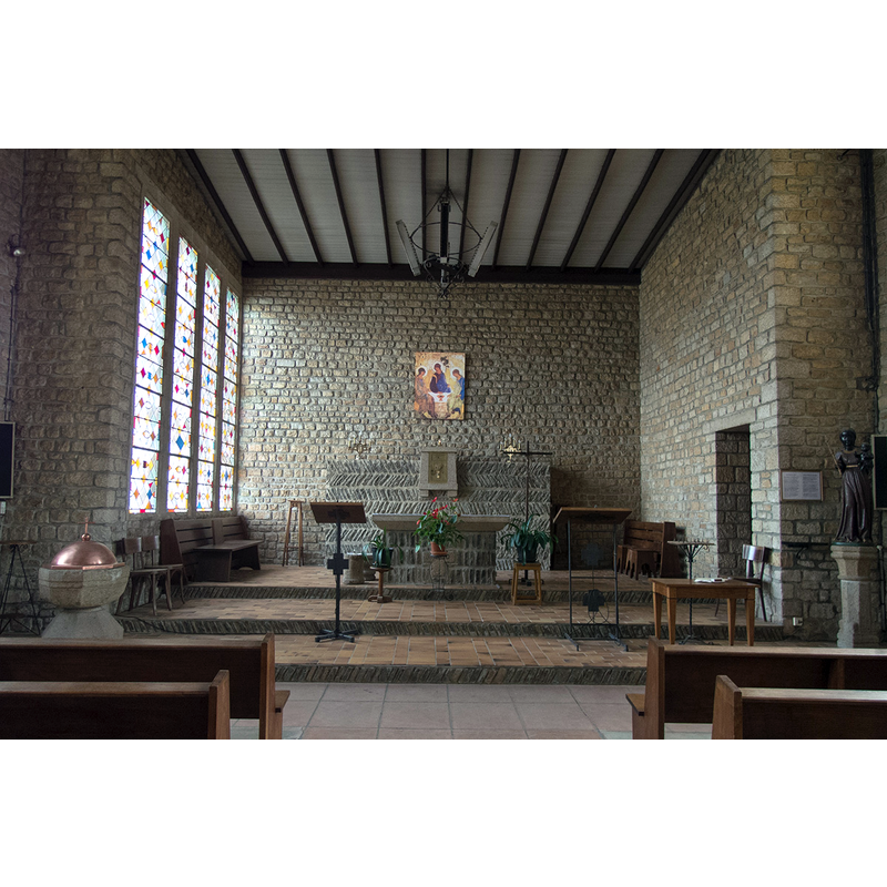
Scene Description: Source caption: "Intérieur de l'église Saint-André de Pontaubault." -- the old font in the new church
Copyright Statement: Image copyright © Yane, 2019
Image Source: digital photograph 1 August 2019 by Yane [https://www.wikimanche.fr/Fichier:Pontaubault-eglise-st-andre-interieur.jpg] [accessed 22 March 2025]
Copyright Instructions: CC-BY-SA-3.0
INFORMATION
Font ID: 03223PON
Object Type: Baptismal Font1
Font Century and Period/Style: 15th century [Malle] / 16th - 17th century[Vivier-Seguin], Renaissance
Church / Chapel Name: Église paroissiale Saint-André de Pontaubault
Font Location in Church: Inside the church
Church Patron Saint(s): St. Andrew
Church Notes: 12thC church destroyed in 1944 in WWII; re-built in 1950s
Church Address: Pl. Armand Blier, 50220 Pontaubault, France
Site Location: Manche, Normandie, France, Europe
Directions to Site: Pontaubault is located off the D113, in the SE corner of the Baie du Mont-Saint-Michel, about 15 km E of Mont-Saint-Michel, 10-15 km S of Avranches.
Additional Comments: The Pascal candle holder next to the font is also of interest.
Font Notes:
Click to view
Octagonal basin mounted on an octagonal base; the basin has a scotia (?) running around the middle of the sides, but is otherwise plain; the base appears equally plain in the source. There is a dome font cover which appears metallic (Malle, 1994). The Pascal candle holder, also made of granit and standing next to the font, is dated by Malle to the 15th century and has at least one rope motif ornament half way up the stem. The description and illustration in Vivier-Seguin (1941) complement Malle's information: the inferior arris of the octagonal basin have been smoothed over giving the lower part of the basin a more rounded appearance; the upper base is made of a large roll moulding over and under the central rope motif; the lower base is an octagonal foot slightly wider at the bottom. As V-S (1941) point out, the chalice-shaped form and the proportions give it a very pleasant appearance.
COORDINATES
Latitude & Longitude (Decimal): 48.630162, -1.350308
Latitude & Longitude (DMS): 48° 37′ 48.58″ N, 1° 21′ 1.11″ W
MEDIUM AND MEASUREMENTS
Material: stone, granite
Font Shape: octagonal, mounted
Basin Exterior Shape: octagonal
LID INFORMATION
Material: metal, copper
Apparatus: no
Notes: dome with cross finial
REFERENCES
- Malle, Louis, Sources du baptême: découvrir les baptistères et les fonts baptismaux, Paris: Éditions de l'atelier, 1994, ill. and caption on p. 79
- Vivier, Em., Les Anciens fonts baptismaux du Département de la Manche, Avranches: Presses de "L'Opinion de la Manche", 1941, p. 78-79