Graville
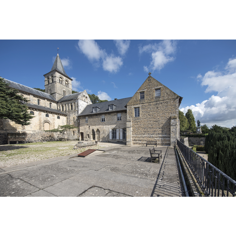
Image copyright © Selbymay, 2017
CC-BY-SA-4.0
Results: 3 records
view of church exterior in context
Scene Description: Source caption: "Prieuré de Graville, Le Havre, 2017"
Copyright Statement: Image copyright © Selbymay, 2017
Image Source: digital photograph 18 September 2017 by Selbymay [https://commons.wikimedia.org/wiki/File:LeHavreGraville_03.jpg] [accessed 7 March 2025]
Copyright Instructions: CC-BY-SA-4.0
view of church interior - statue - fragment
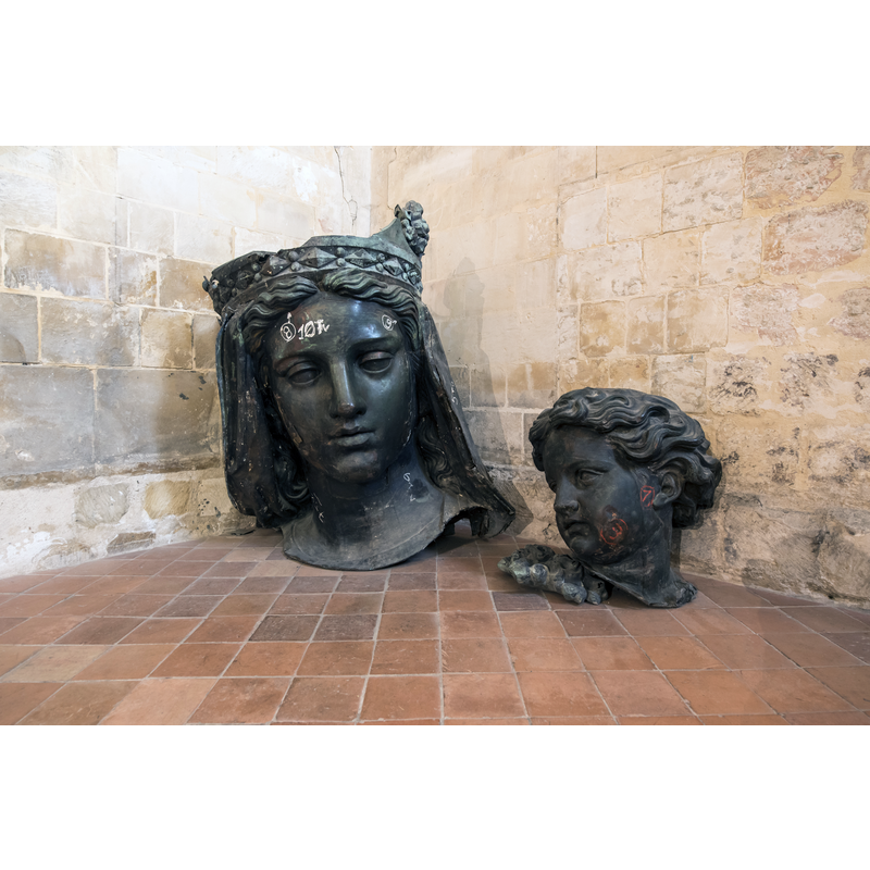
Scene Description: Source caption: "Prieuré de Graville, Le Havre, 2017." -- known as "Vierge noire du Havre"
Copyright Statement: Image copyright © Selbymay, 2017
Image Source: digital photograph 18 September 2017 by Selbymay [https://commons.wikimedia.org/wiki/File:LeHavreGraville_07.jpg] [accessed 7 March 2025]
Copyright Instructions: CC-BY-SA-4.0
view of church interior - looking east
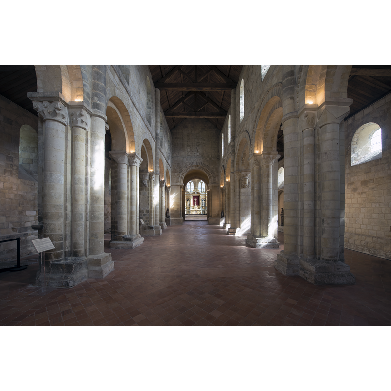
Scene Description: Source caption: "Prieuré de Graville, Le Havre, 2017."
Copyright Statement: Image copyright © Selbymay, 2017
Image Source: digital photograph 18 September 2017 by Selbymay [https://commons.wikimedia.org/wiki/File:LeHavreGraville_05.jpg] [accessed 7 March 2025]
Copyright Instructions: CC-BY-SA-4.0
INFORMATION
Font ID: 02988GRA
Object Type: Baptismal Font1
Font Century and Period/Style: 11th - 12th century, Romanesque
Workshop/Group/Artisan: Tournai font?
Church / Chapel Name: Église priorale de Graville-Sainte-Honorine?
Church Notes: abbey founded 11thC -- listed in Mérimée [ref.: PA00100694]: "Ce prieuré, fondé avant la fin du 11e siècle, comprend une abbatiale (11e-12e siècle) prolongée par un ensemble claustral. Ravagés pendant les guerres de Religion, les bâtiments conventuels ont été restaurés au long du 18e siècle. L'ensemble est bâti au centre d'un enclos ovoïde encore bien lisible, identifié comme l'assise foncière d'origine. Le musée du prieuré a été installé à partir de 1926."
Church Address: Abbaye de Graville rue de l’Abbaye 76600 Le Havre -- Tel.: : 02 79 92 77 70 / 02 35 24 51 00
Site Location: Seine-Maritime, Normandie, France, Europe
Directions to Site: The abbey is located off (N) the D6015, 3 km W of Harfleur, 5-6 km E of Le Havre city centre
Font Notes:
Click to view
Listed by Enlart as a 11-12th century Tournai-like square font mounted on a five-column base (Enlart, 1902). A stoup of the Norman period is listed and illustrated in Parker (1850).
COORDINATES
UTM: 31U 294711 5487288
Latitude & Longitude (Decimal): 49.50344, 0.16444
Latitude & Longitude (DMS): 49° 30′ 12.38″ N, 0° 9′ 51.98″ E
MEDIUM AND MEASUREMENTS
Material: stone
Font Shape: square, mounted
Basin Exterior Shape: square
REFERENCES
- Enlart, Camille, Manuel d'archéologie française depuis les temps mérovingiens jusqu'à la Renaissance, Paris: Alphonse Picard & fils, 1902, p. 774 footnote 2
- Parker, John Henry, A Glossary of Terms used in Grecian, Roman, Italian and Gothic Architecture, Oxford: J. H. Parker, 1850, p. 448