Lessay
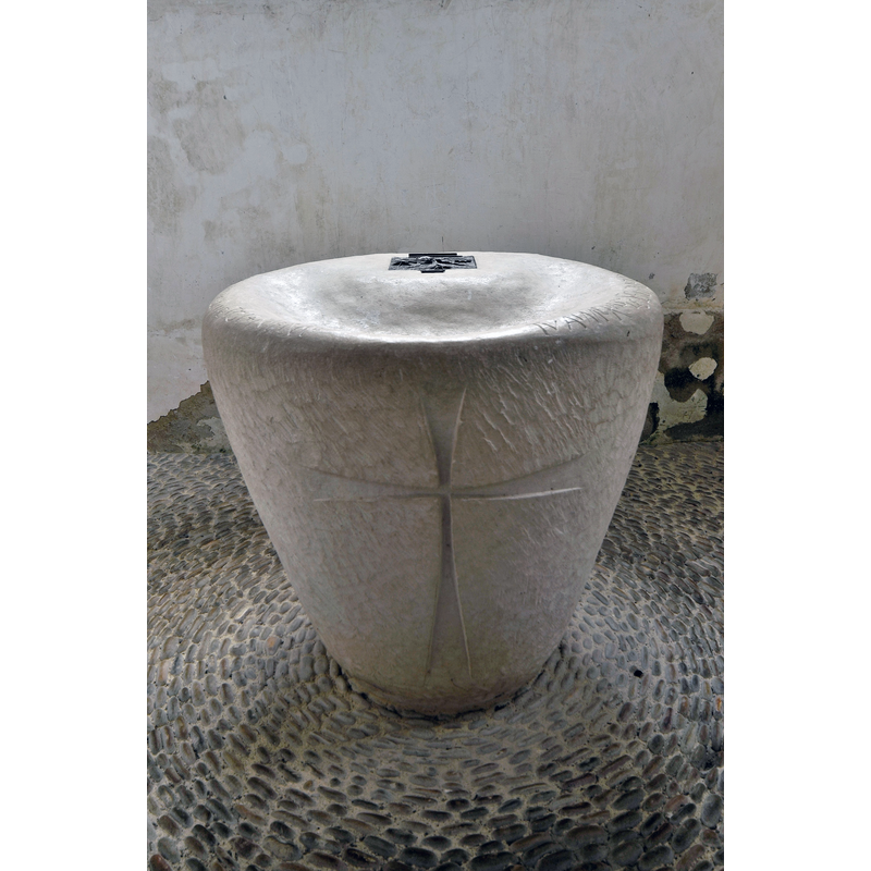
Image copyright © Patrick, 2018
CC-BY-SA-2.0
Results: 4 records
view of font
Scene Description: Source caption: "Fonts baptismaux Abbaye Sainte-Trinité de Lessay" -- the present font in use is modern
Copyright Statement: Image copyright © Patrick, 2018
Image Source: digital photograph 22 June 2018 by Patrick [https://commons.wikimedia.org/wiki/File:Abbaye_de_Lessay-06-fonts-baptismaux.jpg] [accessed 28 February 2025]
Copyright Instructions: CC-BY-SA-2.0
view of church exterior - southeast view
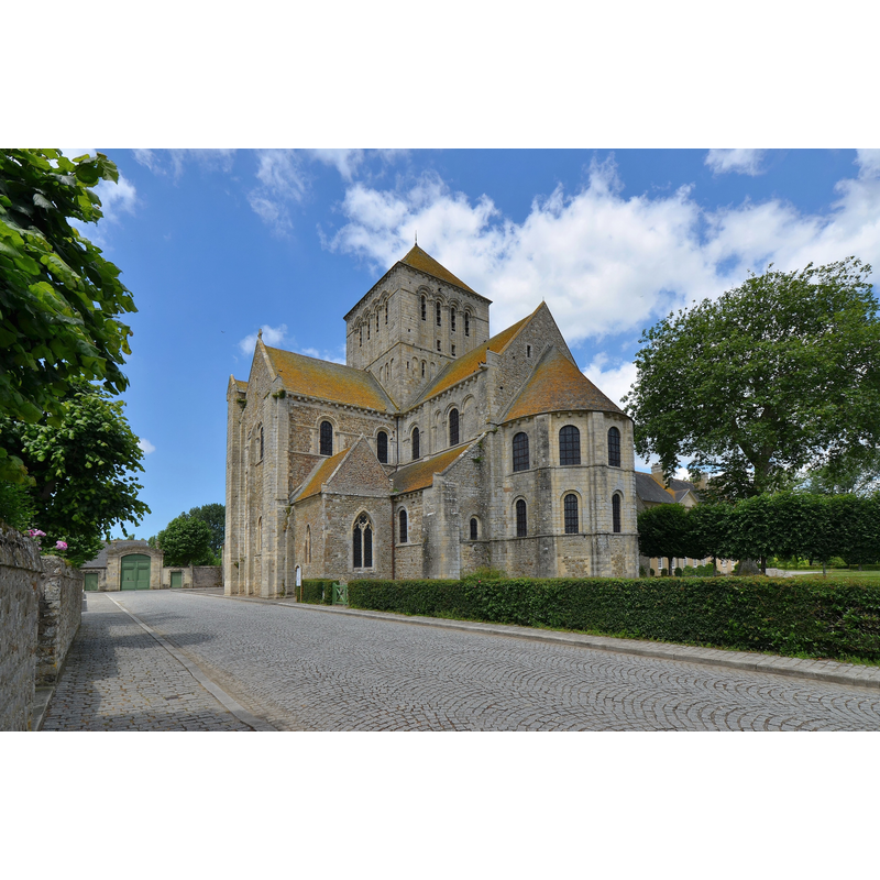
Scene Description: Source caption: "Abbaye Sainte-Trinité de Lessay"
Copyright Statement: Image copyright © Patrick, 2018
Image Source: digital photograph 22 June 2018 by Patrick [https://commons.wikimedia.org/wiki/File:Abbaye_de_Lessay-02.jpg] [accessed 28 February 2025]
Copyright Instructions: CC-BY-SA-2.0
view of church interior - looking east
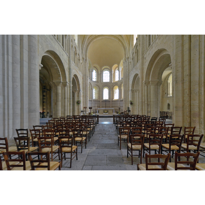
Scene Description: Source caption: "Lessay (Manche) - Abbatiale de la Sainte-Trinité"
Copyright Statement: Image copyright © Patrick, 2018
Image Source: digital photograph 22 June 2018 by Patrick [https://commons.wikimedia.org/wiki/File:Lessay_(Manche)_-_Abbatiale_de_la_Sainte-Trinité_(50168943136).jpg] [accessed 28 February 2025]
Copyright Instructions: CC-BY-SA-2.0
view of font in context
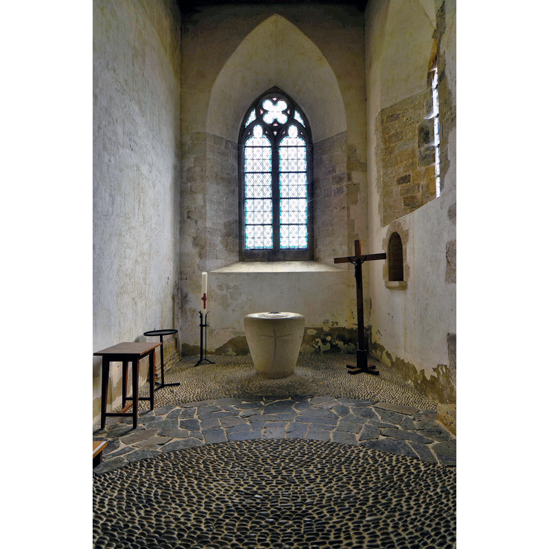
Scene Description: Source caption: "Abbaye Sainte-Trinité de Lessay Chapelle du croisillon Sud" -- the modern font in a south transept chapel
Copyright Statement: Image copyright © Patrick, 2018
Image Source: digital photograph 22 June 2018 by Patrick [https://commons.wikimedia.org/wiki/File:Abbaye_de_Lessay-07_Chapelle_du_croisillon_Sud] [accessed 28 February 2025]
Copyright Instructions: CC-BY-SA-2.0
INFORMATION
Font ID: 02809LES
Object Type: Baptismal Font1
Font Century and Period/Style: 14th - 15th century [Enlart] / 16th - 17th [Vivier-Seguin], Late Gothic? / Renaissance?
Workshop/Group/Artisan: double font [Enlart]
Church / Chapel Name: Abbaye de la Sainte-Trinité / Ancienne église abbatiale, devenue église paroissiale
Font Location in Church: Inside the abbey church
Church Patron Saint(s): Holy Trinity
Church Notes: church listed in Mérimée [ref.: PA00110438]: "L'église date du 11e siècle. Les bâtiments conventuels sont du 17e siècle."
Church Address: 50430 Lessay, France
Site Location: Manche, Normandie, France, Europe
Directions to Site: Lessay is 21 km N of Coutances on the D2 road, direction Cherbourg
Additional Comments: disappeared font? (the one from the 11thC church here)
Font Notes:
Click to view
Included by Enlart (1902) in a list of French double-fonts. Vivier-Seguin (1941) report and illustrate this font as having a polygonal basin (no mention of double basin or font, but they do say that it appears to have been mutilated); the basin is supported on eight "demi-consoles" with curling foliage stylised into rib-like bulges; the whole rests on a crude "socle" (plinth) which V-S suspect may have been totally buried earlier on (Vivier, 1941)
COORDINATES
UTM: 30U 606841 5452949
Latitude & Longitude (Decimal): 49.22, -1.532778
Latitude & Longitude (DMS): 49° 13′ 12″ N, 1° 31′ 58″ W
MEDIUM AND MEASUREMENTS
Material: stone, limestone (Vivier-Seguin)
Font Shape: double-font, polygonal, mounted
Basin Exterior Shape: double basin, polygonal (both)
REFERENCES
- Enlart, Camille, Manuel d'archéologie française depuis les temps mérovingiens jusqu'à la Renaissance, Paris: Alphonse Picard & fils, 1902, p. 764 footnote 1
- Vivier, Em., Les Anciens fonts baptismaux du Département de la Manche, Avranches: Presses de "L'Opinion de la Manche", 1941, p. 72