Riez No. 1
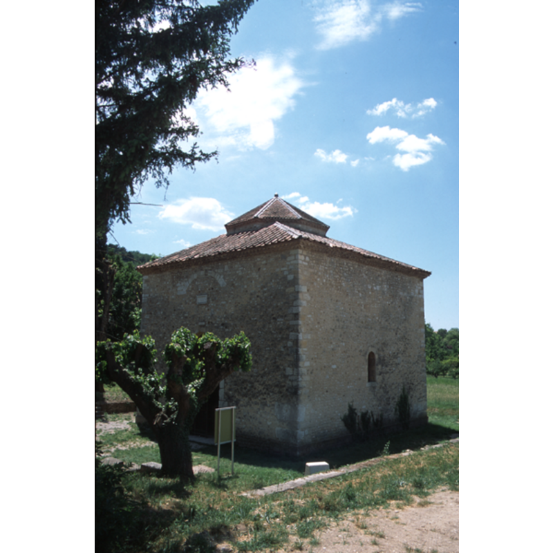
Image copyright © Baptisteria Sacra Index, 2023
CC-BY-NC-ND-4.0
Results: 6 records
Copyright Statement: Image copyright © Baptisteria Sacra Index, 2023
Image Source: BSI - Photographed 2001
Copyright Instructions: CC-BY-NC-ND-4.0
Copyright Statement: Image copyright © Baptisteria Sacra Index, 2023
Image Source: BSI - Photographed 2001
Copyright Instructions: CC-BY-NC-ND-4.0
Copyright Statement: Image copyright © Baptisteria Sacra Index, 2023
Image Source: BSI - Photographed 2001
Copyright Instructions: CC-BY-NC-ND-4.0
Copyright Statement: Image copyright © Baptisteria Sacra Index, 2023
Image Source: BSI - Photographed 2001
Copyright Instructions: CC-BY-NC-ND-4.0
view of baptistery - plan
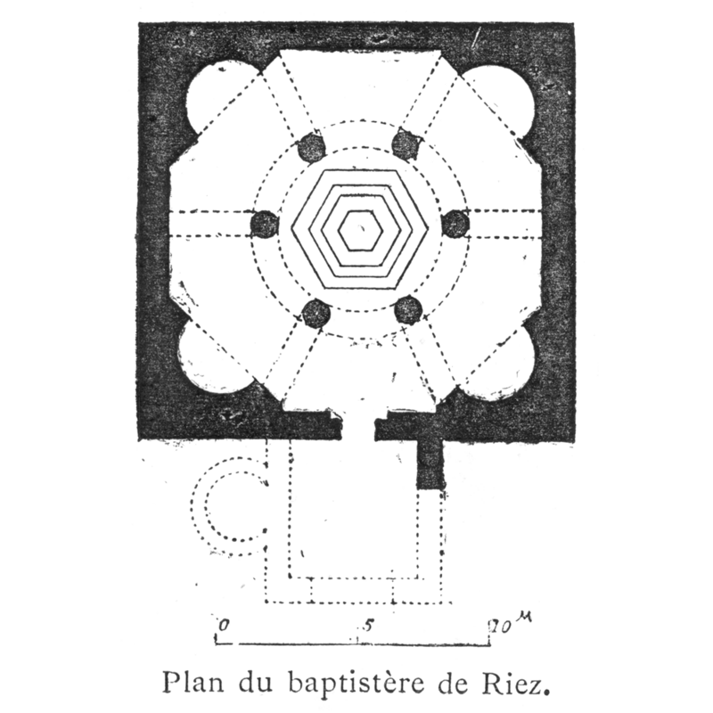
Copyright Statement: Image copyright © [in the public domain]
Image Source: Corblet (1881: v. 2, p. 72)
Copyright Instructions: PD
view of baptistery - plan
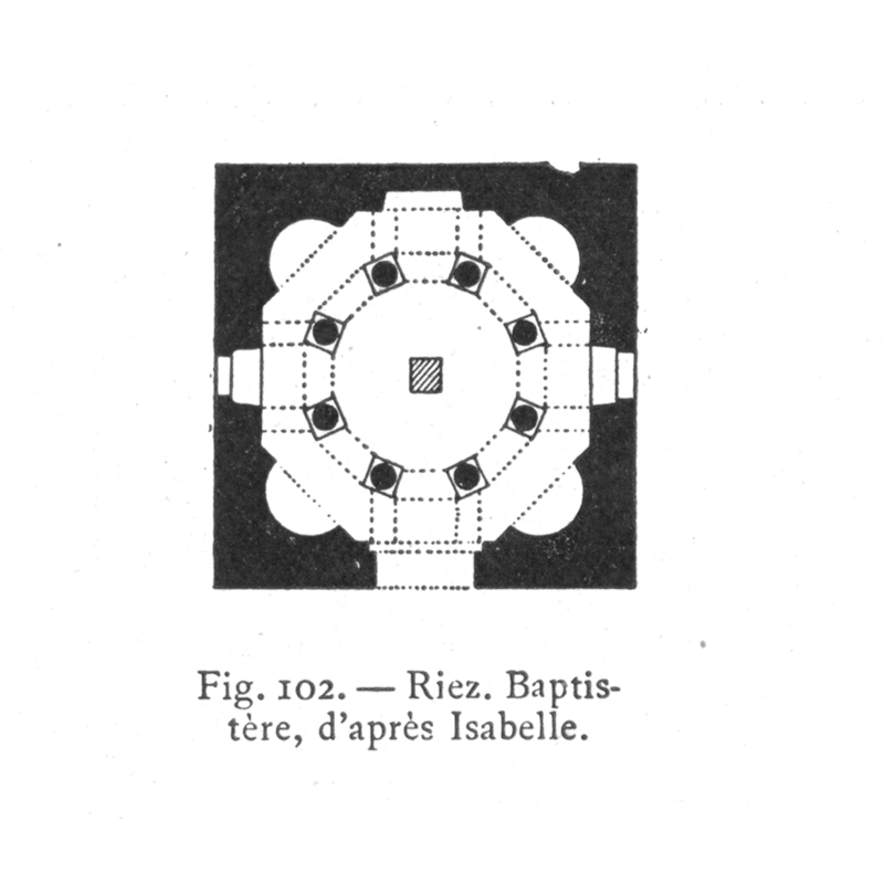
Copyright Statement: Image copyright © Lasteyrie, 1929
Image Source: Lasteyrie (1929: fig. 102
Copyright Instructions: PD
INFORMATION
Font ID: 02793RIE
Object Type: Baptistery
Date Visited: 2001-06-13
Font Century and Period/Style: 5th - 15th century, Early Christian
Church / Chapel Name: Baptistery [a.k.a. "Panthéon"]
Church Address: 04500 Riez, France
Site Location: Alpes-de-Haute-Provence, Provence-Alpes-Côte d'Azur, France, Europe
Directions to Site: Riez is located 42 km S of Digne-les-Bains (D905 south, then, D953 to Riez), just E of the Lac-de-Sainte-Croix
Additional Comments: Recycled baptistery, converted in 1559 into a chapel dedicated to St-Clair, which served in Corblet's time [ca. 1881] as the chapel for the Confrérie des Pénitents (Corblet, 1881-1882, v. 2, p. 72)
Font Notes:
Click to view
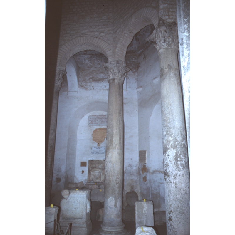
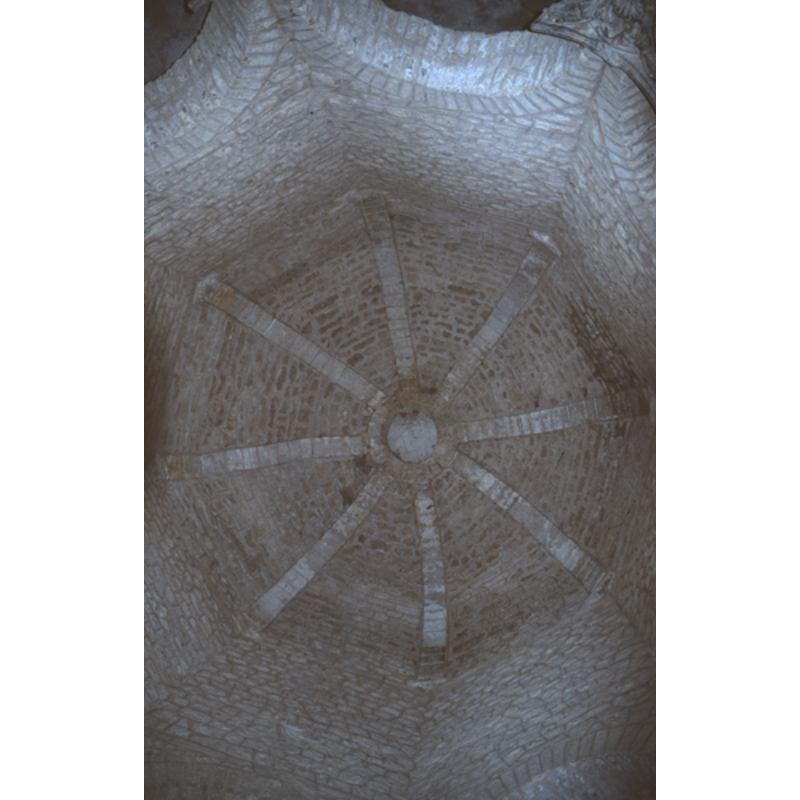
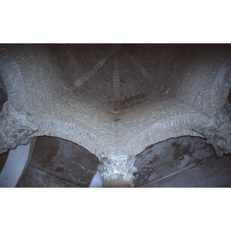
According to Corblet this baptistery, which is now outside the town, was once near the disappeared cathedral. Despite having been "maladroitement restaurée en 1818", this rotunda has the same basic interior distribution as the baptistery at Aix-en-Provence [cf. entry in Index]. Corblet also informs that excavations have unearthed a 5th century "piscine" about 120 cm in diameter and 45 cm in depth, with its sides lined with plaques of white marble. It was converted in 1559 into a chapel dedicated to St-Clair, which served in Corblet's time [ca. 1881] as the chapel for the Confrérie des Pénitents (Corblet, 1881-1882, v. 2, p. 72). Described in Enlart (1902) as a baptistery in which vestiges of the channelling of water are still visible. Delcor (1973) suggests a 6th or 8th century dating for the baptistery. On-site notes: the building, square on the outside but with the original octagonal internal distribution is used now as a lapidary museum. [NB: our gratitude to Mlle. Valéry Reynard, of the Bureau de Tourisme de Riez, for providing full access to us and for being a charming and friendly guide during our visit]
COORDINATES
UTM: 32T 265969 4855535
Latitude & Longitude (Decimal): 43.815833, 6.089861
Latitude & Longitude (DMS): 43° 48′ 57″ N, 6° 5′ 24″ E
REFERENCES
- Dictionnaire des églises de France, Belgique, Luxembourg, Suisse, Paris: R. Laffont, 1966-, II D 120
- Les premiers monuments chrétiens de la France, Paris: A. Picard ; Ministère ce la culture et de la francophonie, Direction du patrimoine, Sous-direction de l'archéologue, 1995-1998, vol. 1: p. 85-93
- Bond, Francis, Fonts and Font Covers, London: Waterstone, 1985 c1908, 19 and ill. on p. 22
- Cabrol, Fernand, Dictionnaire d'archéologie chrétienne et de liturgie, Paris: Letouzey et Ane, 1907-1953, [not recorded]
- Corblet, Jules, Histoire dogmatique, liturgique et archéologique du sacrement de baptême, Paris: V. Palme, 1881-1882, vol. 2, p. 72
- Davies, J.G., The Architectural Setting of Baptism, London: Barrie and Rockliff, 1962, p. 4
- Delcor, M., "Les cuves romanes et leur figuration en Roussillon, Cerdagne et Conflent", 4, Cahiers Saint-Michel-de-Cuxa, 1973, pp. 96-109, 4 pl.; p. 97
- Enlart, Camille, Manuel d'archéologie française depuis les temps mérovingiens jusqu'à la Renaissance, Paris: Alphonse Picard & fils, 1902, p. 763
- Guyon, Jean, Les premiers baptistères des Gaules (IVe-VIIIe siècles), Roma: Unione Internazionale degli Istituti di Archeologia, Storia e Storia dell'Arte in Roma / Union des instituts étrangers de Rome, 2000
- Tyrrell-Green, E., Baptismal Fonts Classified and Illustrated, London: Society for Promoting Christian Knowledge: The Macmillan Co., 1928, p. 14