Albourne
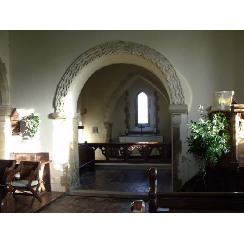
Image copyright © Nick Macneill, 2012
CC-BY-SA-3.0
Results: 1 records
view of church interior - chancel arch and east side
Scene Description: NB: the arch itself is a copy of the 12thC original; some of the stones of the original chancel walls have been incorporated into the churchyard wall, according to the VCH entry [cf. FontNotes]
Copyright Statement: Image copyright © Nick Macneill, 2012
Image Source: digital photograph taken 13 January 2012 by Nick Macneill [www.geograph.org.uk/photo/2773802] [accessed 30 October 2012]
Copyright Instructions: CC-BY-SA-3.0
INFORMATION
Font ID: 02706ALB
Object Type: Baptismal Font1
Font Century and Period/Style: 13th - 14th century, Medieval
Church / Chapel Name: Parish Church of St. Bartholomew
Font Location in Church: Inside the church
Church Patron Saint(s): St. Bartholomew
Church Notes: "church of ST. BARTHOLOMEW (the dedication is recorded from 1442)" [cf. VCH entry in FontNotes]
Church Address: Church Lane, Albourne, West Sussex, BN6 9BY
Site Location: West Sussex, South East, England, United Kingdom
Directions to Site: Located 6 km NW of Hassocks
Ecclesiastic Region: Diocese of Chichester
Historical Region: Hundred of Tipnoak -- Rape of Bamber - Sussex
Additional Comments: altered font: re-tooled font? (the present font) -- disappeared font? (the one from the 12wthC church here?)
Font Notes:
Click to view
The Victoria County History (Sussex, vol. 6, pt. 3, 1987) notes: "Architectural evidence indicates a church at Albourne by the 12th century. [...] The chancel walls are late 11th- or early 12thcentury; the south chancel window is of that period, and a matching north window existed in 1851 [...] It was largely rebuilt in the 19th century. [...] The plain octagonal font is medieval". Noted in Whiteman (1998): "The medieval font, a plain octagonal bowl and stem, stands on a large slab of Sussex marble".
COORDINATES
UTM: 30U 695854 5645888
Latitude & Longitude (Decimal): 50.93133, -0.21274
Latitude & Longitude (DMS): 50° 55′ 52.79″ N, 0° 12′ 45.86″ W
MEDIUM AND MEASUREMENTS
Material: stone
Font Shape: octagonal, mounted
Basin Interior Shape: round
Basin Exterior Shape: octagonal
REFERENCES
- Victoria County History [online], University of London, 1993-. URL: https://www.british-history.ac.uk.
- Whiteman, Ken, Ancient Churches of Suffolk, Seaford, East Sussex: S.B. Publications, 1998, p. 11