Llert / Lert
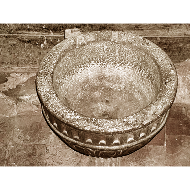
Image copyright © Ver Pueblos, 2022
No known copyright restriction / Far Dealing
Results: 5 records
view of basin - interior
Scene Description: Source caption: "Iglesia San Esteban. Pila bautismal, Llert"
Copyright Statement: Image copyright © Ver Pueblos, 2022
Image Source: digital photograph in Ver Pueblos [https://www.verpueblos.com/aragon/huesca/llert/foto/159700/] [accessed 26 July 2022]
Copyright Instructions: No known copyright restriction / Far Dealing
view of church exterior - apse - south side - corbel
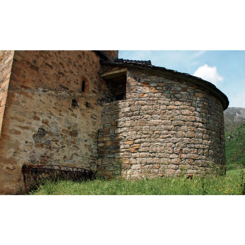
Copyright Statement: Image copyright © Fundación Santa María la Real, 2022
Image Source: digital image in the Enciclopedia del románico [www.romanicodigital.com] [accessed 26 July 2022]
Copyright Instructions: Standing permission received from the FSMLR
view of church exterior in context
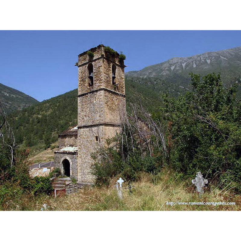
Copyright Statement: Image copyright © Antonio García Omedes, 2022
Image Source: digital photograph by Antonio García Omedes [http://www.castillodeloarre.org/HU-Ribagorza/990373-Llert.htm] [accessed 26 July 2022]
Copyright Instructions: Standing permission
view of church interior - looking northwest
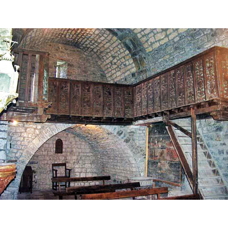
Scene Description: Source caption: "Coro de la Iglesia San Esteban. Pila bautismal, Llert"
Copyright Statement: Image copyright © Ver Pueblos, 2022
Image Source: digital photograph in Ver Pueblos [https://www.verpueblos.com/aragon/huesca/llert/foto/159700/] [accessed 26 July 2022]
Copyright Instructions: No known copyright restriction / Far Dealing
view of font in context
Copyright Statement: Image copyright © Antonio García Omedes, 2022
Image Source: digital photograph by Antonio García Omedes [http://www.castillodeloarre.org/HU-Ribagorza/990373-Llert.htm] [accessed 26 July 2022]
Copyright Instructions: Standing permission
INFORMATION
Font ID: 02660LLE
Object Type: Baptismal Font1
Font Century and Period/Style: 12th - 13th century, Romanesque
Church / Chapel Name: Iglesia Parroquial de San Esteban
Font Location in Church: Inside the church, in the NW corner of the nave, beneath the gallery
Church Patron Saint(s): St. Stephen
Church Notes: 12thC(?) church
Church Address: c./ Unica, 6, 22451 Llert, Huesca, Spain
Site Location: Huesca, Aragón, Spain, Europe
Directions to Site: Located in the municipality of Valle de Bardají, about 32 km from Graus; accessible from Campo via the C-139 (5 km)
Historical Region: Ribagorza
Additional Comments: disappeared font? (the one from the 12thC church here)
Font Notes:
Click to view
The hemispherical basin has fine ribs framed in round mouldings; above them a band of incisions resembling an arcade; the base is striated. The whole is finely carved in a dark stone, probably a local marble. The rim shows two indentations, probably remnants of the font covering (Iglesias Costa, 1985 ). Noted and illustrated in Antonio García Omedes [http://www.castillodeloarre.org/HU-Ribagorza/990373-Llert.htm] [accessed 26 July 2022]. A font and a holy-water stop are noted in the Enciclopedia del románico [www.romanicodigital.com] [accessed 26 July 2022]: "se conservan tanto la pila bautismal como la de agua bendita." [NB: we have no information on the font of the 12th-century church here]
Credit and Acknowledgements: We are grateful to Antonio García Omedes, of Rrománico aragonés, for his photographs of this church and font. We are also grateful to the Fundación Santa María la Real [www.romanicodigital.com] for their permission to reproduce content from the Enciclopedia del románico
COORDINATES
UTM: 31T 291578 4701379
Latitude & Longitude (Decimal): 42.435278, 0.464722
Latitude & Longitude (DMS): 42° 26′ 7″ N, 0° 27′ 53″ E
MEDIUM AND MEASUREMENTS
Material: stone, type unknown
Font Shape: chalice-shaped
Basin Interior Shape: round
Basin Exterior Shape: round
REFERENCES
- Iglesias Costa, Manuel, Arquitectura románica, siglos X-XI, XII, XIII, Barcelona: Akribos, 1985, vol.I/2, p. 147, ill. on p. 144